Index of /aeris/eurec4a-data/FORECASTS/GLOBAL/ARPEGE/2019/20191215/map2D
Name
Last modified
Size
Parent Directory
-
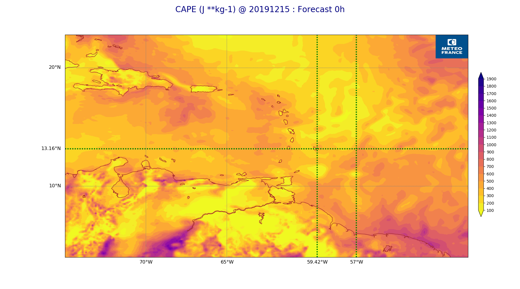
ARPEGE_map2D_CAPE_20191215_fct_0.png
2019-12-16 11:20
269K
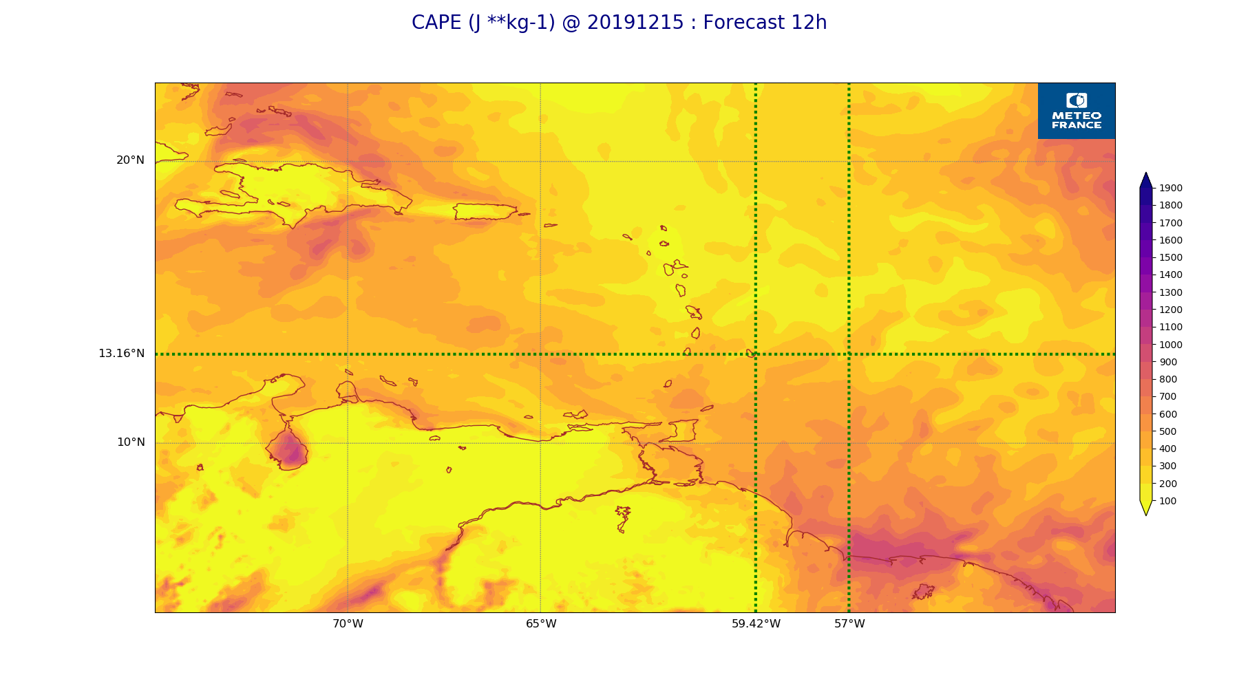
ARPEGE_map2D_CAPE_20191215_fct_12.png
2019-12-16 11:20
238K
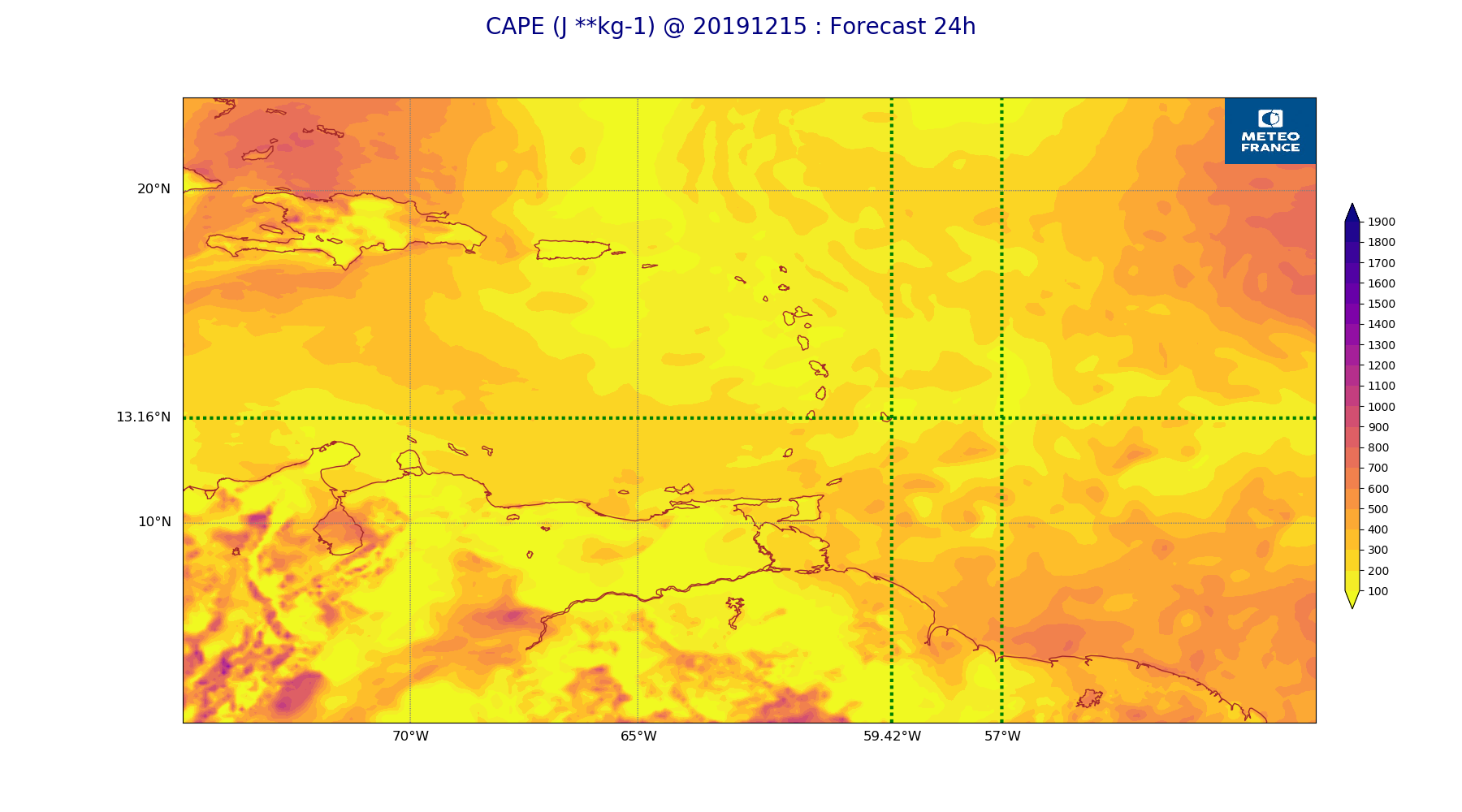
ARPEGE_map2D_CAPE_20191215_fct_24.png
2019-12-16 11:20
253K
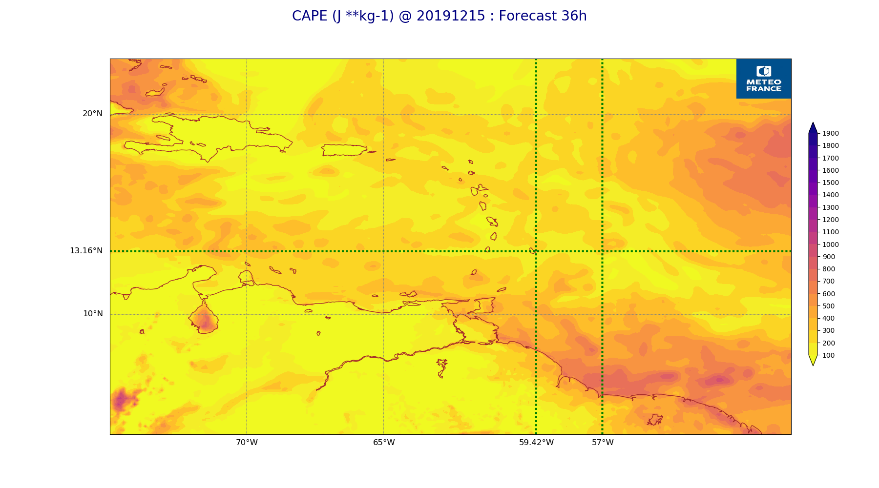
ARPEGE_map2D_CAPE_20191215_fct_36.png
2019-12-16 11:20
228K
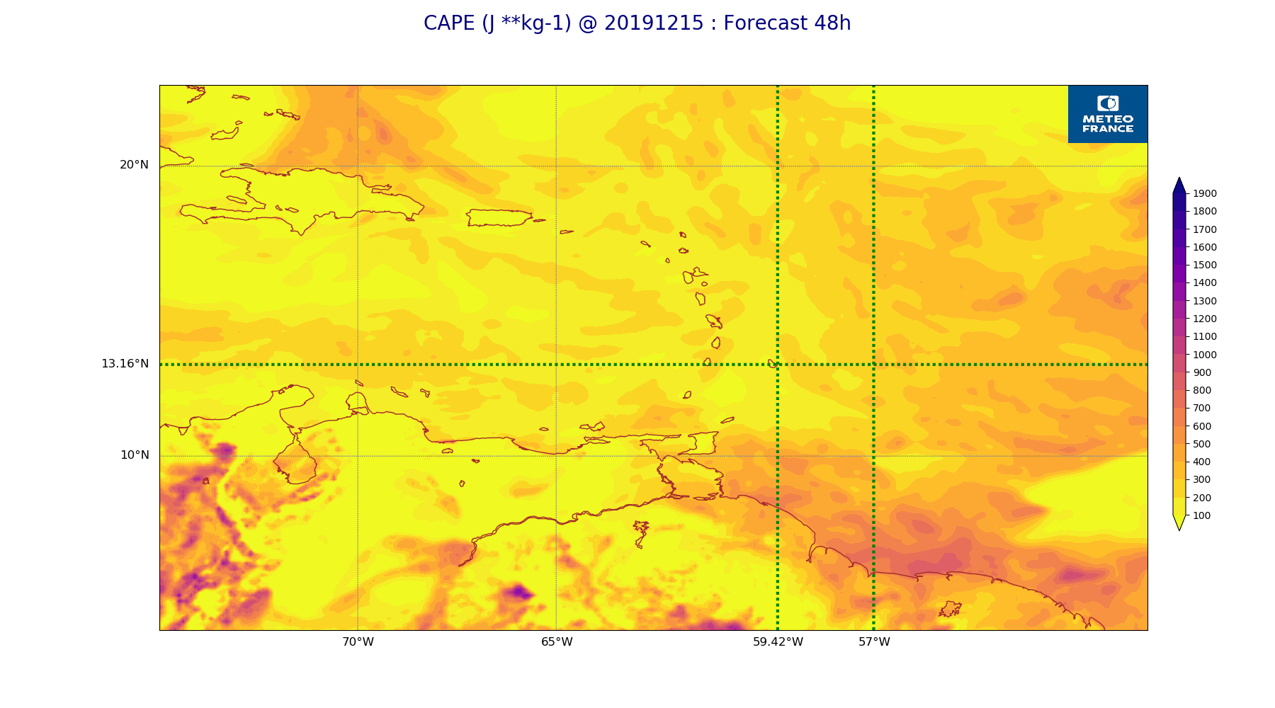
ARPEGE_map2D_CAPE_20191215_fct_48.png
2019-12-16 11:21
250K
ARPEGE_map2D_Cum_3h_RAIN_20191215_fct_0.png
2019-12-16 11:14
151K
ARPEGE_map2D_Cum_3h_RAIN_20191215_fct_12.png
2019-12-16 11:14
223K
ARPEGE_map2D_Cum_3h_RAIN_20191215_fct_24.png
2019-12-16 11:14
230K
ARPEGE_map2D_Cum_3h_RAIN_20191215_fct_36.png
2019-12-16 11:14
186K
ARPEGE_map2D_Cum_3h_RAIN_20191215_fct_48.png
2019-12-16 11:14
188K
ARPEGE_map2D_Fraction_cloud_cover_200hPa_20191215_fct_0.png
2019-12-16 11:05
161K
ARPEGE_map2D_Fraction_cloud_cover_200hPa_20191215_fct_12.png
2019-12-16 11:05
392K
ARPEGE_map2D_Fraction_cloud_cover_200hPa_20191215_fct_24.png
2019-12-16 11:05
409K
ARPEGE_map2D_Fraction_cloud_cover_200hPa_20191215_fct_36.png
2019-12-16 11:05
319K
ARPEGE_map2D_Fraction_cloud_cover_200hPa_20191215_fct_48.png
2019-12-16 11:06
376K
ARPEGE_map2D_Fraction_cloud_cover_500hPa_20191215_fct_0.png
2019-12-16 11:05
161K
ARPEGE_map2D_Fraction_cloud_cover_500hPa_20191215_fct_12.png
2019-12-16 11:05
549K
ARPEGE_map2D_Fraction_cloud_cover_500hPa_20191215_fct_24.png
2019-12-16 11:05
578K
ARPEGE_map2D_Fraction_cloud_cover_500hPa_20191215_fct_36.png
2019-12-16 11:05
543K
ARPEGE_map2D_Fraction_cloud_cover_500hPa_20191215_fct_48.png
2019-12-16 11:06
490K
ARPEGE_map2D_Fraction_cloud_cover_700hPa_20191215_fct_0.png
2019-12-16 11:05
149K
ARPEGE_map2D_Fraction_cloud_cover_700hPa_20191215_fct_12.png
2019-12-16 11:05
149K
ARPEGE_map2D_Fraction_cloud_cover_700hPa_20191215_fct_24.png
2019-12-16 11:05
149K
ARPEGE_map2D_Fraction_cloud_cover_700hPa_20191215_fct_36.png
2019-12-16 11:05
149K
ARPEGE_map2D_Fraction_cloud_cover_700hPa_20191215_fct_48.png
2019-12-16 11:06
149K
ARPEGE_map2D_Fraction_cloud_cover_850hPa_20191215_fct_0.png
2019-12-16 11:05
162K
ARPEGE_map2D_Fraction_cloud_cover_850hPa_20191215_fct_12.png
2019-12-16 11:05
665K
ARPEGE_map2D_Fraction_cloud_cover_850hPa_20191215_fct_24.png
2019-12-16 11:05
779K
ARPEGE_map2D_Fraction_cloud_cover_850hPa_20191215_fct_36.png
2019-12-16 11:05
715K
ARPEGE_map2D_Fraction_cloud_cover_850hPa_20191215_fct_48.png
2019-12-16 11:06
777K
ARPEGE_map2D_Fraction_cloud_cover_925hPa_20191215_fct_0.png
2019-12-16 11:05
162K
ARPEGE_map2D_Fraction_cloud_cover_925hPa_20191215_fct_12.png
2019-12-16 11:05
746K
ARPEGE_map2D_Fraction_cloud_cover_925hPa_20191215_fct_24.png
2019-12-16 11:05
766K
ARPEGE_map2D_Fraction_cloud_cover_925hPa_20191215_fct_36.png
2019-12-16 11:05
747K
ARPEGE_map2D_Fraction_cloud_cover_925hPa_20191215_fct_48.png
2019-12-16 11:06
690K
ARPEGE_map2D_Geopotential_0_7_PVU_20191215_fct_0.png
2019-12-16 11:10
189K
ARPEGE_map2D_Geopotential_0_7_PVU_20191215_fct_12.png
2019-12-16 11:10
186K
ARPEGE_map2D_Geopotential_0_7_PVU_20191215_fct_24.png
2019-12-16 11:10
195K
ARPEGE_map2D_Geopotential_0_7_PVU_20191215_fct_36.png
2019-12-16 11:11
199K
ARPEGE_map2D_Geopotential_0_7_PVU_20191215_fct_48.png
2019-12-16 11:11
196K
ARPEGE_map2D_High_CC_sup_450hPa_20191215_fct_0.png
2019-12-16 11:13
167K
ARPEGE_map2D_High_CC_sup_450hPa_20191215_fct_12.png
2019-12-16 11:13
248K
ARPEGE_map2D_High_CC_sup_450hPa_20191215_fct_24.png
2019-12-16 11:13
317K
ARPEGE_map2D_High_CC_sup_450hPa_20191215_fct_36.png
2019-12-16 11:13
335K
ARPEGE_map2D_High_CC_sup_450hPa_20191215_fct_48.png
2019-12-16 11:14
394K
ARPEGE_map2D_IWP_20191215_fct_0.png
2019-12-16 11:18
150K
ARPEGE_map2D_IWP_20191215_fct_12.png
2019-12-16 11:18
151K
ARPEGE_map2D_IWP_20191215_fct_24.png
2019-12-16 11:18
151K
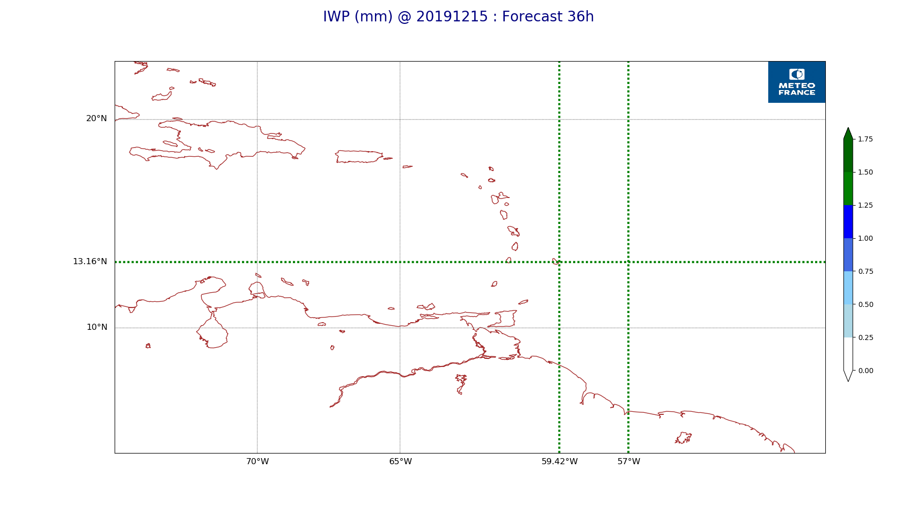
ARPEGE_map2D_IWP_20191215_fct_36.png
2019-12-16 11:19
151K
ARPEGE_map2D_IWP_20191215_fct_48.png
2019-12-16 11:19
151K
ARPEGE_map2D_LWP_20191215_fct_0.png
2019-12-16 11:17
140K
ARPEGE_map2D_LWP_20191215_fct_12.png
2019-12-16 11:17
140K
ARPEGE_map2D_LWP_20191215_fct_24.png
2019-12-16 11:18
141K
ARPEGE_map2D_LWP_20191215_fct_36.png
2019-12-16 11:18
141K
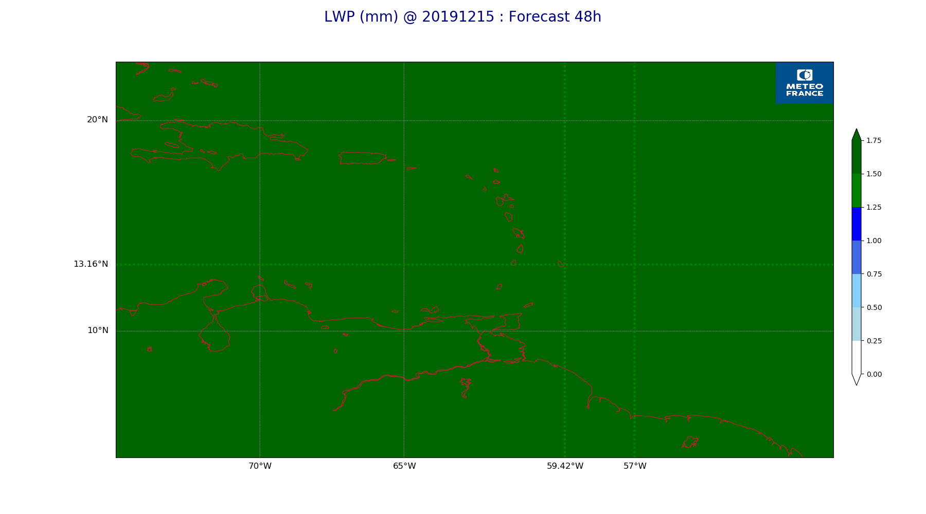
ARPEGE_map2D_LWP_20191215_fct_48.png
2019-12-16 11:18
141K
ARPEGE_map2D_Low_CC_inf_785hPa_20191215_fct_0.png
2019-12-16 11:11
167K
ARPEGE_map2D_Low_CC_inf_785hPa_20191215_fct_12.png
2019-12-16 11:11
340K
ARPEGE_map2D_Low_CC_inf_785hPa_20191215_fct_24.png
2019-12-16 11:11
366K
ARPEGE_map2D_Low_CC_inf_785hPa_20191215_fct_36.png
2019-12-16 11:12
401K
ARPEGE_map2D_Low_CC_inf_785hPa_20191215_fct_48.png
2019-12-16 11:12
390K
ARPEGE_map2D_Mid_CC_785_450hPa_20191215_fct_0.png
2019-12-16 11:12
167K
ARPEGE_map2D_Mid_CC_785_450hPa_20191215_fct_12.png
2019-12-16 11:12
426K
ARPEGE_map2D_Mid_CC_785_450hPa_20191215_fct_24.png
2019-12-16 11:12
494K
ARPEGE_map2D_Mid_CC_785_450hPa_20191215_fct_36.png
2019-12-16 11:12
506K
ARPEGE_map2D_Mid_CC_785_450hPa_20191215_fct_48.png
2019-12-16 11:13
500K
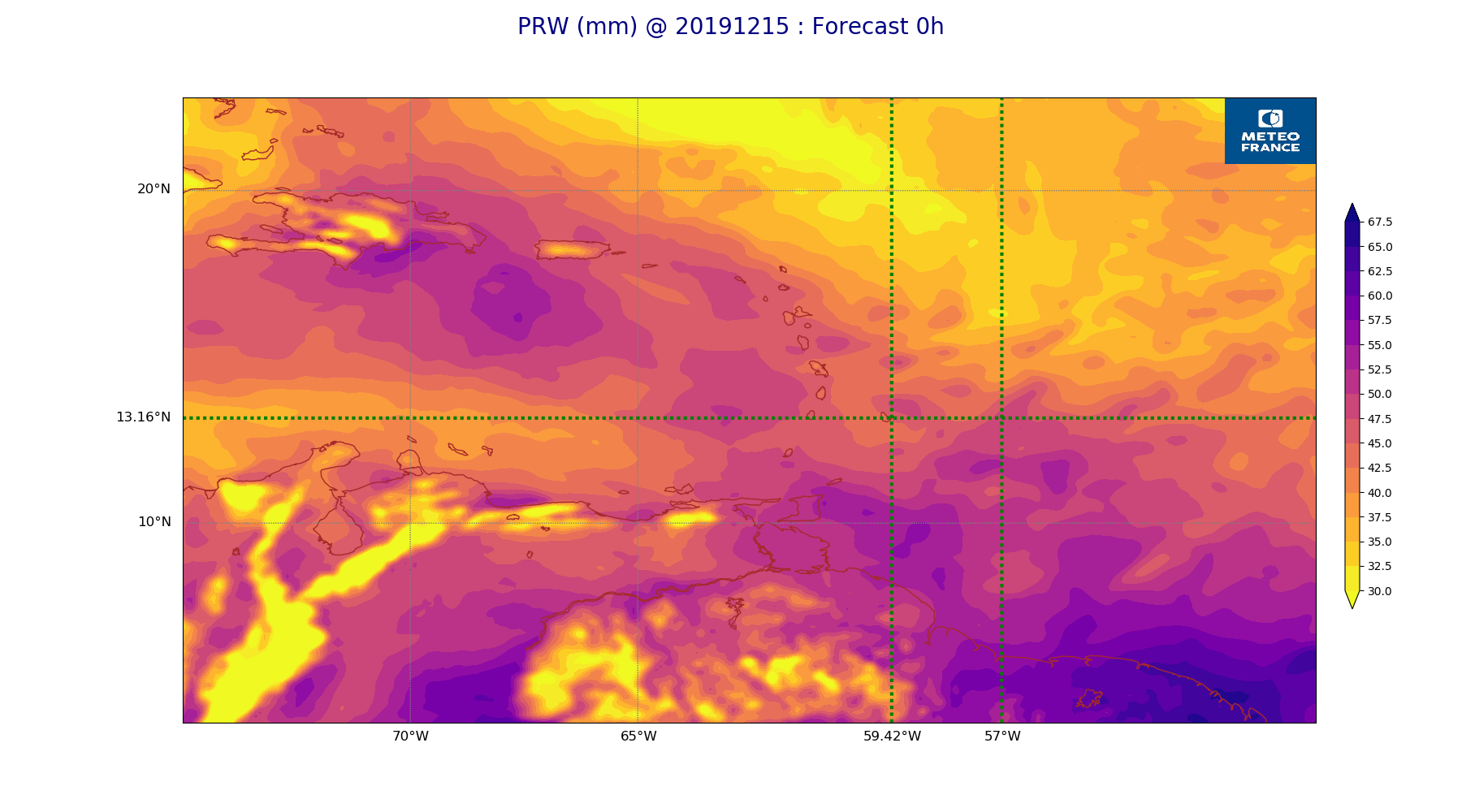
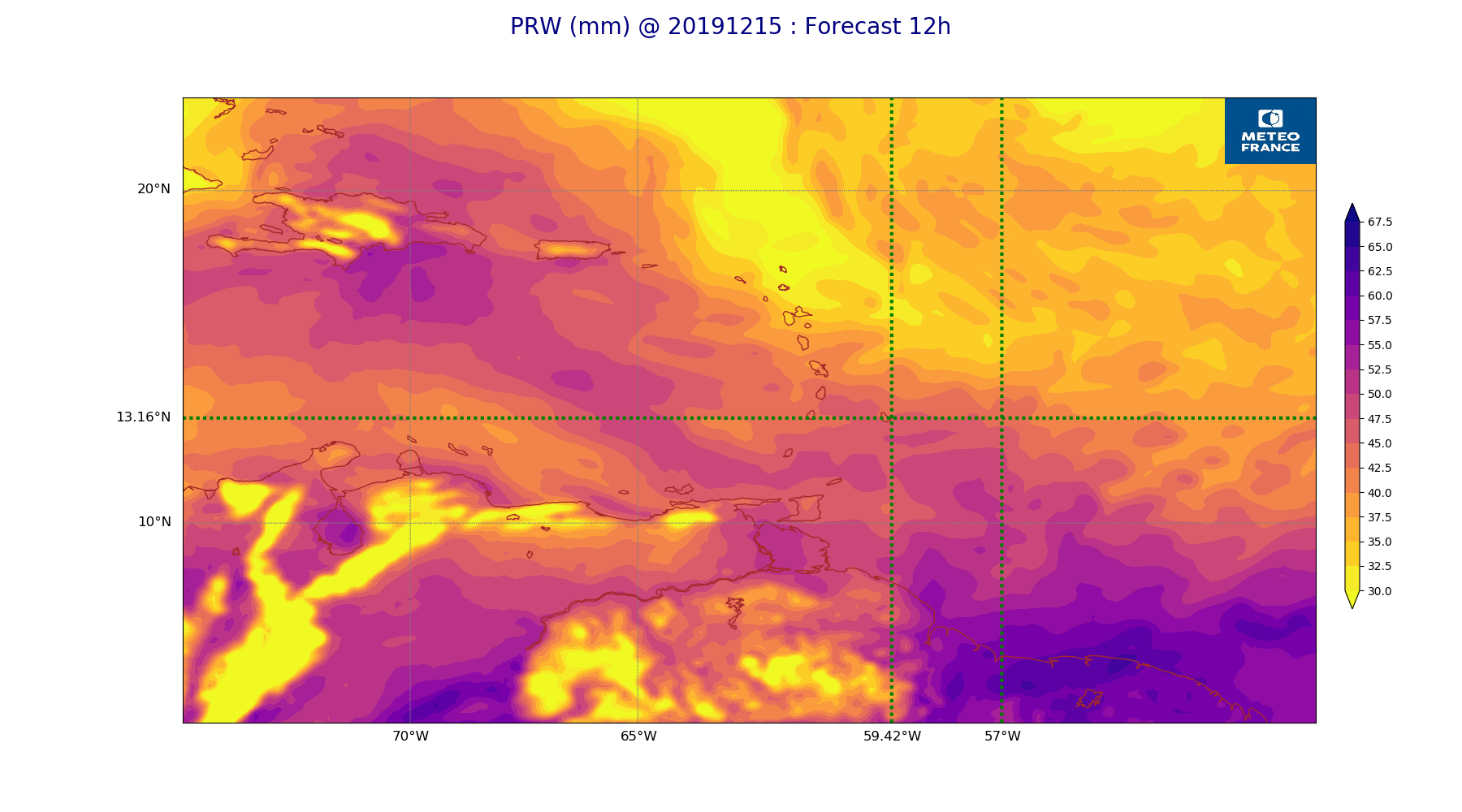
ARPEGE_map2D_PRW_20191215_fct_0.png
2019-12-16 11:15
235K
ARPEGE_map2D_PRW_20191215_fct_12.png
2019-12-16 11:15
239K
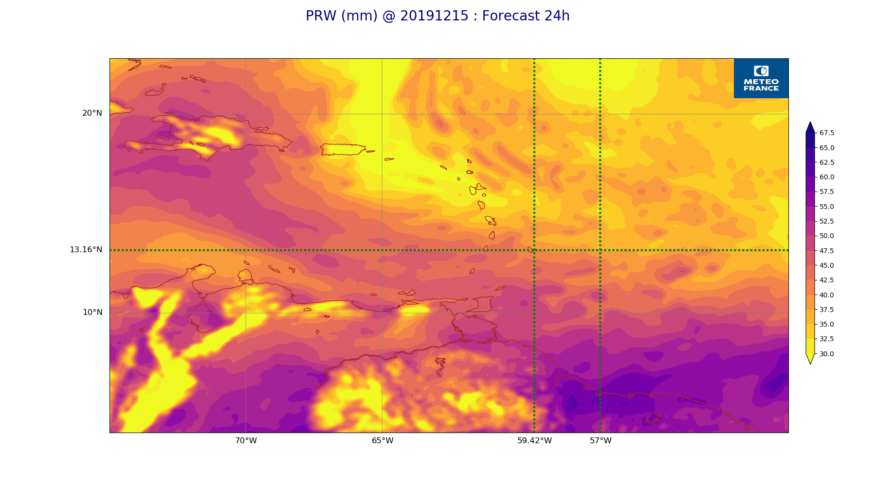
ARPEGE_map2D_PRW_20191215_fct_24.png
2019-12-16 11:15
240K
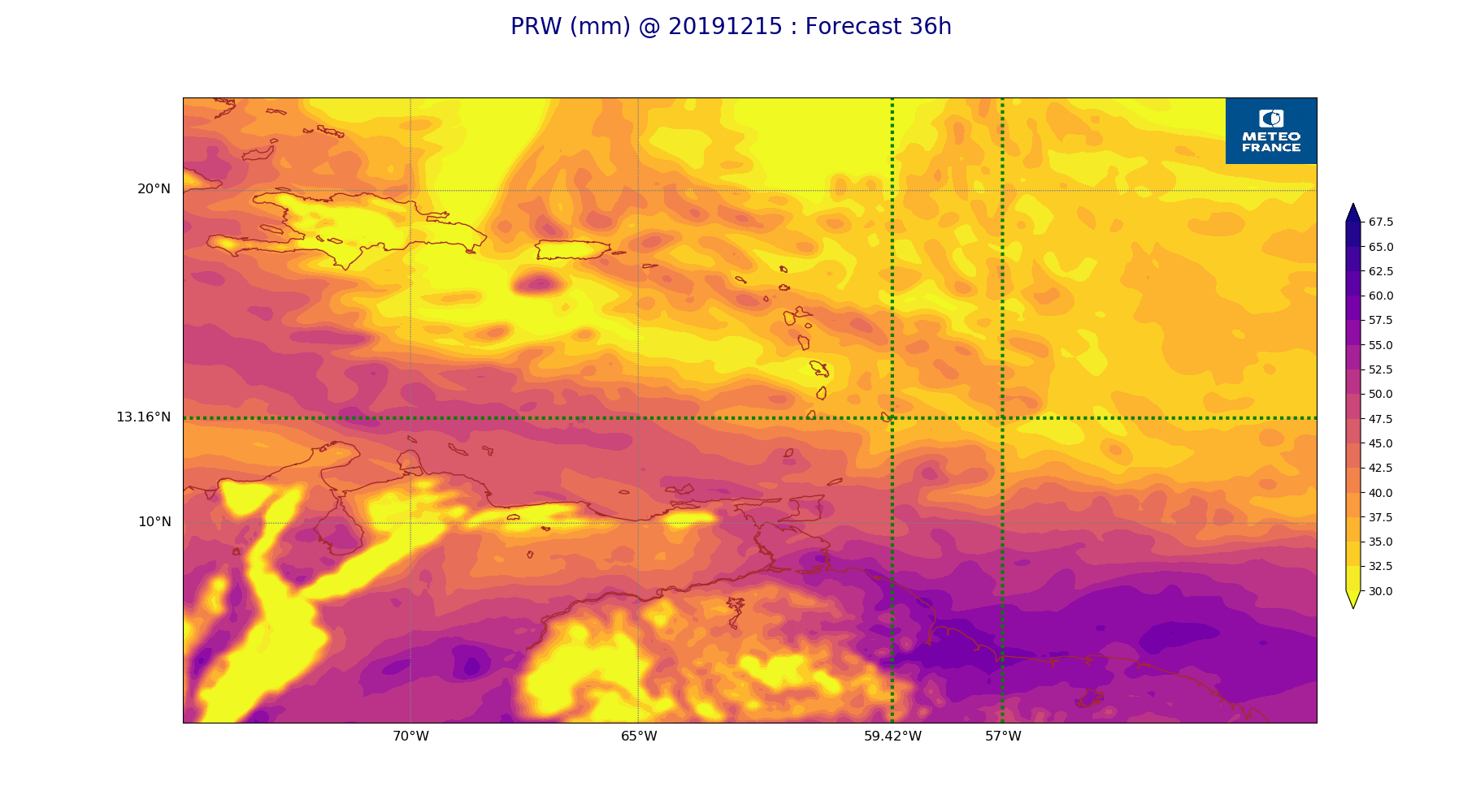
ARPEGE_map2D_PRW_20191215_fct_36.png
2019-12-16 11:15
244K
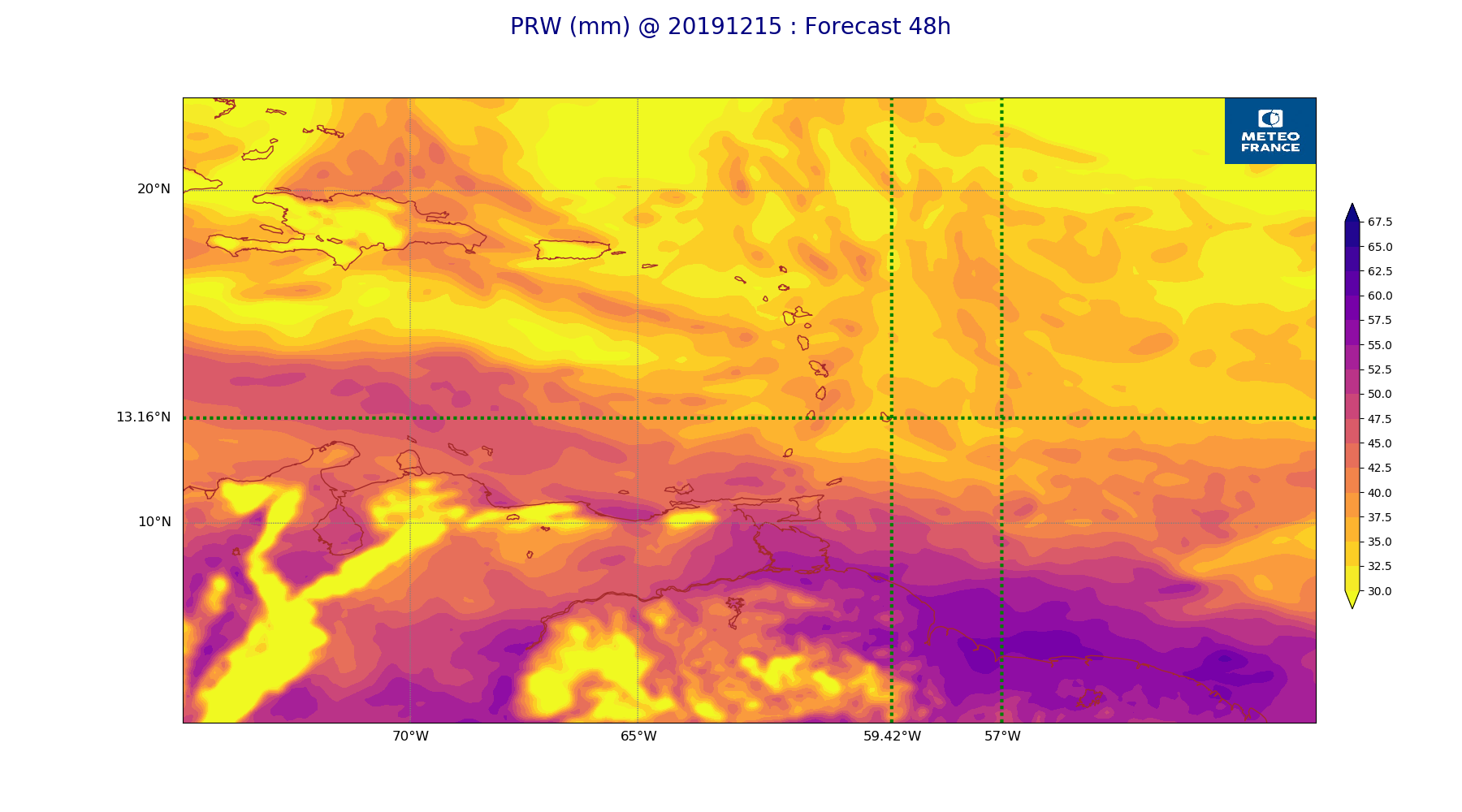
ARPEGE_map2D_PRW_20191215_fct_48.png
2019-12-16 11:15
243K
ARPEGE_map2D_Psfc_20191215_fct_0.png
2019-12-16 11:19
147K
ARPEGE_map2D_Psfc_20191215_fct_12.png
2019-12-16 11:19
147K
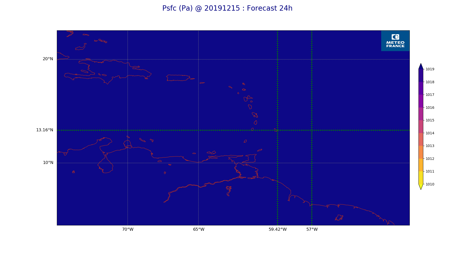
ARPEGE_map2D_Psfc_20191215_fct_24.png
2019-12-16 11:19
147K
ARPEGE_map2D_Psfc_20191215_fct_36.png
2019-12-16 11:19
148K
ARPEGE_map2D_Psfc_20191215_fct_48.png
2019-12-16 11:20
148K
ARPEGE_map2D_RH_200hPa_20191215_fct_0.png
2019-12-16 11:08
159K
ARPEGE_map2D_RH_200hPa_20191215_fct_12.png
2019-12-16 11:08
159K
ARPEGE_map2D_RH_200hPa_20191215_fct_24.png
2019-12-16 11:09
159K
ARPEGE_map2D_RH_200hPa_20191215_fct_36.png
2019-12-16 11:09
159K
ARPEGE_map2D_RH_200hPa_20191215_fct_48.png
2019-12-16 11:09
159K
ARPEGE_map2D_RH_500hPa_20191215_fct_0.png
2019-12-16 11:08
249K
ARPEGE_map2D_RH_500hPa_20191215_fct_12.png
2019-12-16 11:08
251K
ARPEGE_map2D_RH_500hPa_20191215_fct_24.png
2019-12-16 11:09
241K
ARPEGE_map2D_RH_500hPa_20191215_fct_36.png
2019-12-16 11:09
246K
ARPEGE_map2D_RH_500hPa_20191215_fct_48.png
2019-12-16 11:09
234K
ARPEGE_map2D_RH_700hPa_20191215_fct_0.png
2019-12-16 11:08
252K
ARPEGE_map2D_RH_700hPa_20191215_fct_12.png
2019-12-16 11:08
250K
ARPEGE_map2D_RH_700hPa_20191215_fct_24.png
2019-12-16 11:09
249K
ARPEGE_map2D_RH_700hPa_20191215_fct_36.png
2019-12-16 11:09
255K
ARPEGE_map2D_RH_700hPa_20191215_fct_48.png
2019-12-16 11:09
252K
ARPEGE_map2D_RH_850hPa_20191215_fct_0.png
2019-12-16 11:08
255K
ARPEGE_map2D_RH_850hPa_20191215_fct_12.png
2019-12-16 11:09
252K
ARPEGE_map2D_RH_850hPa_20191215_fct_24.png
2019-12-16 11:09
258K
ARPEGE_map2D_RH_850hPa_20191215_fct_36.png
2019-12-16 11:09
277K
ARPEGE_map2D_RH_850hPa_20191215_fct_48.png
2019-12-16 11:09
281K
ARPEGE_map2D_RH_925hPa_20191215_fct_0.png
2019-12-16 11:08
252K
ARPEGE_map2D_RH_925hPa_20191215_fct_12.png
2019-12-16 11:09
252K
ARPEGE_map2D_RH_925hPa_20191215_fct_24.png
2019-12-16 11:09
251K
ARPEGE_map2D_RH_925hPa_20191215_fct_36.png
2019-12-16 11:09
256K
ARPEGE_map2D_RH_925hPa_20191215_fct_48.png
2019-12-16 11:09
245K
ARPEGE_map2D_T_200hPa_20191215_fct_0.png
2019-12-16 11:07
159K
ARPEGE_map2D_T_200hPa_20191215_fct_12.png
2019-12-16 11:08
159K
ARPEGE_map2D_T_200hPa_20191215_fct_24.png
2019-12-16 11:08
160K
ARPEGE_map2D_T_200hPa_20191215_fct_36.png
2019-12-16 11:08
160K
ARPEGE_map2D_T_200hPa_20191215_fct_48.png
2019-12-16 11:08
160K
ARPEGE_map2D_T_500hPa_20191215_fct_0.png
2019-12-16 11:07
139K
ARPEGE_map2D_T_500hPa_20191215_fct_12.png
2019-12-16 11:08
140K
ARPEGE_map2D_T_500hPa_20191215_fct_24.png
2019-12-16 11:08
139K
ARPEGE_map2D_T_500hPa_20191215_fct_36.png
2019-12-16 11:08
140K
ARPEGE_map2D_T_500hPa_20191215_fct_48.png
2019-12-16 11:08
140K
ARPEGE_map2D_T_700hPa_20191215_fct_0.png
2019-12-16 11:07
159K
ARPEGE_map2D_T_700hPa_20191215_fct_12.png
2019-12-16 11:08
159K
ARPEGE_map2D_T_700hPa_20191215_fct_24.png
2019-12-16 11:08
159K
ARPEGE_map2D_T_700hPa_20191215_fct_36.png
2019-12-16 11:08
160K
ARPEGE_map2D_T_700hPa_20191215_fct_48.png
2019-12-16 11:08
160K
ARPEGE_map2D_T_850hPa_20191215_fct_0.png
2019-12-16 11:07
163K
ARPEGE_map2D_T_850hPa_20191215_fct_12.png
2019-12-16 11:08
166K
ARPEGE_map2D_T_850hPa_20191215_fct_24.png
2019-12-16 11:08
163K
ARPEGE_map2D_T_850hPa_20191215_fct_36.png
2019-12-16 11:08
169K
ARPEGE_map2D_T_850hPa_20191215_fct_48.png
2019-12-16 11:08
166K
ARPEGE_map2D_T_925hPa_20191215_fct_0.png
2019-12-16 11:08
169K
ARPEGE_map2D_T_925hPa_20191215_fct_12.png
2019-12-16 11:08
165K
ARPEGE_map2D_T_925hPa_20191215_fct_24.png
2019-12-16 11:08
163K
ARPEGE_map2D_T_925hPa_20191215_fct_36.png
2019-12-16 11:08
163K
ARPEGE_map2D_T_925hPa_20191215_fct_48.png
2019-12-16 11:08
162K
ARPEGE_map2D_U_200hPa_20191215_fct_0.png
2019-12-16 11:03
200K
ARPEGE_map2D_U_200hPa_20191215_fct_12.png
2019-12-16 11:03
198K
ARPEGE_map2D_U_200hPa_20191215_fct_24.png
2019-12-16 11:03
203K
ARPEGE_map2D_U_200hPa_20191215_fct_36.png
2019-12-16 11:04
199K
ARPEGE_map2D_U_200hPa_20191215_fct_48.png
2019-12-16 11:04
198K
ARPEGE_map2D_U_500hPa_20191215_fct_0.png
2019-12-16 11:03
193K
ARPEGE_map2D_U_500hPa_20191215_fct_12.png
2019-12-16 11:03
190K
ARPEGE_map2D_U_500hPa_20191215_fct_24.png
2019-12-16 11:03
181K
ARPEGE_map2D_U_500hPa_20191215_fct_36.png
2019-12-16 11:04
183K
ARPEGE_map2D_U_500hPa_20191215_fct_48.png
2019-12-16 11:04
181K
ARPEGE_map2D_U_700hPa_20191215_fct_0.png
2019-12-16 11:03
163K
ARPEGE_map2D_U_700hPa_20191215_fct_12.png
2019-12-16 11:03
163K
ARPEGE_map2D_U_700hPa_20191215_fct_24.png
2019-12-16 11:03
164K
ARPEGE_map2D_U_700hPa_20191215_fct_36.png
2019-12-16 11:04
164K
ARPEGE_map2D_U_700hPa_20191215_fct_48.png
2019-12-16 11:04
164K
ARPEGE_map2D_U_850hPa_20191215_fct_0.png
2019-12-16 11:03
192K
ARPEGE_map2D_U_850hPa_20191215_fct_12.png
2019-12-16 11:03
192K
ARPEGE_map2D_U_850hPa_20191215_fct_24.png
2019-12-16 11:04
191K
ARPEGE_map2D_U_850hPa_20191215_fct_36.png
2019-12-16 11:04
194K
ARPEGE_map2D_U_850hPa_20191215_fct_48.png
2019-12-16 11:04
195K
ARPEGE_map2D_U_925hPa_20191215_fct_0.png
2019-12-16 11:03
191K
ARPEGE_map2D_U_925hPa_20191215_fct_12.png
2019-12-16 11:03
193K
ARPEGE_map2D_U_925hPa_20191215_fct_24.png
2019-12-16 11:04
191K
ARPEGE_map2D_U_925hPa_20191215_fct_36.png
2019-12-16 11:04
193K
ARPEGE_map2D_U_925hPa_20191215_fct_48.png
2019-12-16 11:04
193K
ARPEGE_map2D_V_200hPa_20191215_fct_0.png
2019-12-16 11:04
202K
ARPEGE_map2D_V_200hPa_20191215_fct_12.png
2019-12-16 11:04
205K
ARPEGE_map2D_V_200hPa_20191215_fct_24.png
2019-12-16 11:04
209K
ARPEGE_map2D_V_200hPa_20191215_fct_36.png
2019-12-16 11:04
192K
ARPEGE_map2D_V_200hPa_20191215_fct_48.png
2019-12-16 11:05
189K
ARPEGE_map2D_V_500hPa_20191215_fct_0.png
2019-12-16 11:04
220K
ARPEGE_map2D_V_500hPa_20191215_fct_12.png
2019-12-16 11:04
225K
ARPEGE_map2D_V_500hPa_20191215_fct_24.png
2019-12-16 11:04
218K
ARPEGE_map2D_V_500hPa_20191215_fct_36.png
2019-12-16 11:04
227K
ARPEGE_map2D_V_500hPa_20191215_fct_48.png
2019-12-16 11:05
216K
ARPEGE_map2D_V_700hPa_20191215_fct_0.png
2019-12-16 11:04
156K
ARPEGE_map2D_V_700hPa_20191215_fct_12.png
2019-12-16 11:04
156K
ARPEGE_map2D_V_700hPa_20191215_fct_24.png
2019-12-16 11:04
156K
ARPEGE_map2D_V_700hPa_20191215_fct_36.png
2019-12-16 11:05
156K
ARPEGE_map2D_V_700hPa_20191215_fct_48.png
2019-12-16 11:05
156K
ARPEGE_map2D_V_850hPa_20191215_fct_0.png
2019-12-16 11:04
240K
ARPEGE_map2D_V_850hPa_20191215_fct_12.png
2019-12-16 11:04
244K
ARPEGE_map2D_V_850hPa_20191215_fct_24.png
2019-12-16 11:04
246K
ARPEGE_map2D_V_850hPa_20191215_fct_36.png
2019-12-16 11:05
257K
ARPEGE_map2D_V_850hPa_20191215_fct_48.png
2019-12-16 11:05
255K
ARPEGE_map2D_V_925hPa_20191215_fct_0.png
2019-12-16 11:04
239K
ARPEGE_map2D_V_925hPa_20191215_fct_12.png
2019-12-16 11:04
242K
ARPEGE_map2D_V_925hPa_20191215_fct_24.png
2019-12-16 11:04
240K
ARPEGE_map2D_V_925hPa_20191215_fct_36.png
2019-12-16 11:05
245K
ARPEGE_map2D_V_925hPa_20191215_fct_48.png
2019-12-16 11:05
247K
ARPEGE_map2D_Vertical_velocity_200hPa_20191215_fct_0.png
2019-12-16 11:02
163K
ARPEGE_map2D_Vertical_velocity_200hPa_20191215_fct_12.png
2019-12-16 11:02
163K
ARPEGE_map2D_Vertical_velocity_200hPa_20191215_fct_24.png
2019-12-16 11:03
163K
ARPEGE_map2D_Vertical_velocity_200hPa_20191215_fct_36.png
2019-12-16 11:03
163K
ARPEGE_map2D_Vertical_velocity_200hPa_20191215_fct_48.png
2019-12-16 11:03
163K
ARPEGE_map2D_Vertical_velocity_500hPa_20191215_fct_0.png
2019-12-16 11:02
306K
ARPEGE_map2D_Vertical_velocity_500hPa_20191215_fct_12.png
2019-12-16 11:02
311K
ARPEGE_map2D_Vertical_velocity_500hPa_20191215_fct_24.png
2019-12-16 11:03
299K
ARPEGE_map2D_Vertical_velocity_500hPa_20191215_fct_36.png
2019-12-16 11:03
312K
ARPEGE_map2D_Vertical_velocity_500hPa_20191215_fct_48.png
2019-12-16 11:03
308K
ARPEGE_map2D_Vertical_velocity_700hPa_20191215_fct_0.png
2019-12-16 11:02
327K
ARPEGE_map2D_Vertical_velocity_700hPa_20191215_fct_12.png
2019-12-16 11:02
340K
ARPEGE_map2D_Vertical_velocity_700hPa_20191215_fct_24.png
2019-12-16 11:03
343K
ARPEGE_map2D_Vertical_velocity_700hPa_20191215_fct_36.png
2019-12-16 11:03
357K
ARPEGE_map2D_Vertical_velocity_700hPa_20191215_fct_48.png
2019-12-16 11:03
357K
ARPEGE_map2D_Vertical_velocity_850hPa_20191215_fct_0.png
2019-12-16 11:02
354K
ARPEGE_map2D_Vertical_velocity_850hPa_20191215_fct_12.png
2019-12-16 11:02
354K
ARPEGE_map2D_Vertical_velocity_850hPa_20191215_fct_24.png
2019-12-16 11:03
362K
ARPEGE_map2D_Vertical_velocity_850hPa_20191215_fct_36.png
2019-12-16 11:03
370K
ARPEGE_map2D_Vertical_velocity_850hPa_20191215_fct_48.png
2019-12-16 11:03
379K
ARPEGE_map2D_Vertical_velocity_925hPa_20191215_fct_0.png
2019-12-16 11:02
163K
ARPEGE_map2D_Vertical_velocity_925hPa_20191215_fct_12.png
2019-12-16 11:03
163K
ARPEGE_map2D_Vertical_velocity_925hPa_20191215_fct_24.png
2019-12-16 11:03
163K
ARPEGE_map2D_Vertical_velocity_925hPa_20191215_fct_36.png
2019-12-16 11:03
163K
ARPEGE_map2D_Vertical_velocity_925hPa_20191215_fct_48.png
2019-12-16 11:03
163K
ARPEGE_map2D_qv_200hPa_20191215_fct_0.png
2019-12-16 11:09
159K
ARPEGE_map2D_qv_200hPa_20191215_fct_12.png
2019-12-16 11:09
159K
ARPEGE_map2D_qv_200hPa_20191215_fct_24.png
2019-12-16 11:09
160K
ARPEGE_map2D_qv_200hPa_20191215_fct_36.png
2019-12-16 11:10
160K
ARPEGE_map2D_qv_200hPa_20191215_fct_48.png
2019-12-16 11:10
160K
ARPEGE_map2D_qv_500hPa_20191215_fct_0.png
2019-12-16 11:09
153K
ARPEGE_map2D_qv_500hPa_20191215_fct_12.png
2019-12-16 11:09
153K
ARPEGE_map2D_qv_500hPa_20191215_fct_24.png
2019-12-16 11:10
153K
ARPEGE_map2D_qv_500hPa_20191215_fct_36.png
2019-12-16 11:10
153K
ARPEGE_map2D_qv_500hPa_20191215_fct_48.png
2019-12-16 11:10
153K
ARPEGE_map2D_qv_700hPa_20191215_fct_0.png
2019-12-16 11:09
159K
ARPEGE_map2D_qv_700hPa_20191215_fct_12.png
2019-12-16 11:09
159K
ARPEGE_map2D_qv_700hPa_20191215_fct_24.png
2019-12-16 11:10
159K
ARPEGE_map2D_qv_700hPa_20191215_fct_36.png
2019-12-16 11:10
160K
ARPEGE_map2D_qv_700hPa_20191215_fct_48.png
2019-12-16 11:10
160K
ARPEGE_map2D_qv_850hPa_20191215_fct_0.png
2019-12-16 11:09
201K
ARPEGE_map2D_qv_850hPa_20191215_fct_12.png
2019-12-16 11:09
192K
ARPEGE_map2D_qv_850hPa_20191215_fct_24.png
2019-12-16 11:10
197K
ARPEGE_map2D_qv_850hPa_20191215_fct_36.png
2019-12-16 11:10
194K
ARPEGE_map2D_qv_850hPa_20191215_fct_48.png
2019-12-16 11:10
199K
ARPEGE_map2D_qv_925hPa_20191215_fct_0.png
2019-12-16 11:09
225K
ARPEGE_map2D_qv_925hPa_20191215_fct_12.png
2019-12-16 11:09
223K
ARPEGE_map2D_qv_925hPa_20191215_fct_24.png
2019-12-16 11:10
222K
ARPEGE_map2D_qv_925hPa_20191215_fct_36.png
2019-12-16 11:10
223K
ARPEGE_map2D_qv_925hPa_20191215_fct_48.png
2019-12-16 11:10
214K
ARPEGE_map2D_theta_200hPa_20191215_fct_0.png
2019-12-16 11:07
157K
ARPEGE_map2D_theta_200hPa_20191215_fct_12.png
2019-12-16 11:07
157K
ARPEGE_map2D_theta_200hPa_20191215_fct_24.png
2019-12-16 11:07
157K
ARPEGE_map2D_theta_200hPa_20191215_fct_36.png
2019-12-16 11:07
157K
ARPEGE_map2D_theta_200hPa_20191215_fct_48.png
2019-12-16 11:07
157K
ARPEGE_map2D_theta_500hPa_20191215_fct_0.png
2019-12-16 11:07
151K
ARPEGE_map2D_theta_500hPa_20191215_fct_12.png
2019-12-16 11:07
151K
ARPEGE_map2D_theta_500hPa_20191215_fct_24.png
2019-12-16 11:07
151K
ARPEGE_map2D_theta_500hPa_20191215_fct_36.png
2019-12-16 11:07
152K
ARPEGE_map2D_theta_500hPa_20191215_fct_48.png
2019-12-16 11:07
151K
ARPEGE_map2D_theta_700hPa_20191215_fct_0.png
2019-12-16 11:07
157K
ARPEGE_map2D_theta_700hPa_20191215_fct_12.png
2019-12-16 11:07
157K
ARPEGE_map2D_theta_700hPa_20191215_fct_24.png
2019-12-16 11:07
157K
ARPEGE_map2D_theta_700hPa_20191215_fct_36.png
2019-12-16 11:07
157K
ARPEGE_map2D_theta_700hPa_20191215_fct_48.png
2019-12-16 11:07
157K
ARPEGE_map2D_theta_850hPa_20191215_fct_0.png
2019-12-16 11:07
151K
ARPEGE_map2D_theta_850hPa_20191215_fct_12.png
2019-12-16 11:07
151K
ARPEGE_map2D_theta_850hPa_20191215_fct_24.png
2019-12-16 11:07
151K
ARPEGE_map2D_theta_850hPa_20191215_fct_36.png
2019-12-16 11:07
152K
ARPEGE_map2D_theta_850hPa_20191215_fct_48.png
2019-12-16 11:07
152K
ARPEGE_map2D_theta_925hPa_20191215_fct_0.png
2019-12-16 11:07
155K
ARPEGE_map2D_theta_925hPa_20191215_fct_12.png
2019-12-16 11:07
158K
ARPEGE_map2D_theta_925hPa_20191215_fct_24.png
2019-12-16 11:07
157K
ARPEGE_map2D_theta_925hPa_20191215_fct_36.png
2019-12-16 11:07
160K
ARPEGE_map2D_theta_925hPa_20191215_fct_48.png
2019-12-16 11:07
158K
ARPEGE_map2D_theta_e_200hPa_20191215_fct_0.png
2019-12-16 11:06
142K
ARPEGE_map2D_theta_e_200hPa_20191215_fct_12.png
2019-12-16 11:06
140K
ARPEGE_map2D_theta_e_200hPa_20191215_fct_24.png
2019-12-16 11:06
145K
ARPEGE_map2D_theta_e_200hPa_20191215_fct_36.png
2019-12-16 11:06
140K
ARPEGE_map2D_theta_e_200hPa_20191215_fct_48.png
2019-12-16 11:06
147K
ARPEGE_map2D_theta_e_500hPa_20191215_fct_0.png
2019-12-16 11:06
175K
ARPEGE_map2D_theta_e_500hPa_20191215_fct_12.png
2019-12-16 11:06
177K
ARPEGE_map2D_theta_e_500hPa_20191215_fct_24.png
2019-12-16 11:06
173K
ARPEGE_map2D_theta_e_500hPa_20191215_fct_36.png
2019-12-16 11:06
174K
ARPEGE_map2D_theta_e_500hPa_20191215_fct_48.png
2019-12-16 11:06
173K
ARPEGE_map2D_theta_e_700hPa_20191215_fct_0.png
2019-12-16 11:06
157K
ARPEGE_map2D_theta_e_700hPa_20191215_fct_12.png
2019-12-16 11:06
157K
ARPEGE_map2D_theta_e_700hPa_20191215_fct_24.png
2019-12-16 11:06
157K
ARPEGE_map2D_theta_e_700hPa_20191215_fct_36.png
2019-12-16 11:06
158K
ARPEGE_map2D_theta_e_700hPa_20191215_fct_48.png
2019-12-16 11:06
158K
ARPEGE_map2D_theta_e_850hPa_20191215_fct_0.png
2019-12-16 11:06
204K
ARPEGE_map2D_theta_e_850hPa_20191215_fct_12.png
2019-12-16 11:06
200K
ARPEGE_map2D_theta_e_850hPa_20191215_fct_24.png
2019-12-16 11:06
203K
ARPEGE_map2D_theta_e_850hPa_20191215_fct_36.png
2019-12-16 11:06
215K
ARPEGE_map2D_theta_e_850hPa_20191215_fct_48.png
2019-12-16 11:06
214K
ARPEGE_map2D_theta_e_925hPa_20191215_fct_0.png
2019-12-16 11:06
207K
ARPEGE_map2D_theta_e_925hPa_20191215_fct_12.png
2019-12-16 11:06
207K
ARPEGE_map2D_theta_e_925hPa_20191215_fct_24.png
2019-12-16 11:06
203K
ARPEGE_map2D_theta_e_925hPa_20191215_fct_36.png
2019-12-16 11:06
209K
ARPEGE_map2D_theta_e_925hPa_20191215_fct_48.png
2019-12-16 11:07
204K
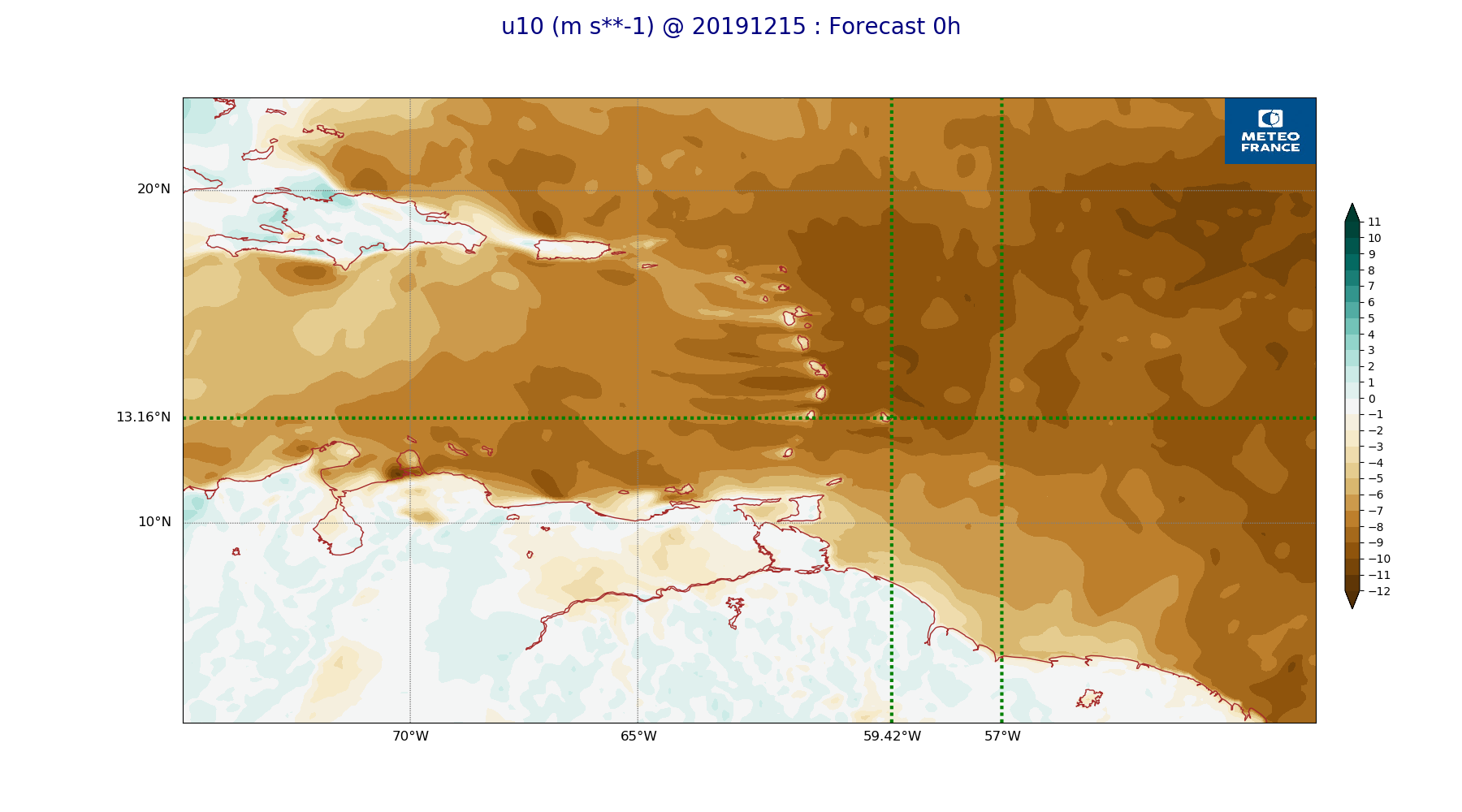
ARPEGE_map2D_u10_20191215_fct_0.png
2019-12-16 11:15
225K
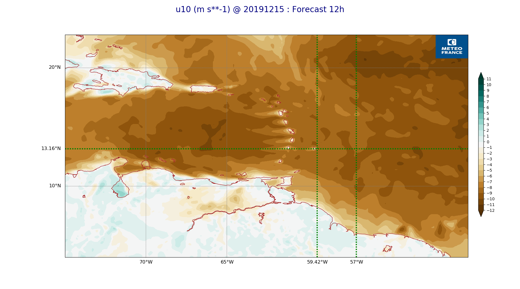
ARPEGE_map2D_u10_20191215_fct_12.png
2019-12-16 11:16
229K
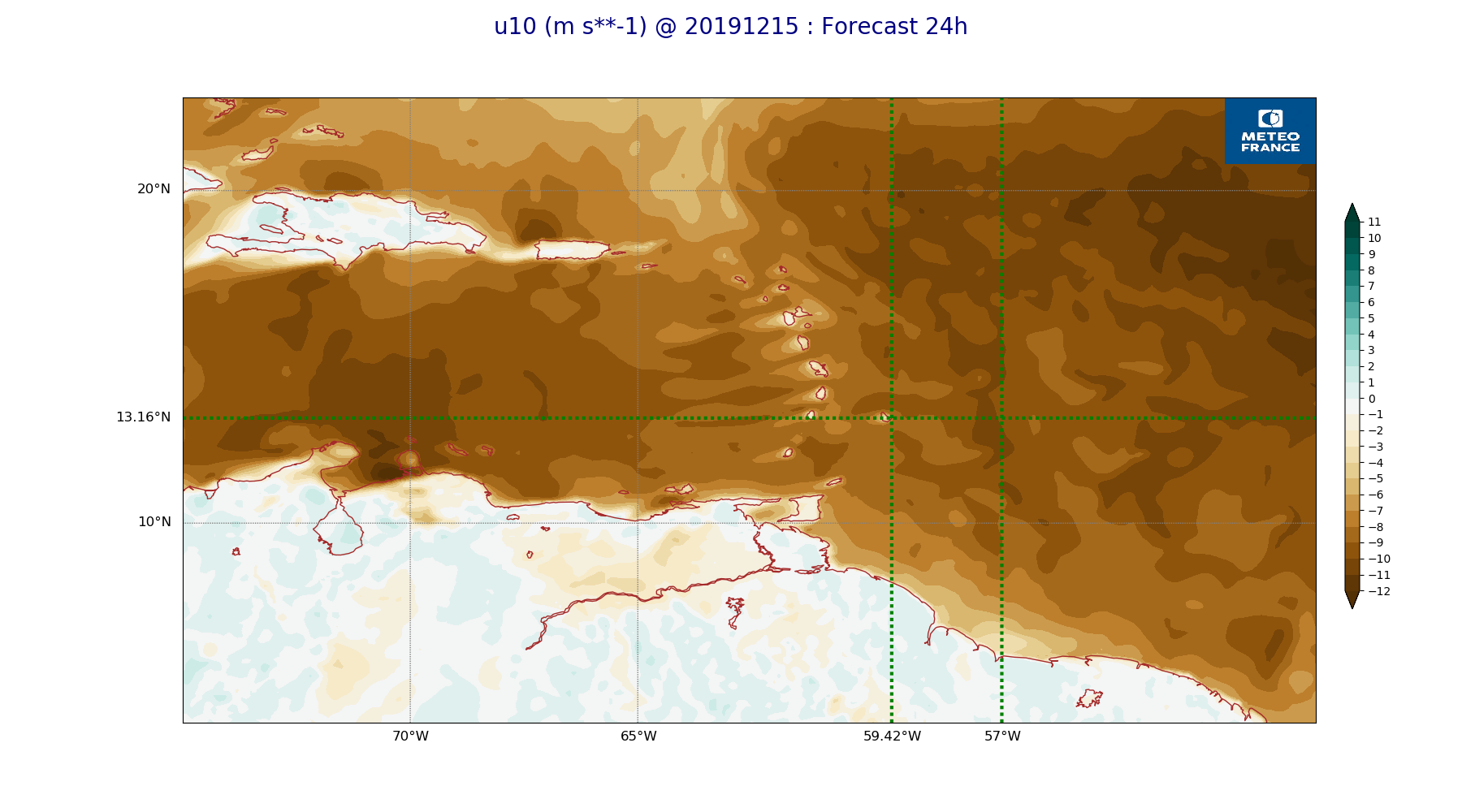
ARPEGE_map2D_u10_20191215_fct_24.png
2019-12-16 11:16
230K
ARPEGE_map2D_u10_20191215_fct_36.png
2019-12-16 11:16
232K
ARPEGE_map2D_u10_20191215_fct_48.png
2019-12-16 11:16
231K
ARPEGE_map2D_v10_20191215_fct_0.png
2019-12-16 11:16
210K
ARPEGE_map2D_v10_20191215_fct_12.png
2019-12-16 11:17
209K
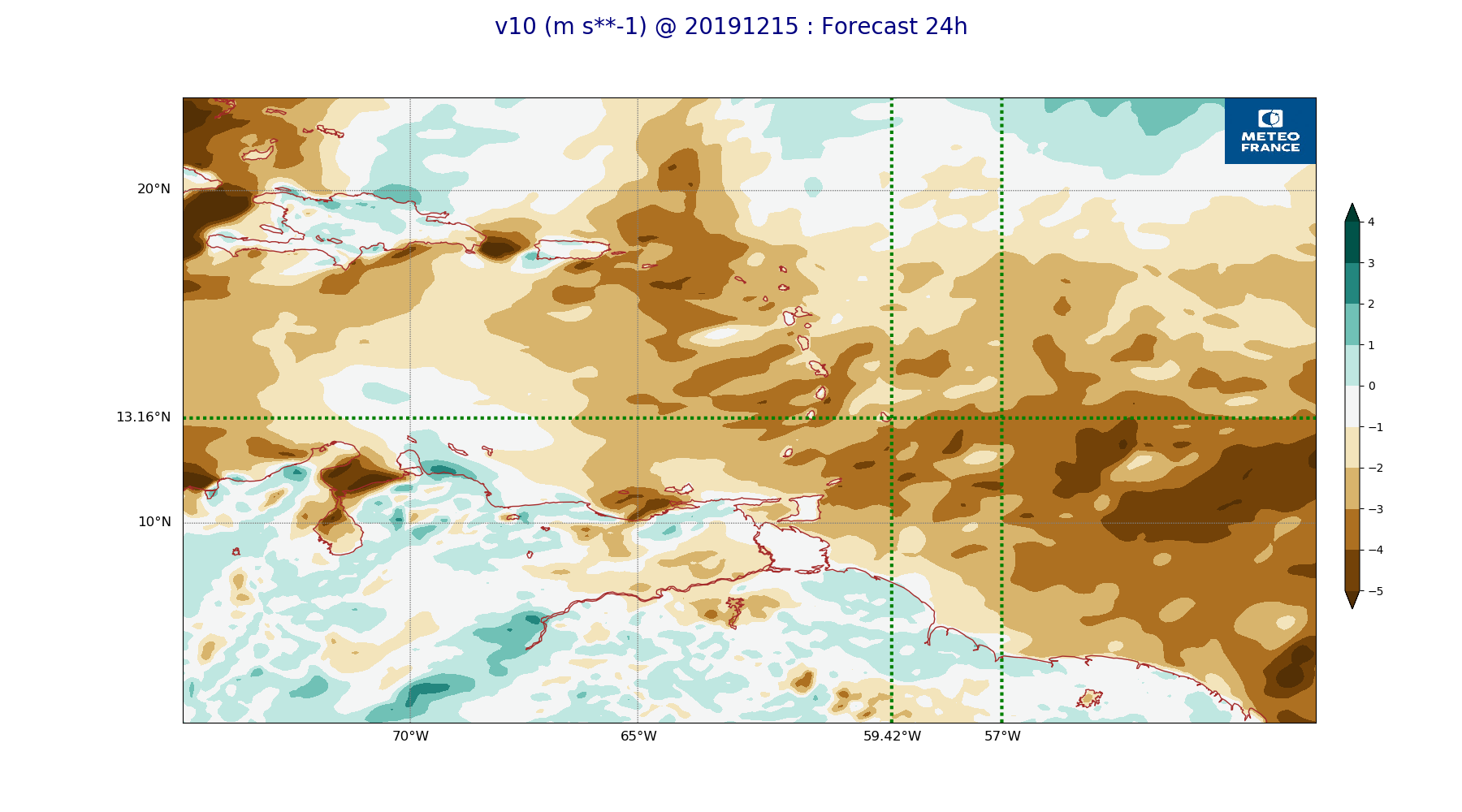
ARPEGE_map2D_v10_20191215_fct_24.png
2019-12-16 11:17
213K
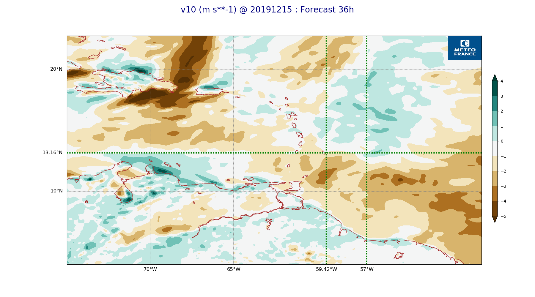
ARPEGE_map2D_v10_20191215_fct_36.png
2019-12-16 11:17
216K
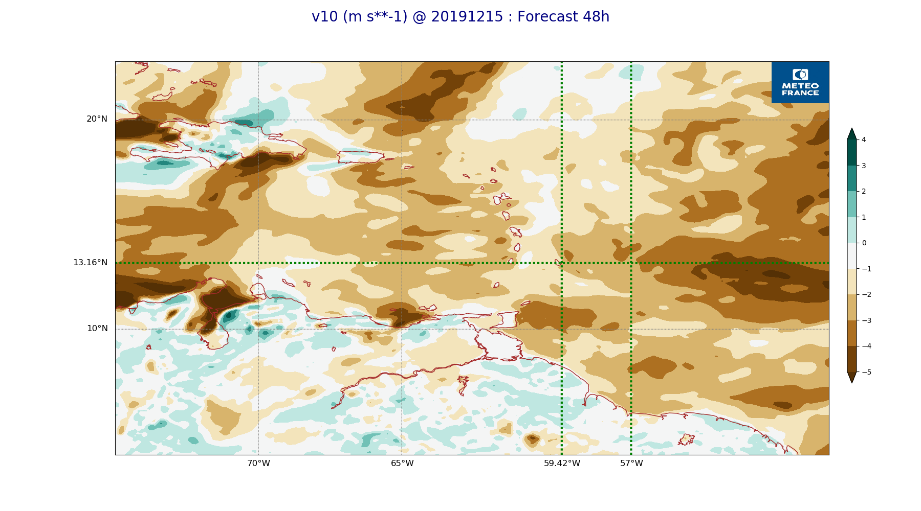
ARPEGE_map2D_v10_20191215_fct_48.png
2019-12-16 11:17
217K