Index of /aeris/eurec4a-data/FORECASTS/GLOBAL/ARPEGE/2019/20191216/map2D
Name
Last modified
Size
Parent Directory
-
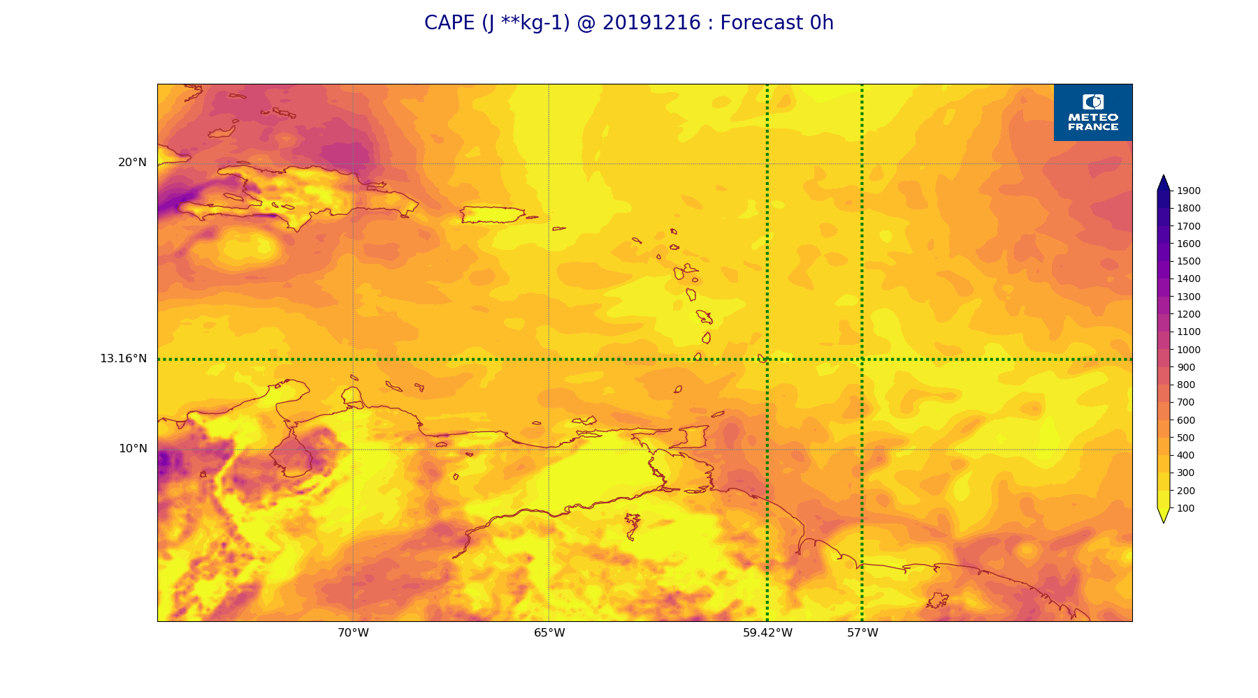
ARPEGE_map2D_CAPE_20191216_fct_0.png
2019-12-16 19:37
264K
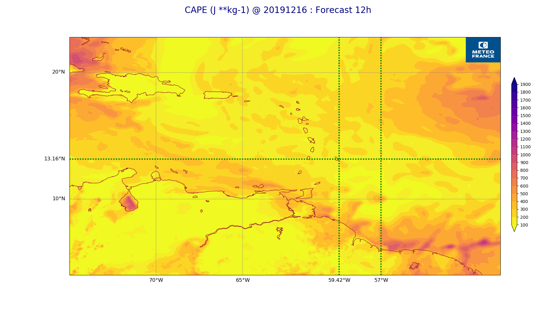
ARPEGE_map2D_CAPE_20191216_fct_12.png
2019-12-16 19:37
229K
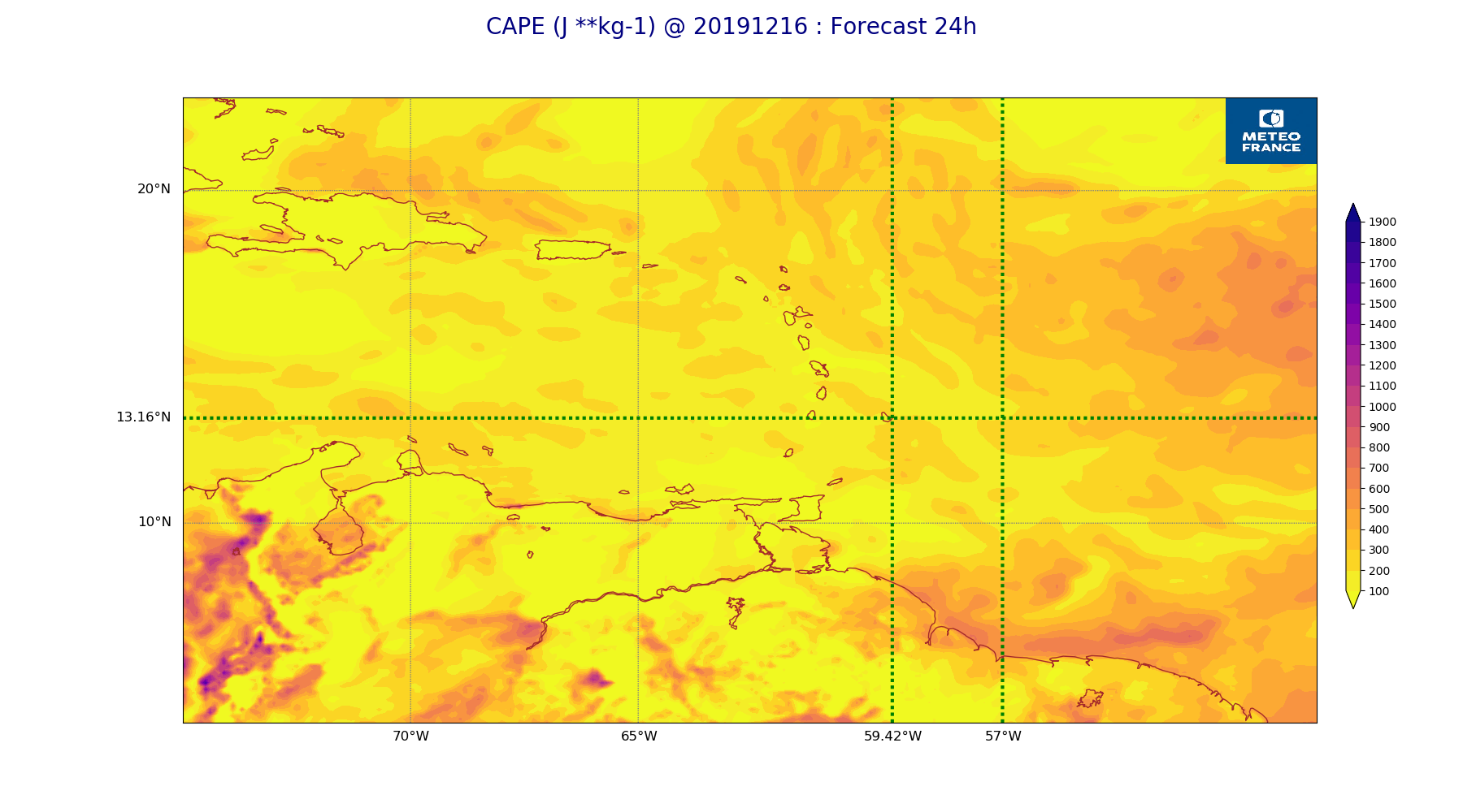
ARPEGE_map2D_CAPE_20191216_fct_24.png
2019-12-16 19:37
250K
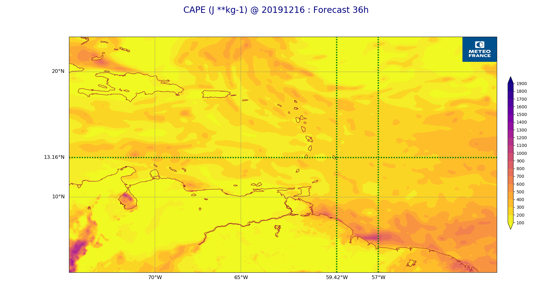
ARPEGE_map2D_CAPE_20191216_fct_36.png
2019-12-16 19:37
226K
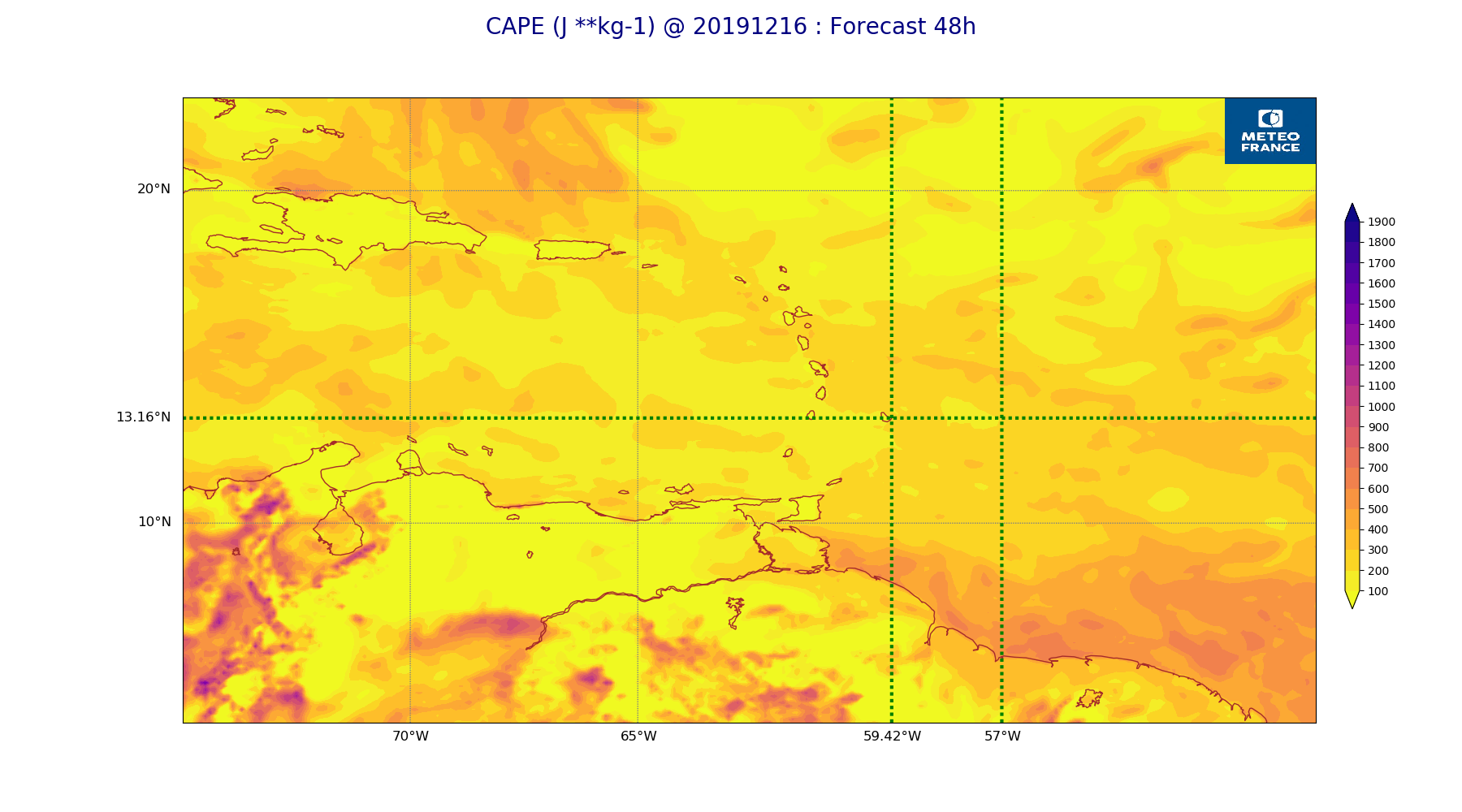
ARPEGE_map2D_CAPE_20191216_fct_48.png
2019-12-16 19:37
250K
ARPEGE_map2D_Cum_3h_RAIN_20191216_fct_0.png
2019-12-16 19:31
151K
ARPEGE_map2D_Cum_3h_RAIN_20191216_fct_12.png
2019-12-16 19:31
215K
ARPEGE_map2D_Cum_3h_RAIN_20191216_fct_24.png
2019-12-16 19:31
219K
ARPEGE_map2D_Cum_3h_RAIN_20191216_fct_36.png
2019-12-16 19:31
188K
ARPEGE_map2D_Cum_3h_RAIN_20191216_fct_48.png
2019-12-16 19:31
233K
ARPEGE_map2D_Fraction_cloud_cover_200hPa_20191216_fct_0.png
2019-12-16 19:22
162K
ARPEGE_map2D_Fraction_cloud_cover_200hPa_20191216_fct_12.png
2019-12-16 19:22
364K
ARPEGE_map2D_Fraction_cloud_cover_200hPa_20191216_fct_24.png
2019-12-16 19:22
374K
ARPEGE_map2D_Fraction_cloud_cover_200hPa_20191216_fct_36.png
2019-12-16 19:23
331K
ARPEGE_map2D_Fraction_cloud_cover_200hPa_20191216_fct_48.png
2019-12-16 19:23
368K
ARPEGE_map2D_Fraction_cloud_cover_500hPa_20191216_fct_0.png
2019-12-16 19:22
162K
ARPEGE_map2D_Fraction_cloud_cover_500hPa_20191216_fct_12.png
2019-12-16 19:22
460K
ARPEGE_map2D_Fraction_cloud_cover_500hPa_20191216_fct_24.png
2019-12-16 19:22
458K
ARPEGE_map2D_Fraction_cloud_cover_500hPa_20191216_fct_36.png
2019-12-16 19:23
437K
ARPEGE_map2D_Fraction_cloud_cover_500hPa_20191216_fct_48.png
2019-12-16 19:23
385K
ARPEGE_map2D_Fraction_cloud_cover_700hPa_20191216_fct_0.png
2019-12-16 19:22
149K
ARPEGE_map2D_Fraction_cloud_cover_700hPa_20191216_fct_12.png
2019-12-16 19:22
149K
ARPEGE_map2D_Fraction_cloud_cover_700hPa_20191216_fct_24.png
2019-12-16 19:22
149K
ARPEGE_map2D_Fraction_cloud_cover_700hPa_20191216_fct_36.png
2019-12-16 19:23
150K
ARPEGE_map2D_Fraction_cloud_cover_700hPa_20191216_fct_48.png
2019-12-16 19:23
149K
ARPEGE_map2D_Fraction_cloud_cover_850hPa_20191216_fct_0.png
2019-12-16 19:22
162K
ARPEGE_map2D_Fraction_cloud_cover_850hPa_20191216_fct_12.png
2019-12-16 19:22
722K
ARPEGE_map2D_Fraction_cloud_cover_850hPa_20191216_fct_24.png
2019-12-16 19:22
803K
ARPEGE_map2D_Fraction_cloud_cover_850hPa_20191216_fct_36.png
2019-12-16 19:23
720K
ARPEGE_map2D_Fraction_cloud_cover_850hPa_20191216_fct_48.png
2019-12-16 19:23
817K
ARPEGE_map2D_Fraction_cloud_cover_925hPa_20191216_fct_0.png
2019-12-16 19:22
162K
ARPEGE_map2D_Fraction_cloud_cover_925hPa_20191216_fct_12.png
2019-12-16 19:22
687K
ARPEGE_map2D_Fraction_cloud_cover_925hPa_20191216_fct_24.png
2019-12-16 19:22
715K
ARPEGE_map2D_Fraction_cloud_cover_925hPa_20191216_fct_36.png
2019-12-16 19:23
687K
ARPEGE_map2D_Fraction_cloud_cover_925hPa_20191216_fct_48.png
2019-12-16 19:23
672K
ARPEGE_map2D_Geopotential_0_7_PVU_20191216_fct_0.png
2019-12-16 19:27
199K
ARPEGE_map2D_Geopotential_0_7_PVU_20191216_fct_12.png
2019-12-16 19:27
202K
ARPEGE_map2D_Geopotential_0_7_PVU_20191216_fct_24.png
2019-12-16 19:28
206K
ARPEGE_map2D_Geopotential_0_7_PVU_20191216_fct_36.png
2019-12-16 19:28
209K
ARPEGE_map2D_Geopotential_0_7_PVU_20191216_fct_48.png
2019-12-16 19:28
206K
ARPEGE_map2D_High_CC_sup_450hPa_20191216_fct_0.png
2019-12-16 19:30
167K
ARPEGE_map2D_High_CC_sup_450hPa_20191216_fct_12.png
2019-12-16 19:30
285K
ARPEGE_map2D_High_CC_sup_450hPa_20191216_fct_24.png
2019-12-16 19:30
354K
ARPEGE_map2D_High_CC_sup_450hPa_20191216_fct_36.png
2019-12-16 19:30
307K
ARPEGE_map2D_High_CC_sup_450hPa_20191216_fct_48.png
2019-12-16 19:30
344K
ARPEGE_map2D_IWP_20191216_fct_0.png
2019-12-16 19:35
151K
ARPEGE_map2D_IWP_20191216_fct_12.png
2019-12-16 19:35
151K
ARPEGE_map2D_IWP_20191216_fct_24.png
2019-12-16 19:35
151K
ARPEGE_map2D_IWP_20191216_fct_36.png
2019-12-16 19:35
151K
ARPEGE_map2D_IWP_20191216_fct_48.png
2019-12-16 19:36
151K
ARPEGE_map2D_LWP_20191216_fct_0.png
2019-12-16 19:34
141K
ARPEGE_map2D_LWP_20191216_fct_12.png
2019-12-16 19:34
141K
ARPEGE_map2D_LWP_20191216_fct_24.png
2019-12-16 19:34
141K
ARPEGE_map2D_LWP_20191216_fct_36.png
2019-12-16 19:35
141K
ARPEGE_map2D_LWP_20191216_fct_48.png
2019-12-16 19:35
141K
ARPEGE_map2D_Low_CC_inf_785hPa_20191216_fct_0.png
2019-12-16 19:28
167K
ARPEGE_map2D_Low_CC_inf_785hPa_20191216_fct_12.png
2019-12-16 19:28
386K
ARPEGE_map2D_Low_CC_inf_785hPa_20191216_fct_24.png
2019-12-16 19:28
401K
ARPEGE_map2D_Low_CC_inf_785hPa_20191216_fct_36.png
2019-12-16 19:29
408K
ARPEGE_map2D_Low_CC_inf_785hPa_20191216_fct_48.png
2019-12-16 19:29
409K
ARPEGE_map2D_Mid_CC_785_450hPa_20191216_fct_0.png
2019-12-16 19:29
168K
ARPEGE_map2D_Mid_CC_785_450hPa_20191216_fct_12.png
2019-12-16 19:29
502K
ARPEGE_map2D_Mid_CC_785_450hPa_20191216_fct_24.png
2019-12-16 19:29
522K
ARPEGE_map2D_Mid_CC_785_450hPa_20191216_fct_36.png
2019-12-16 19:29
525K
ARPEGE_map2D_Mid_CC_785_450hPa_20191216_fct_48.png
2019-12-16 19:30
507K
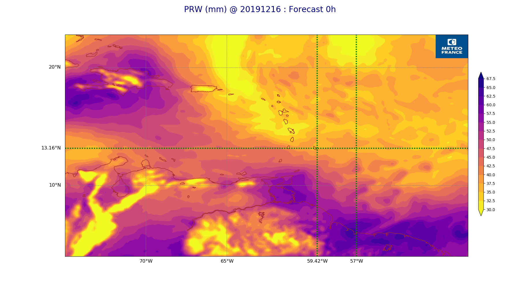
ARPEGE_map2D_PRW_20191216_fct_0.png
2019-12-16 19:32
244K
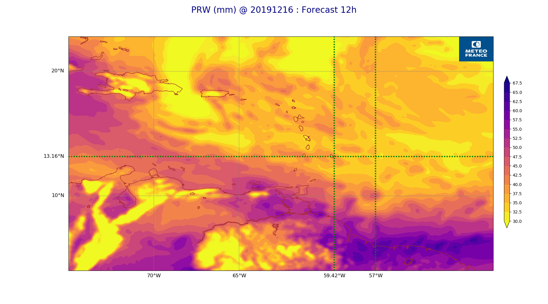
ARPEGE_map2D_PRW_20191216_fct_12.png
2019-12-16 19:32
248K
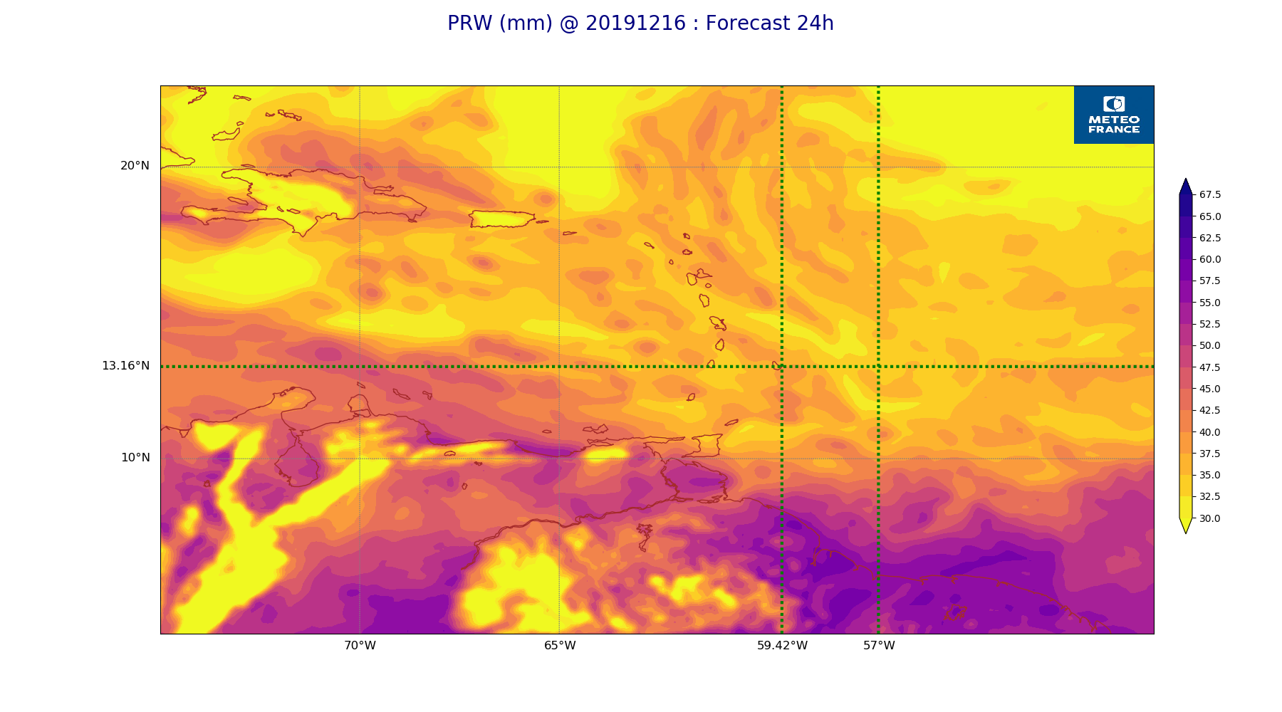
ARPEGE_map2D_PRW_20191216_fct_24.png
2019-12-16 19:32
248K
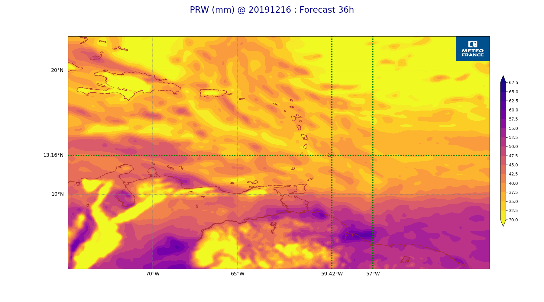
ARPEGE_map2D_PRW_20191216_fct_36.png
2019-12-16 19:32
246K
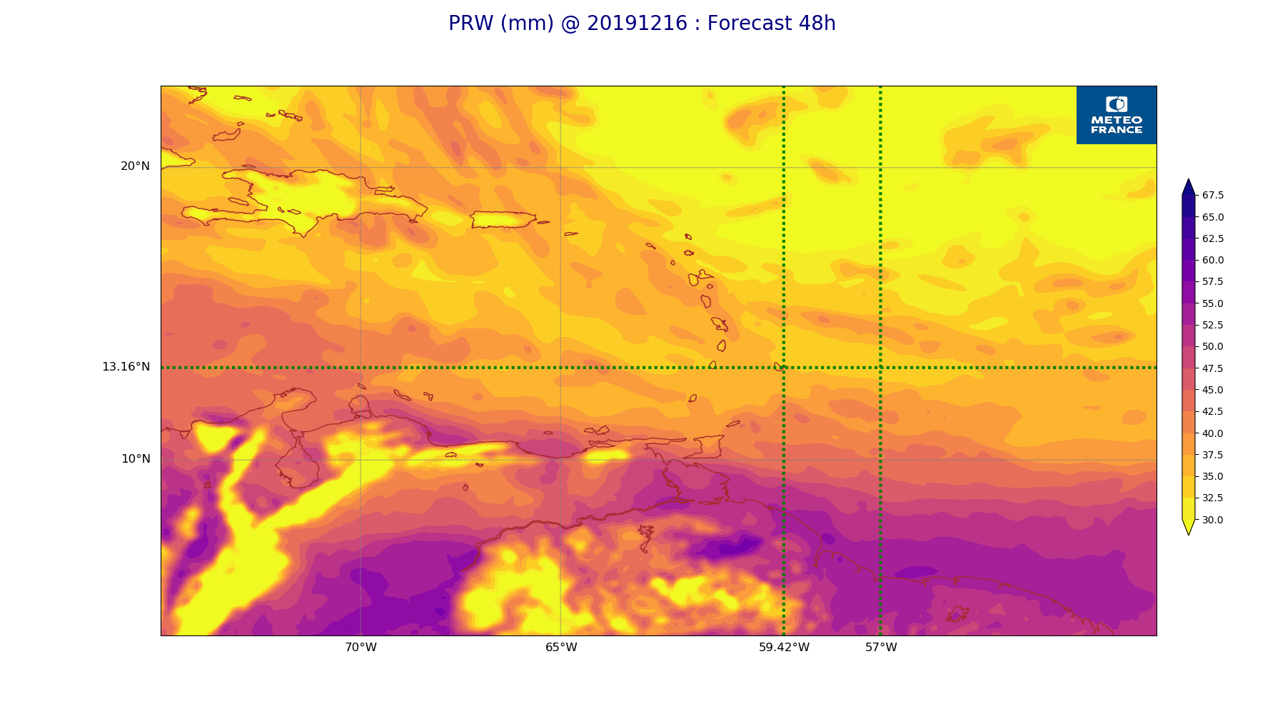
ARPEGE_map2D_PRW_20191216_fct_48.png
2019-12-16 19:32
233K
ARPEGE_map2D_Psfc_20191216_fct_0.png
2019-12-16 19:36
147K
ARPEGE_map2D_Psfc_20191216_fct_12.png
2019-12-16 19:36
147K
ARPEGE_map2D_Psfc_20191216_fct_24.png
2019-12-16 19:36
148K
ARPEGE_map2D_Psfc_20191216_fct_36.png
2019-12-16 19:36
148K
ARPEGE_map2D_Psfc_20191216_fct_48.png
2019-12-16 19:36
148K
ARPEGE_map2D_RH_200hPa_20191216_fct_0.png
2019-12-16 19:25
159K
ARPEGE_map2D_RH_200hPa_20191216_fct_12.png
2019-12-16 19:26
159K
ARPEGE_map2D_RH_200hPa_20191216_fct_24.png
2019-12-16 19:26
159K
ARPEGE_map2D_RH_200hPa_20191216_fct_36.png
2019-12-16 19:26
160K
ARPEGE_map2D_RH_200hPa_20191216_fct_48.png
2019-12-16 19:26
159K
ARPEGE_map2D_RH_500hPa_20191216_fct_0.png
2019-12-16 19:25
257K
ARPEGE_map2D_RH_500hPa_20191216_fct_12.png
2019-12-16 19:26
248K
ARPEGE_map2D_RH_500hPa_20191216_fct_24.png
2019-12-16 19:26
242K
ARPEGE_map2D_RH_500hPa_20191216_fct_36.png
2019-12-16 19:26
239K
ARPEGE_map2D_RH_500hPa_20191216_fct_48.png
2019-12-16 19:26
223K
ARPEGE_map2D_RH_700hPa_20191216_fct_0.png
2019-12-16 19:25
253K
ARPEGE_map2D_RH_700hPa_20191216_fct_12.png
2019-12-16 19:26
260K
ARPEGE_map2D_RH_700hPa_20191216_fct_24.png
2019-12-16 19:26
257K
ARPEGE_map2D_RH_700hPa_20191216_fct_36.png
2019-12-16 19:26
256K
ARPEGE_map2D_RH_700hPa_20191216_fct_48.png
2019-12-16 19:26
254K
ARPEGE_map2D_RH_850hPa_20191216_fct_0.png
2019-12-16 19:25
258K
ARPEGE_map2D_RH_850hPa_20191216_fct_12.png
2019-12-16 19:26
278K
ARPEGE_map2D_RH_850hPa_20191216_fct_24.png
2019-12-16 19:26
288K
ARPEGE_map2D_RH_850hPa_20191216_fct_36.png
2019-12-16 19:26
292K
ARPEGE_map2D_RH_850hPa_20191216_fct_48.png
2019-12-16 19:26
282K
ARPEGE_map2D_RH_925hPa_20191216_fct_0.png
2019-12-16 19:26
252K
ARPEGE_map2D_RH_925hPa_20191216_fct_12.png
2019-12-16 19:26
248K
ARPEGE_map2D_RH_925hPa_20191216_fct_24.png
2019-12-16 19:26
249K
ARPEGE_map2D_RH_925hPa_20191216_fct_36.png
2019-12-16 19:26
249K
ARPEGE_map2D_RH_925hPa_20191216_fct_48.png
2019-12-16 19:26
241K
ARPEGE_map2D_T_200hPa_20191216_fct_0.png
2019-12-16 19:25
159K
ARPEGE_map2D_T_200hPa_20191216_fct_12.png
2019-12-16 19:25
160K
ARPEGE_map2D_T_200hPa_20191216_fct_24.png
2019-12-16 19:25
160K
ARPEGE_map2D_T_200hPa_20191216_fct_36.png
2019-12-16 19:25
160K
ARPEGE_map2D_T_200hPa_20191216_fct_48.png
2019-12-16 19:25
160K
ARPEGE_map2D_T_500hPa_20191216_fct_0.png
2019-12-16 19:25
139K
ARPEGE_map2D_T_500hPa_20191216_fct_12.png
2019-12-16 19:25
139K
ARPEGE_map2D_T_500hPa_20191216_fct_24.png
2019-12-16 19:25
141K
ARPEGE_map2D_T_500hPa_20191216_fct_36.png
2019-12-16 19:25
140K
ARPEGE_map2D_T_500hPa_20191216_fct_48.png
2019-12-16 19:25
140K
ARPEGE_map2D_T_700hPa_20191216_fct_0.png
2019-12-16 19:25
159K
ARPEGE_map2D_T_700hPa_20191216_fct_12.png
2019-12-16 19:25
159K
ARPEGE_map2D_T_700hPa_20191216_fct_24.png
2019-12-16 19:25
160K
ARPEGE_map2D_T_700hPa_20191216_fct_36.png
2019-12-16 19:25
160K
ARPEGE_map2D_T_700hPa_20191216_fct_48.png
2019-12-16 19:25
160K
ARPEGE_map2D_T_850hPa_20191216_fct_0.png
2019-12-16 19:25
165K
ARPEGE_map2D_T_850hPa_20191216_fct_12.png
2019-12-16 19:25
171K
ARPEGE_map2D_T_850hPa_20191216_fct_24.png
2019-12-16 19:25
166K
ARPEGE_map2D_T_850hPa_20191216_fct_36.png
2019-12-16 19:25
171K
ARPEGE_map2D_T_850hPa_20191216_fct_48.png
2019-12-16 19:25
165K
ARPEGE_map2D_T_925hPa_20191216_fct_0.png
2019-12-16 19:25
164K
ARPEGE_map2D_T_925hPa_20191216_fct_12.png
2019-12-16 19:25
161K
ARPEGE_map2D_T_925hPa_20191216_fct_24.png
2019-12-16 19:25
163K
ARPEGE_map2D_T_925hPa_20191216_fct_36.png
2019-12-16 19:25
161K
ARPEGE_map2D_T_925hPa_20191216_fct_48.png
2019-12-16 19:25
163K
ARPEGE_map2D_U_200hPa_20191216_fct_0.png
2019-12-16 19:20
204K
ARPEGE_map2D_U_200hPa_20191216_fct_12.png
2019-12-16 19:20
200K
ARPEGE_map2D_U_200hPa_20191216_fct_24.png
2019-12-16 19:21
199K
ARPEGE_map2D_U_200hPa_20191216_fct_36.png
2019-12-16 19:21
193K
ARPEGE_map2D_U_200hPa_20191216_fct_48.png
2019-12-16 19:21
193K
ARPEGE_map2D_U_500hPa_20191216_fct_0.png
2019-12-16 19:20
188K
ARPEGE_map2D_U_500hPa_20191216_fct_12.png
2019-12-16 19:20
185K
ARPEGE_map2D_U_500hPa_20191216_fct_24.png
2019-12-16 19:21
185K
ARPEGE_map2D_U_500hPa_20191216_fct_36.png
2019-12-16 19:21
191K
ARPEGE_map2D_U_500hPa_20191216_fct_48.png
2019-12-16 19:21
183K
ARPEGE_map2D_U_700hPa_20191216_fct_0.png
2019-12-16 19:20
164K
ARPEGE_map2D_U_700hPa_20191216_fct_12.png
2019-12-16 19:21
164K
ARPEGE_map2D_U_700hPa_20191216_fct_24.png
2019-12-16 19:21
164K
ARPEGE_map2D_U_700hPa_20191216_fct_36.png
2019-12-16 19:21
164K
ARPEGE_map2D_U_700hPa_20191216_fct_48.png
2019-12-16 19:21
164K
ARPEGE_map2D_U_850hPa_20191216_fct_0.png
2019-12-16 19:20
190K
ARPEGE_map2D_U_850hPa_20191216_fct_12.png
2019-12-16 19:21
195K
ARPEGE_map2D_U_850hPa_20191216_fct_24.png
2019-12-16 19:21
199K
ARPEGE_map2D_U_850hPa_20191216_fct_36.png
2019-12-16 19:21
201K
ARPEGE_map2D_U_850hPa_20191216_fct_48.png
2019-12-16 19:21
200K
ARPEGE_map2D_U_925hPa_20191216_fct_0.png
2019-12-16 19:20
190K
ARPEGE_map2D_U_925hPa_20191216_fct_12.png
2019-12-16 19:21
192K
ARPEGE_map2D_U_925hPa_20191216_fct_24.png
2019-12-16 19:21
198K
ARPEGE_map2D_U_925hPa_20191216_fct_36.png
2019-12-16 19:21
195K
ARPEGE_map2D_U_925hPa_20191216_fct_48.png
2019-12-16 19:21
195K
ARPEGE_map2D_V_200hPa_20191216_fct_0.png
2019-12-16 19:21
215K
ARPEGE_map2D_V_200hPa_20191216_fct_12.png
2019-12-16 19:21
202K
ARPEGE_map2D_V_200hPa_20191216_fct_24.png
2019-12-16 19:21
190K
ARPEGE_map2D_V_200hPa_20191216_fct_36.png
2019-12-16 19:22
184K
ARPEGE_map2D_V_200hPa_20191216_fct_48.png
2019-12-16 19:22
201K
ARPEGE_map2D_V_500hPa_20191216_fct_0.png
2019-12-16 19:21
228K
ARPEGE_map2D_V_500hPa_20191216_fct_12.png
2019-12-16 19:21
230K
ARPEGE_map2D_V_500hPa_20191216_fct_24.png
2019-12-16 19:22
222K
ARPEGE_map2D_V_500hPa_20191216_fct_36.png
2019-12-16 19:22
223K
ARPEGE_map2D_V_500hPa_20191216_fct_48.png
2019-12-16 19:22
210K
ARPEGE_map2D_V_700hPa_20191216_fct_0.png
2019-12-16 19:21
156K
ARPEGE_map2D_V_700hPa_20191216_fct_12.png
2019-12-16 19:21
156K
ARPEGE_map2D_V_700hPa_20191216_fct_24.png
2019-12-16 19:22
156K
ARPEGE_map2D_V_700hPa_20191216_fct_36.png
2019-12-16 19:22
156K
ARPEGE_map2D_V_700hPa_20191216_fct_48.png
2019-12-16 19:22
156K
ARPEGE_map2D_V_850hPa_20191216_fct_0.png
2019-12-16 19:21
243K
ARPEGE_map2D_V_850hPa_20191216_fct_12.png
2019-12-16 19:21
256K
ARPEGE_map2D_V_850hPa_20191216_fct_24.png
2019-12-16 19:22
263K
ARPEGE_map2D_V_850hPa_20191216_fct_36.png
2019-12-16 19:22
262K
ARPEGE_map2D_V_850hPa_20191216_fct_48.png
2019-12-16 19:22
260K
ARPEGE_map2D_V_925hPa_20191216_fct_0.png
2019-12-16 19:21
241K
ARPEGE_map2D_V_925hPa_20191216_fct_12.png
2019-12-16 19:21
243K
ARPEGE_map2D_V_925hPa_20191216_fct_24.png
2019-12-16 19:22
249K
ARPEGE_map2D_V_925hPa_20191216_fct_36.png
2019-12-16 19:22
251K
ARPEGE_map2D_V_925hPa_20191216_fct_48.png
2019-12-16 19:22
247K
ARPEGE_map2D_Vertical_velocity_200hPa_20191216_fct_0.png
2019-12-16 19:19
163K
ARPEGE_map2D_Vertical_velocity_200hPa_20191216_fct_12.png
2019-12-16 19:20
163K
ARPEGE_map2D_Vertical_velocity_200hPa_20191216_fct_24.png
2019-12-16 19:20
163K
ARPEGE_map2D_Vertical_velocity_200hPa_20191216_fct_36.png
2019-12-16 19:20
163K
ARPEGE_map2D_Vertical_velocity_200hPa_20191216_fct_48.png
2019-12-16 19:20
163K
ARPEGE_map2D_Vertical_velocity_500hPa_20191216_fct_0.png
2019-12-16 19:19
314K
ARPEGE_map2D_Vertical_velocity_500hPa_20191216_fct_12.png
2019-12-16 19:20
306K
ARPEGE_map2D_Vertical_velocity_500hPa_20191216_fct_24.png
2019-12-16 19:20
315K
ARPEGE_map2D_Vertical_velocity_500hPa_20191216_fct_36.png
2019-12-16 19:20
312K
ARPEGE_map2D_Vertical_velocity_500hPa_20191216_fct_48.png
2019-12-16 19:20
285K
ARPEGE_map2D_Vertical_velocity_700hPa_20191216_fct_0.png
2019-12-16 19:20
352K
ARPEGE_map2D_Vertical_velocity_700hPa_20191216_fct_12.png
2019-12-16 19:20
359K
ARPEGE_map2D_Vertical_velocity_700hPa_20191216_fct_24.png
2019-12-16 19:20
365K
ARPEGE_map2D_Vertical_velocity_700hPa_20191216_fct_36.png
2019-12-16 19:20
364K
ARPEGE_map2D_Vertical_velocity_700hPa_20191216_fct_48.png
2019-12-16 19:20
343K
ARPEGE_map2D_Vertical_velocity_850hPa_20191216_fct_0.png
2019-12-16 19:20
372K
ARPEGE_map2D_Vertical_velocity_850hPa_20191216_fct_12.png
2019-12-16 19:20
377K
ARPEGE_map2D_Vertical_velocity_850hPa_20191216_fct_24.png
2019-12-16 19:20
381K
ARPEGE_map2D_Vertical_velocity_850hPa_20191216_fct_36.png
2019-12-16 19:20
376K
ARPEGE_map2D_Vertical_velocity_850hPa_20191216_fct_48.png
2019-12-16 19:20
373K
ARPEGE_map2D_Vertical_velocity_925hPa_20191216_fct_0.png
2019-12-16 19:20
163K
ARPEGE_map2D_Vertical_velocity_925hPa_20191216_fct_12.png
2019-12-16 19:20
163K
ARPEGE_map2D_Vertical_velocity_925hPa_20191216_fct_24.png
2019-12-16 19:20
163K
ARPEGE_map2D_Vertical_velocity_925hPa_20191216_fct_36.png
2019-12-16 19:20
164K
ARPEGE_map2D_Vertical_velocity_925hPa_20191216_fct_48.png
2019-12-16 19:20
164K
ARPEGE_map2D_qv_200hPa_20191216_fct_0.png
2019-12-16 19:26
160K
ARPEGE_map2D_qv_200hPa_20191216_fct_12.png
2019-12-16 19:26
160K
ARPEGE_map2D_qv_200hPa_20191216_fct_24.png
2019-12-16 19:27
160K
ARPEGE_map2D_qv_200hPa_20191216_fct_36.png
2019-12-16 19:27
160K
ARPEGE_map2D_qv_200hPa_20191216_fct_48.png
2019-12-16 19:27
160K
ARPEGE_map2D_qv_500hPa_20191216_fct_0.png
2019-12-16 19:26
153K
ARPEGE_map2D_qv_500hPa_20191216_fct_12.png
2019-12-16 19:26
153K
ARPEGE_map2D_qv_500hPa_20191216_fct_24.png
2019-12-16 19:27
153K
ARPEGE_map2D_qv_500hPa_20191216_fct_36.png
2019-12-16 19:27
154K
ARPEGE_map2D_qv_500hPa_20191216_fct_48.png
2019-12-16 19:27
153K
ARPEGE_map2D_qv_700hPa_20191216_fct_0.png
2019-12-16 19:26
160K
ARPEGE_map2D_qv_700hPa_20191216_fct_12.png
2019-12-16 19:26
160K
ARPEGE_map2D_qv_700hPa_20191216_fct_24.png
2019-12-16 19:27
160K
ARPEGE_map2D_qv_700hPa_20191216_fct_36.png
2019-12-16 19:27
160K
ARPEGE_map2D_qv_700hPa_20191216_fct_48.png
2019-12-16 19:27
160K
ARPEGE_map2D_qv_850hPa_20191216_fct_0.png
2019-12-16 19:26
197K
ARPEGE_map2D_qv_850hPa_20191216_fct_12.png
2019-12-16 19:27
194K
ARPEGE_map2D_qv_850hPa_20191216_fct_24.png
2019-12-16 19:27
205K
ARPEGE_map2D_qv_850hPa_20191216_fct_36.png
2019-12-16 19:27
201K
ARPEGE_map2D_qv_850hPa_20191216_fct_48.png
2019-12-16 19:27
201K
ARPEGE_map2D_qv_925hPa_20191216_fct_0.png
2019-12-16 19:26
223K
ARPEGE_map2D_qv_925hPa_20191216_fct_12.png
2019-12-16 19:27
219K
ARPEGE_map2D_qv_925hPa_20191216_fct_24.png
2019-12-16 19:27
219K
ARPEGE_map2D_qv_925hPa_20191216_fct_36.png
2019-12-16 19:27
219K
ARPEGE_map2D_qv_925hPa_20191216_fct_48.png
2019-12-16 19:27
214K
ARPEGE_map2D_theta_200hPa_20191216_fct_0.png
2019-12-16 19:24
157K
ARPEGE_map2D_theta_200hPa_20191216_fct_12.png
2019-12-16 19:24
157K
ARPEGE_map2D_theta_200hPa_20191216_fct_24.png
2019-12-16 19:24
157K
ARPEGE_map2D_theta_200hPa_20191216_fct_36.png
2019-12-16 19:24
158K
ARPEGE_map2D_theta_200hPa_20191216_fct_48.png
2019-12-16 19:24
157K
ARPEGE_map2D_theta_500hPa_20191216_fct_0.png
2019-12-16 19:24
151K
ARPEGE_map2D_theta_500hPa_20191216_fct_12.png
2019-12-16 19:24
151K
ARPEGE_map2D_theta_500hPa_20191216_fct_24.png
2019-12-16 19:24
151K
ARPEGE_map2D_theta_500hPa_20191216_fct_36.png
2019-12-16 19:24
152K
ARPEGE_map2D_theta_500hPa_20191216_fct_48.png
2019-12-16 19:24
152K
ARPEGE_map2D_theta_700hPa_20191216_fct_0.png
2019-12-16 19:24
157K
ARPEGE_map2D_theta_700hPa_20191216_fct_12.png
2019-12-16 19:24
157K
ARPEGE_map2D_theta_700hPa_20191216_fct_24.png
2019-12-16 19:24
157K
ARPEGE_map2D_theta_700hPa_20191216_fct_36.png
2019-12-16 19:24
158K
ARPEGE_map2D_theta_700hPa_20191216_fct_48.png
2019-12-16 19:24
157K
ARPEGE_map2D_theta_850hPa_20191216_fct_0.png
2019-12-16 19:24
151K
ARPEGE_map2D_theta_850hPa_20191216_fct_12.png
2019-12-16 19:24
151K
ARPEGE_map2D_theta_850hPa_20191216_fct_24.png
2019-12-16 19:24
152K
ARPEGE_map2D_theta_850hPa_20191216_fct_36.png
2019-12-16 19:24
152K
ARPEGE_map2D_theta_850hPa_20191216_fct_48.png
2019-12-16 19:24
152K
ARPEGE_map2D_theta_925hPa_20191216_fct_0.png
2019-12-16 19:24
156K
ARPEGE_map2D_theta_925hPa_20191216_fct_12.png
2019-12-16 19:24
160K
ARPEGE_map2D_theta_925hPa_20191216_fct_24.png
2019-12-16 19:24
158K
ARPEGE_map2D_theta_925hPa_20191216_fct_36.png
2019-12-16 19:24
159K
ARPEGE_map2D_theta_925hPa_20191216_fct_48.png
2019-12-16 19:24
159K
ARPEGE_map2D_theta_e_200hPa_20191216_fct_0.png
2019-12-16 19:23
139K
ARPEGE_map2D_theta_e_200hPa_20191216_fct_12.png
2019-12-16 19:23
140K
ARPEGE_map2D_theta_e_200hPa_20191216_fct_24.png
2019-12-16 19:23
145K
ARPEGE_map2D_theta_e_200hPa_20191216_fct_36.png
2019-12-16 19:23
143K
ARPEGE_map2D_theta_e_200hPa_20191216_fct_48.png
2019-12-16 19:24
149K
ARPEGE_map2D_theta_e_500hPa_20191216_fct_0.png
2019-12-16 19:23
178K
ARPEGE_map2D_theta_e_500hPa_20191216_fct_12.png
2019-12-16 19:23
177K
ARPEGE_map2D_theta_e_500hPa_20191216_fct_24.png
2019-12-16 19:23
180K
ARPEGE_map2D_theta_e_500hPa_20191216_fct_36.png
2019-12-16 19:23
175K
ARPEGE_map2D_theta_e_500hPa_20191216_fct_48.png
2019-12-16 19:24
177K
ARPEGE_map2D_theta_e_700hPa_20191216_fct_0.png
2019-12-16 19:23
157K
ARPEGE_map2D_theta_e_700hPa_20191216_fct_12.png
2019-12-16 19:23
157K
ARPEGE_map2D_theta_e_700hPa_20191216_fct_24.png
2019-12-16 19:23
158K
ARPEGE_map2D_theta_e_700hPa_20191216_fct_36.png
2019-12-16 19:23
158K
ARPEGE_map2D_theta_e_700hPa_20191216_fct_48.png
2019-12-16 19:24
158K
ARPEGE_map2D_theta_e_850hPa_20191216_fct_0.png
2019-12-16 19:23
204K
ARPEGE_map2D_theta_e_850hPa_20191216_fct_12.png
2019-12-16 19:23
215K
ARPEGE_map2D_theta_e_850hPa_20191216_fct_24.png
2019-12-16 19:23
222K
ARPEGE_map2D_theta_e_850hPa_20191216_fct_36.png
2019-12-16 19:23
222K
ARPEGE_map2D_theta_e_850hPa_20191216_fct_48.png
2019-12-16 19:24
214K
ARPEGE_map2D_theta_e_925hPa_20191216_fct_0.png
2019-12-16 19:23
207K
ARPEGE_map2D_theta_e_925hPa_20191216_fct_12.png
2019-12-16 19:23
205K
ARPEGE_map2D_theta_e_925hPa_20191216_fct_24.png
2019-12-16 19:23
207K
ARPEGE_map2D_theta_e_925hPa_20191216_fct_36.png
2019-12-16 19:23
206K
ARPEGE_map2D_theta_e_925hPa_20191216_fct_48.png
2019-12-16 19:24
199K
ARPEGE_map2D_u10_20191216_fct_0.png
2019-12-16 19:32
227K
ARPEGE_map2D_u10_20191216_fct_12.png
2019-12-16 19:33
233K
ARPEGE_map2D_u10_20191216_fct_24.png
2019-12-16 19:33
234K
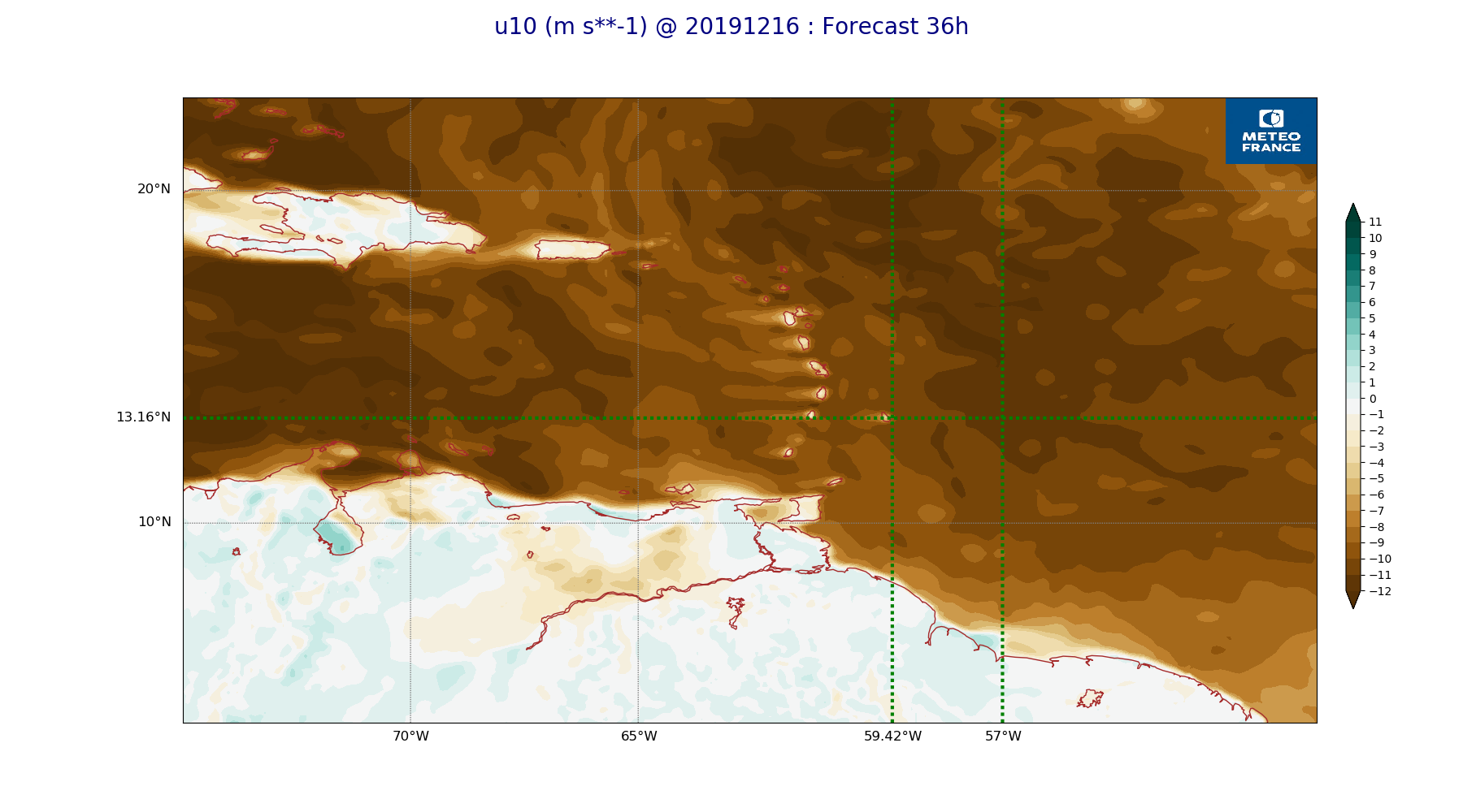
ARPEGE_map2D_u10_20191216_fct_36.png
2019-12-16 19:33
236K
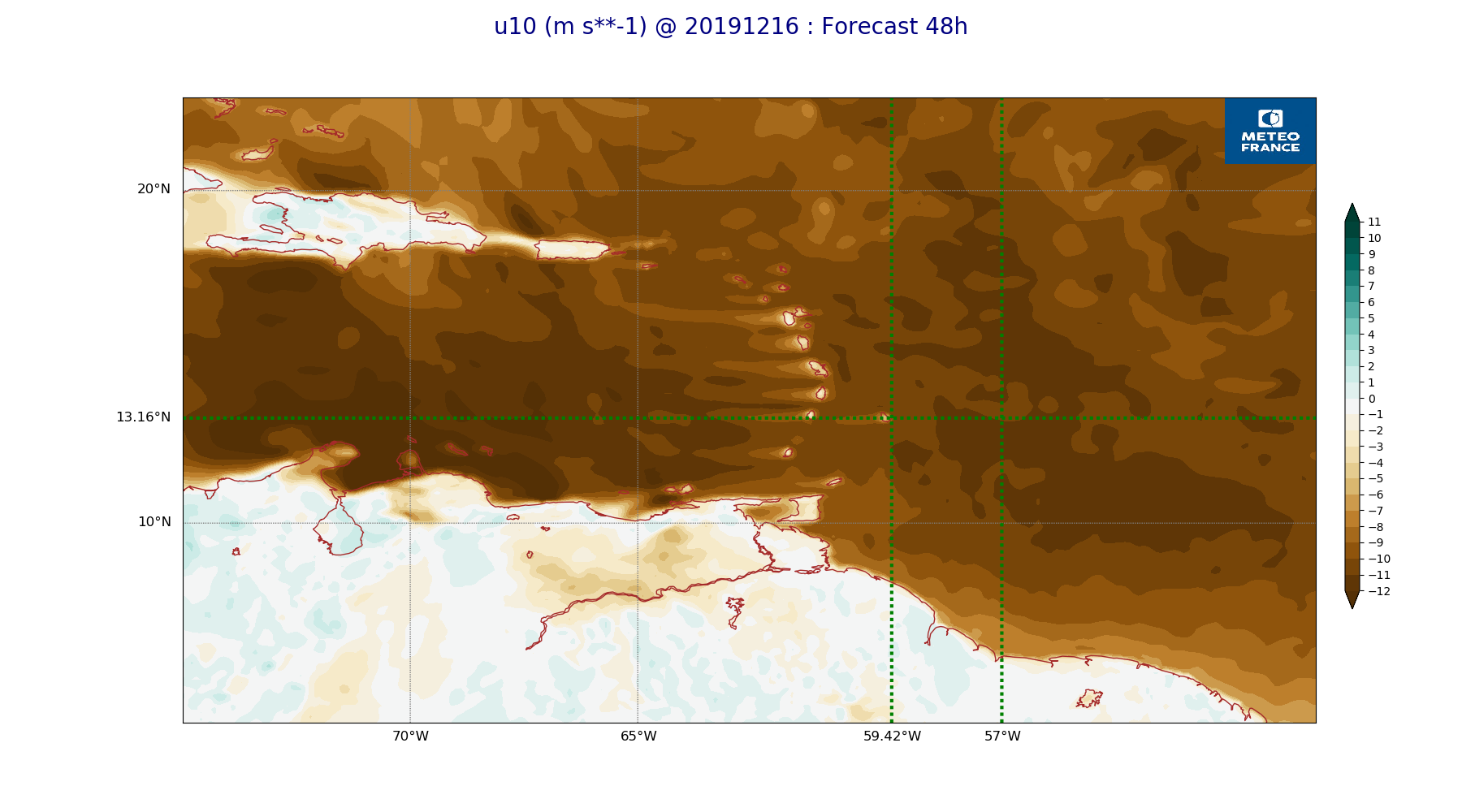
ARPEGE_map2D_u10_20191216_fct_48.png
2019-12-16 19:33
229K
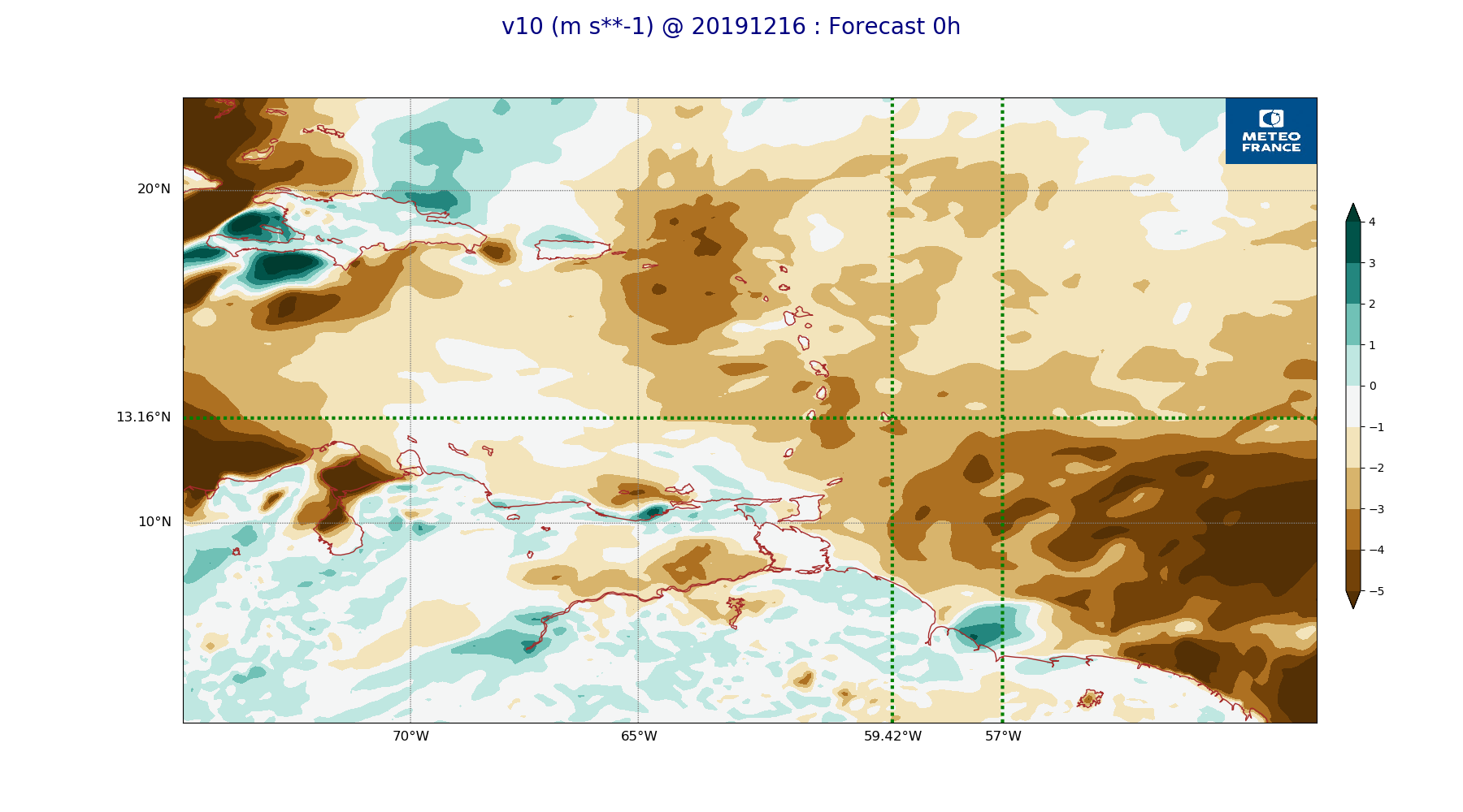
ARPEGE_map2D_v10_20191216_fct_0.png
2019-12-16 19:33
215K
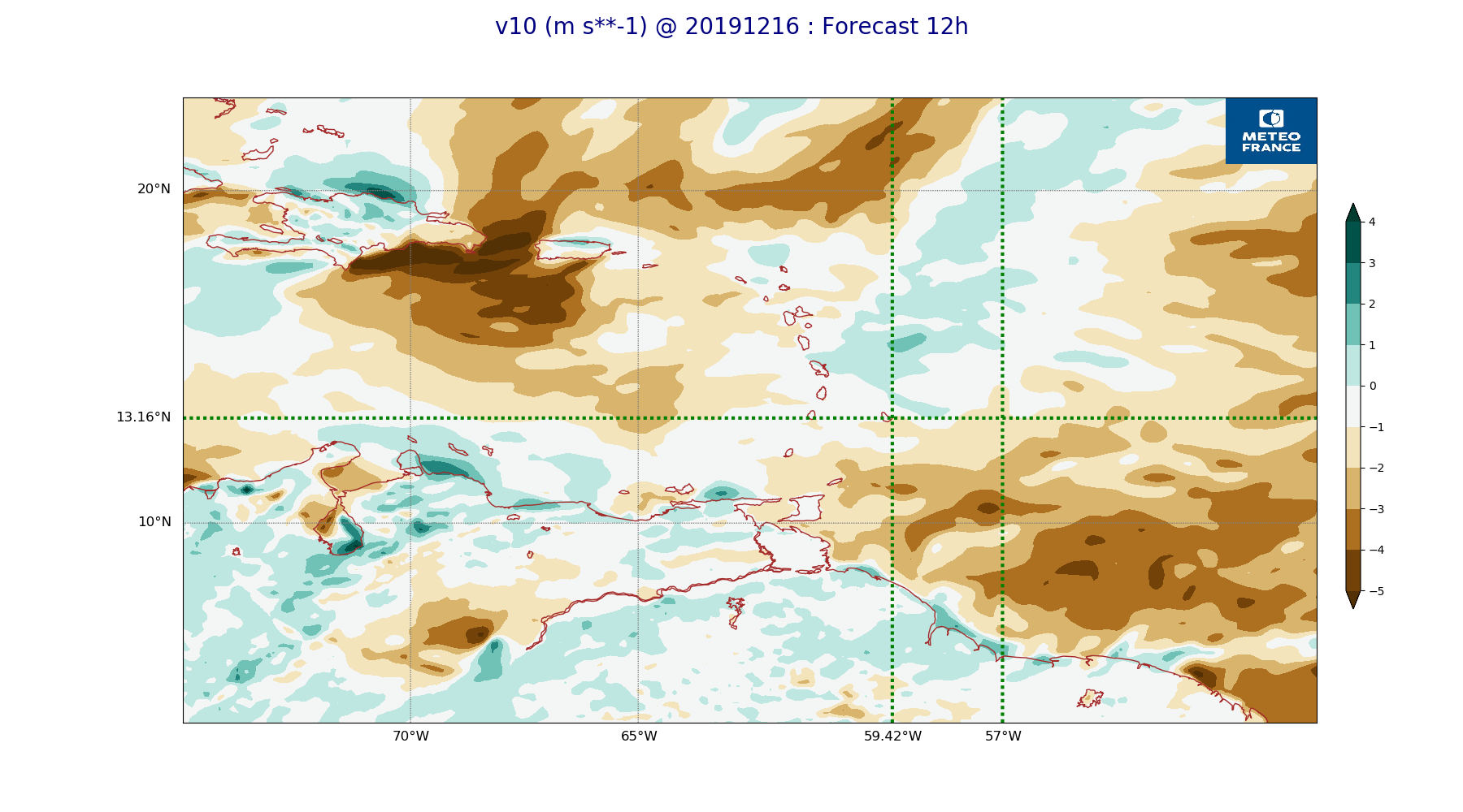
ARPEGE_map2D_v10_20191216_fct_12.png
2019-12-16 19:33
216K
ARPEGE_map2D_v10_20191216_fct_24.png
2019-12-16 19:34
220K
ARPEGE_map2D_v10_20191216_fct_36.png
2019-12-16 19:34
220K
ARPEGE_map2D_v10_20191216_fct_48.png
2019-12-16 19:34
216K