Index of /aeris/eurec4a-data/FORECASTS/GLOBAL/ARPEGE/2019/20191224/map2D
Name
Last modified
Size
Parent Directory
-
ARPEGE_map2D_LWP_20191224_fct_0.png
2019-12-24 12:04
140K
ARPEGE_map2D_LWP_20191224_fct_12.png
2019-12-24 12:05
140K
ARPEGE_map2D_LWP_20191224_fct_24.png
2019-12-24 12:05
140K
ARPEGE_map2D_LWP_20191224_fct_48.png
2019-12-24 12:05
141K
ARPEGE_map2D_LWP_20191224_fct_36.png
2019-12-24 12:05
141K
ARPEGE_map2D_Psfc_20191224_fct_12.png
2019-12-24 12:06
147K
ARPEGE_map2D_Psfc_20191224_fct_0.png
2019-12-24 12:06
147K
ARPEGE_map2D_Psfc_20191224_fct_24.png
2019-12-24 12:06
147K
ARPEGE_map2D_Psfc_20191224_fct_48.png
2019-12-24 12:06
147K
ARPEGE_map2D_Psfc_20191224_fct_36.png
2019-12-24 12:06
148K
ARPEGE_map2D_IWP_20191224_fct_0.png
2019-12-24 12:05
150K
ARPEGE_map2D_IWP_20191224_fct_12.png
2019-12-24 12:05
150K
ARPEGE_map2D_Cum_3h_RAIN_20191224_fct_0.png
2019-12-24 12:02
150K
ARPEGE_map2D_IWP_20191224_fct_24.png
2019-12-24 12:05
151K
ARPEGE_map2D_IWP_20191224_fct_36.png
2019-12-24 12:06
151K
ARPEGE_map2D_IWP_20191224_fct_48.png
2019-12-24 12:06
151K
ARPEGE_map2D_qv_500hPa_20191224_fct_48.png
2019-12-24 11:59
158K
ARPEGE_map2D_qv_500hPa_20191224_fct_0.png
2019-12-24 11:58
158K
ARPEGE_map2D_qv_500hPa_20191224_fct_36.png
2019-12-24 11:59
159K
ARPEGE_map2D_qv_500hPa_20191224_fct_12.png
2019-12-24 11:58
159K
ARPEGE_map2D_qv_500hPa_20191224_fct_24.png
2019-12-24 11:59
159K
ARPEGE_map2D_Fraction_cloud_cover_925hPa_20191224_fct_0.png
2019-12-24 11:56
161K
ARPEGE_map2D_Fraction_cloud_cover_500hPa_20191224_fct_0.png
2019-12-24 11:56
161K
ARPEGE_map2D_Fraction_cloud_cover_200hPa_20191224_fct_0.png
2019-12-24 11:56
161K
ARPEGE_map2D_Fraction_cloud_cover_850hPa_20191224_fct_0.png
2019-12-24 11:56
161K
ARPEGE_map2D_theta_500hPa_20191224_fct_24.png
2019-12-24 11:57
161K
ARPEGE_map2D_theta_500hPa_20191224_fct_0.png
2019-12-24 11:57
163K
ARPEGE_map2D_theta_500hPa_20191224_fct_48.png
2019-12-24 11:57
163K
ARPEGE_map2D_U_200hPa_20191224_fct_48.png
2019-12-24 11:55
163K
ARPEGE_map2D_theta_500hPa_20191224_fct_12.png
2019-12-24 11:57
163K
ARPEGE_map2D_T_500hPa_20191224_fct_24.png
2019-12-24 11:57
164K
ARPEGE_map2D_U_200hPa_20191224_fct_36.png
2019-12-24 11:55
166K
ARPEGE_map2D_T_500hPa_20191224_fct_48.png
2019-12-24 11:58
166K
ARPEGE_map2D_theta_500hPa_20191224_fct_36.png
2019-12-24 11:57
166K
ARPEGE_map2D_Low_CC_inf_785hPa_20191224_fct_0.png
2019-12-24 12:00
167K
ARPEGE_map2D_High_CC_sup_450hPa_20191224_fct_0.png
2019-12-24 12:01
167K
ARPEGE_map2D_Mid_CC_785_450hPa_20191224_fct_0.png
2019-12-24 12:00
167K
ARPEGE_map2D_theta_850hPa_20191224_fct_0.png
2019-12-24 11:57
167K
ARPEGE_map2D_theta_850hPa_20191224_fct_48.png
2019-12-24 11:57
168K
ARPEGE_map2D_T_500hPa_20191224_fct_12.png
2019-12-24 11:57
168K
ARPEGE_map2D_T_500hPa_20191224_fct_0.png
2019-12-24 11:57
169K
ARPEGE_map2D_T_500hPa_20191224_fct_36.png
2019-12-24 11:57
170K
ARPEGE_map2D_T_850hPa_20191224_fct_48.png
2019-12-24 11:58
170K
ARPEGE_map2D_theta_850hPa_20191224_fct_12.png
2019-12-24 11:57
171K
ARPEGE_map2D_theta_850hPa_20191224_fct_24.png
2019-12-24 11:57
171K
ARPEGE_map2D_U_200hPa_20191224_fct_24.png
2019-12-24 11:55
173K
ARPEGE_map2D_T_850hPa_20191224_fct_0.png
2019-12-24 11:57
174K
ARPEGE_map2D_U_200hPa_20191224_fct_0.png
2019-12-24 11:55
175K
ARPEGE_map2D_U_200hPa_20191224_fct_12.png
2019-12-24 11:55
175K
ARPEGE_map2D_T_850hPa_20191224_fct_12.png
2019-12-24 11:57
176K
ARPEGE_map2D_theta_850hPa_20191224_fct_36.png
2019-12-24 11:57
176K
ARPEGE_map2D_T_850hPa_20191224_fct_24.png
2019-12-24 11:57
177K
ARPEGE_map2D_T_850hPa_20191224_fct_36.png
2019-12-24 11:57
180K
ARPEGE_map2D_T_925hPa_20191224_fct_0.png
2019-12-24 11:57
181K
ARPEGE_map2D_theta_925hPa_20191224_fct_0.png
2019-12-24 11:57
181K
ARPEGE_map2D_T_925hPa_20191224_fct_48.png
2019-12-24 11:58
182K
ARPEGE_map2D_theta_925hPa_20191224_fct_48.png
2019-12-24 11:57
182K
ARPEGE_map2D_T_925hPa_20191224_fct_24.png
2019-12-24 11:57
183K
ARPEGE_map2D_Geopotential_0_7_PVU_20191224_fct_12.png
2019-12-24 11:59
184K
ARPEGE_map2D_High_CC_sup_450hPa_20191224_fct_12.png
2019-12-24 12:01
185K
ARPEGE_map2D_theta_925hPa_20191224_fct_24.png
2019-12-24 11:57
186K
ARPEGE_map2D_U_500hPa_20191224_fct_24.png
2019-12-24 11:55
186K
ARPEGE_map2D_High_CC_sup_450hPa_20191224_fct_36.png
2019-12-24 12:01
187K
ARPEGE_map2D_theta_925hPa_20191224_fct_12.png
2019-12-24 11:57
187K
ARPEGE_map2D_U_500hPa_20191224_fct_36.png
2019-12-24 11:55
188K
ARPEGE_map2D_High_CC_sup_450hPa_20191224_fct_24.png
2019-12-24 12:01
188K
ARPEGE_map2D_U_500hPa_20191224_fct_48.png
2019-12-24 11:55
188K
ARPEGE_map2D_Geopotential_0_7_PVU_20191224_fct_24.png
2019-12-24 11:59
189K
ARPEGE_map2D_Geopotential_0_7_PVU_20191224_fct_36.png
2019-12-24 11:59
189K
ARPEGE_map2D_U_500hPa_20191224_fct_0.png
2019-12-24 11:55
190K
ARPEGE_map2D_U_500hPa_20191224_fct_12.png
2019-12-24 11:55
190K
ARPEGE_map2D_T_925hPa_20191224_fct_12.png
2019-12-24 11:57
190K
ARPEGE_map2D_T_925hPa_20191224_fct_36.png
2019-12-24 11:58
191K
ARPEGE_map2D_High_CC_sup_450hPa_20191224_fct_48.png
2019-12-24 12:02
192K
ARPEGE_map2D_theta_925hPa_20191224_fct_36.png
2019-12-24 11:57
193K
ARPEGE_map2D_Geopotential_0_7_PVU_20191224_fct_0.png
2019-12-24 11:59
198K
ARPEGE_map2D_Geopotential_0_7_PVU_20191224_fct_48.png
2019-12-24 12:00
199K
ARPEGE_map2D_U_925hPa_20191224_fct_12.png
2019-12-24 11:55
201K
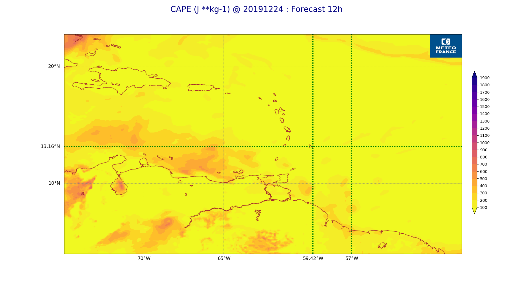
ARPEGE_map2D_CAPE_20191224_fct_12.png
2019-12-24 12:07
202K
ARPEGE_map2D_U_925hPa_20191224_fct_0.png
2019-12-24 11:55
203K
ARPEGE_map2D_V_200hPa_20191224_fct_48.png
2019-12-24 11:56
203K
ARPEGE_map2D_U_850hPa_20191224_fct_0.png
2019-12-24 11:55
203K
ARPEGE_map2D_U_925hPa_20191224_fct_48.png
2019-12-24 11:55
207K
ARPEGE_map2D_U_925hPa_20191224_fct_24.png
2019-12-24 11:55
208K
ARPEGE_map2D_U_850hPa_20191224_fct_12.png
2019-12-24 11:55
209K
ARPEGE_map2D_V_200hPa_20191224_fct_24.png
2019-12-24 11:56
209K
ARPEGE_map2D_U_850hPa_20191224_fct_48.png
2019-12-24 11:55
209K
ARPEGE_map2D_V_200hPa_20191224_fct_12.png
2019-12-24 11:55
210K
ARPEGE_map2D_V_200hPa_20191224_fct_36.png
2019-12-24 11:56
211K
ARPEGE_map2D_U_925hPa_20191224_fct_36.png
2019-12-24 11:55
211K
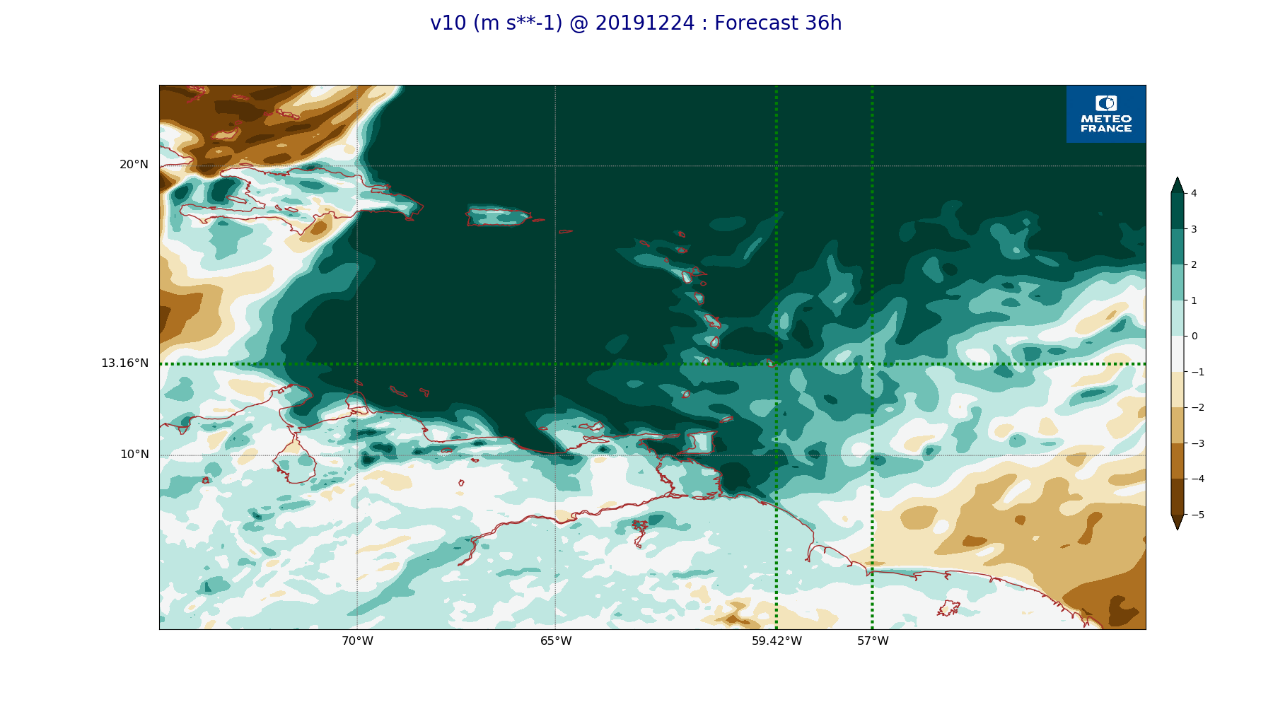
ARPEGE_map2D_v10_20191224_fct_36.png
2019-12-24 12:04
212K
ARPEGE_map2D_Cum_3h_RAIN_20191224_fct_12.png
2019-12-24 12:02
212K
ARPEGE_map2D_U_850hPa_20191224_fct_24.png
2019-12-24 11:55
213K
ARPEGE_map2D_V_200hPa_20191224_fct_0.png
2019-12-24 11:55
213K
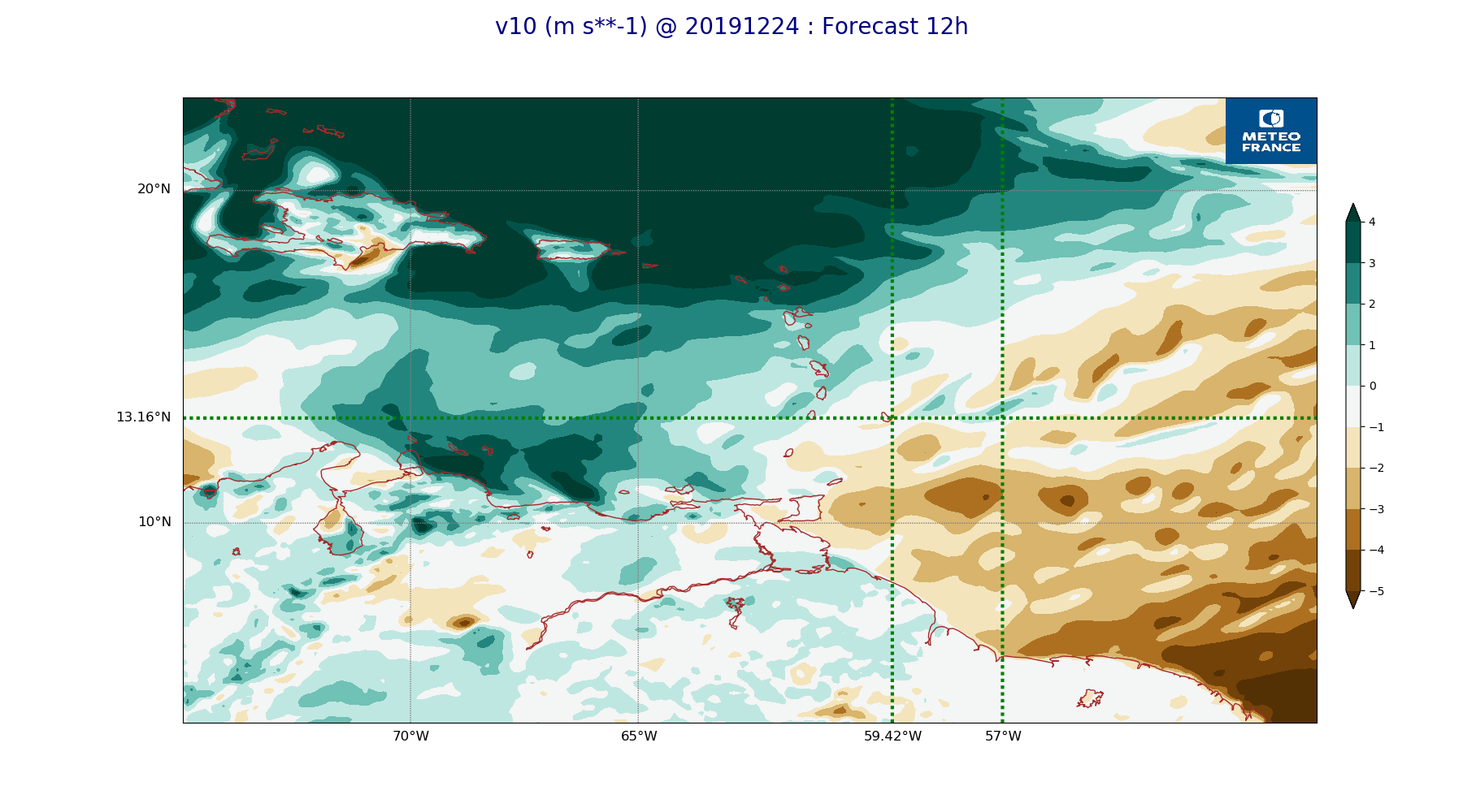
ARPEGE_map2D_v10_20191224_fct_12.png
2019-12-24 12:04
214K
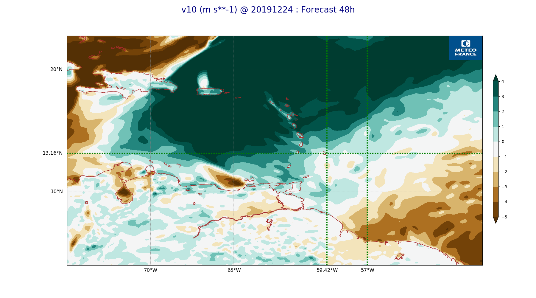
ARPEGE_map2D_v10_20191224_fct_48.png
2019-12-24 12:04
214K
ARPEGE_map2D_U_850hPa_20191224_fct_36.png
2019-12-24 11:55
215K
ARPEGE_map2D_RH_500hPa_20191224_fct_0.png
2019-12-24 11:58
216K
ARPEGE_map2D_v10_20191224_fct_0.png
2019-12-24 12:04
217K
ARPEGE_map2D_RH_500hPa_20191224_fct_12.png
2019-12-24 11:58
218K
ARPEGE_map2D_V_500hPa_20191224_fct_48.png
2019-12-24 11:56
219K
ARPEGE_map2D_RH_500hPa_20191224_fct_24.png
2019-12-24 11:58
219K
ARPEGE_map2D_v10_20191224_fct_24.png
2019-12-24 12:04
221K
ARPEGE_map2D_V_500hPa_20191224_fct_0.png
2019-12-24 11:55
222K
ARPEGE_map2D_V_500hPa_20191224_fct_24.png
2019-12-24 11:56
225K
ARPEGE_map2D_V_500hPa_20191224_fct_36.png
2019-12-24 11:56
225K
ARPEGE_map2D_CAPE_20191224_fct_0.png
2019-12-24 12:07
225K
ARPEGE_map2D_CAPE_20191224_fct_36.png
2019-12-24 12:07
225K
ARPEGE_map2D_Cum_3h_RAIN_20191224_fct_36.png
2019-12-24 12:02
226K
ARPEGE_map2D_RH_500hPa_20191224_fct_48.png
2019-12-24 11:58
226K
ARPEGE_map2D_RH_500hPa_20191224_fct_36.png
2019-12-24 11:58
228K
ARPEGE_map2D_V_500hPa_20191224_fct_12.png
2019-12-24 11:55
229K
ARPEGE_map2D_RH_700hPa_20191224_fct_24.png
2019-12-24 11:58
231K
ARPEGE_map2D_u10_20191224_fct_0.png
2019-12-24 12:03
231K
ARPEGE_map2D_RH_700hPa_20191224_fct_12.png
2019-12-24 11:58
232K
ARPEGE_map2D_RH_700hPa_20191224_fct_0.png
2019-12-24 11:58
232K
ARPEGE_map2D_PRW_20191224_fct_0.png
2019-12-24 12:02
232K
ARPEGE_map2D_Cum_3h_RAIN_20191224_fct_24.png
2019-12-24 12:02
233K
ARPEGE_map2D_Vertical_velocity_500hPa_20191224_fct_0.png
2019-12-24 11:54
233K
ARPEGE_map2D_RH_700hPa_20191224_fct_48.png
2019-12-24 11:58
233K
ARPEGE_map2D_CAPE_20191224_fct_24.png
2019-12-24 12:07
234K
ARPEGE_map2D_PRW_20191224_fct_48.png
2019-12-24 12:03
235K
ARPEGE_map2D_u10_20191224_fct_48.png
2019-12-24 12:04
235K
ARPEGE_map2D_Vertical_velocity_500hPa_20191224_fct_48.png
2019-12-24 11:54
235K
ARPEGE_map2D_PRW_20191224_fct_12.png
2019-12-24 12:03
237K
ARPEGE_map2D_PRW_20191224_fct_24.png
2019-12-24 12:03
238K
ARPEGE_map2D_qv_850hPa_20191224_fct_12.png
2019-12-24 11:58
238K
ARPEGE_map2D_CAPE_20191224_fct_48.png
2019-12-24 12:07
238K
ARPEGE_map2D_qv_925hPa_20191224_fct_24.png
2019-12-24 11:59
241K
ARPEGE_map2D_qv_925hPa_20191224_fct_0.png
2019-12-24 11:58
241K
ARPEGE_map2D_u10_20191224_fct_24.png
2019-12-24 12:03
241K
ARPEGE_map2D_qv_850hPa_20191224_fct_48.png
2019-12-24 11:59
242K
ARPEGE_map2D_u10_20191224_fct_12.png
2019-12-24 12:03
242K
ARPEGE_map2D_qv_850hPa_20191224_fct_0.png
2019-12-24 11:58
243K
ARPEGE_map2D_Vertical_velocity_500hPa_20191224_fct_24.png
2019-12-24 11:54
243K
ARPEGE_map2D_qv_850hPa_20191224_fct_36.png
2019-12-24 11:59
243K
ARPEGE_map2D_u10_20191224_fct_36.png
2019-12-24 12:04
244K
ARPEGE_map2D_Cum_3h_RAIN_20191224_fct_48.png
2019-12-24 12:02
245K
ARPEGE_map2D_qv_925hPa_20191224_fct_12.png
2019-12-24 11:59
245K
ARPEGE_map2D_qv_850hPa_20191224_fct_24.png
2019-12-24 11:59
245K
ARPEGE_map2D_Vertical_velocity_500hPa_20191224_fct_36.png
2019-12-24 11:54
246K
ARPEGE_map2D_PRW_20191224_fct_36.png
2019-12-24 12:03
247K
ARPEGE_map2D_Vertical_velocity_500hPa_20191224_fct_12.png
2019-12-24 11:54
247K
ARPEGE_map2D_RH_700hPa_20191224_fct_36.png
2019-12-24 11:58
247K
ARPEGE_map2D_V_925hPa_20191224_fct_0.png
2019-12-24 11:55
250K
ARPEGE_map2D_qv_925hPa_20191224_fct_48.png
2019-12-24 11:59
250K
ARPEGE_map2D_Vertical_velocity_700hPa_20191224_fct_48.png
2019-12-24 11:55
255K
ARPEGE_map2D_V_925hPa_20191224_fct_12.png
2019-12-24 11:55
255K
ARPEGE_map2D_Vertical_velocity_700hPa_20191224_fct_0.png
2019-12-24 11:54
255K
ARPEGE_map2D_qv_925hPa_20191224_fct_36.png
2019-12-24 11:59
255K
ARPEGE_map2D_V_925hPa_20191224_fct_24.png
2019-12-24 11:56
256K
ARPEGE_map2D_V_850hPa_20191224_fct_0.png
2019-12-24 11:55
258K
ARPEGE_map2D_Vertical_velocity_700hPa_20191224_fct_24.png
2019-12-24 11:54
261K
ARPEGE_map2D_V_925hPa_20191224_fct_48.png
2019-12-24 11:56
263K
ARPEGE_map2D_V_925hPa_20191224_fct_36.png
2019-12-24 11:56
263K
ARPEGE_map2D_Vertical_velocity_700hPa_20191224_fct_12.png
2019-12-24 11:54
267K
ARPEGE_map2D_V_850hPa_20191224_fct_24.png
2019-12-24 11:56
269K
ARPEGE_map2D_V_850hPa_20191224_fct_12.png
2019-12-24 11:55
270K
ARPEGE_map2D_V_850hPa_20191224_fct_36.png
2019-12-24 11:56
271K
ARPEGE_map2D_V_850hPa_20191224_fct_48.png
2019-12-24 11:56
272K
ARPEGE_map2D_Vertical_velocity_700hPa_20191224_fct_36.png
2019-12-24 11:54
274K
ARPEGE_map2D_RH_850hPa_20191224_fct_12.png
2019-12-24 11:58
278K
ARPEGE_map2D_RH_850hPa_20191224_fct_48.png
2019-12-24 11:58
279K
ARPEGE_map2D_RH_850hPa_20191224_fct_0.png
2019-12-24 11:58
281K
ARPEGE_map2D_RH_850hPa_20191224_fct_24.png
2019-12-24 11:58
286K
ARPEGE_map2D_Vertical_velocity_850hPa_20191224_fct_0.png
2019-12-24 11:54
287K
ARPEGE_map2D_RH_850hPa_20191224_fct_36.png
2019-12-24 11:58
287K
ARPEGE_map2D_Vertical_velocity_850hPa_20191224_fct_48.png
2019-12-24 11:55
288K
ARPEGE_map2D_Vertical_velocity_850hPa_20191224_fct_24.png
2019-12-24 11:54
290K
ARPEGE_map2D_Fraction_cloud_cover_500hPa_20191224_fct_24.png
2019-12-24 11:56
297K
ARPEGE_map2D_Fraction_cloud_cover_500hPa_20191224_fct_12.png
2019-12-24 11:56
302K
ARPEGE_map2D_Vertical_velocity_850hPa_20191224_fct_12.png
2019-12-24 11:54
303K
ARPEGE_map2D_Vertical_velocity_850hPa_20191224_fct_36.png
2019-12-24 11:54
306K
ARPEGE_map2D_Fraction_cloud_cover_200hPa_20191224_fct_12.png
2019-12-24 11:56
324K
ARPEGE_map2D_Fraction_cloud_cover_500hPa_20191224_fct_48.png
2019-12-24 11:57
329K
ARPEGE_map2D_Fraction_cloud_cover_200hPa_20191224_fct_36.png
2019-12-24 11:56
343K
ARPEGE_map2D_Fraction_cloud_cover_500hPa_20191224_fct_36.png
2019-12-24 11:56
345K
ARPEGE_map2D_Mid_CC_785_450hPa_20191224_fct_24.png
2019-12-24 12:01
347K
ARPEGE_map2D_Mid_CC_785_450hPa_20191224_fct_12.png
2019-12-24 12:00
354K
ARPEGE_map2D_Fraction_cloud_cover_200hPa_20191224_fct_24.png
2019-12-24 11:56
362K
ARPEGE_map2D_Mid_CC_785_450hPa_20191224_fct_48.png
2019-12-24 12:01
385K
ARPEGE_map2D_Low_CC_inf_785hPa_20191224_fct_24.png
2019-12-24 12:00
386K
ARPEGE_map2D_Low_CC_inf_785hPa_20191224_fct_48.png
2019-12-24 12:00
386K
ARPEGE_map2D_Fraction_cloud_cover_200hPa_20191224_fct_48.png
2019-12-24 11:56
388K
ARPEGE_map2D_Low_CC_inf_785hPa_20191224_fct_12.png
2019-12-24 12:00
388K
ARPEGE_map2D_Mid_CC_785_450hPa_20191224_fct_36.png
2019-12-24 12:01
407K
ARPEGE_map2D_Low_CC_inf_785hPa_20191224_fct_36.png
2019-12-24 12:00
413K
ARPEGE_map2D_Fraction_cloud_cover_850hPa_20191224_fct_12.png
2019-12-24 11:56
521K
ARPEGE_map2D_Fraction_cloud_cover_850hPa_20191224_fct_48.png
2019-12-24 11:57
559K
ARPEGE_map2D_Fraction_cloud_cover_850hPa_20191224_fct_24.png
2019-12-24 11:56
595K
ARPEGE_map2D_Fraction_cloud_cover_850hPa_20191224_fct_36.png
2019-12-24 11:56
597K
ARPEGE_map2D_Fraction_cloud_cover_925hPa_20191224_fct_12.png
2019-12-24 11:56
612K
ARPEGE_map2D_Fraction_cloud_cover_925hPa_20191224_fct_48.png
2019-12-24 11:57
629K
ARPEGE_map2D_Fraction_cloud_cover_925hPa_20191224_fct_24.png
2019-12-24 11:56
631K
ARPEGE_map2D_Fraction_cloud_cover_925hPa_20191224_fct_36.png
2019-12-24 11:56
650K