Index of /aeris/eurec4a-data/FORECASTS/GLOBAL/ARPEGE/2019/20191227/map2D
Name
Last modified
Size
Parent Directory
-
ARPEGE_map2D_LWP_20191227_fct_0.png
2019-12-27 12:04
140K
ARPEGE_map2D_LWP_20191227_fct_12.png
2019-12-27 12:04
140K
ARPEGE_map2D_LWP_20191227_fct_24.png
2019-12-27 12:05
140K
ARPEGE_map2D_LWP_20191227_fct_48.png
2019-12-27 12:05
141K
ARPEGE_map2D_LWP_20191227_fct_36.png
2019-12-27 12:05
141K
ARPEGE_map2D_Psfc_20191227_fct_12.png
2019-12-27 12:06
147K
ARPEGE_map2D_Psfc_20191227_fct_0.png
2019-12-27 12:06
147K
ARPEGE_map2D_Psfc_20191227_fct_24.png
2019-12-27 12:06
147K
ARPEGE_map2D_Psfc_20191227_fct_48.png
2019-12-27 12:06
147K
ARPEGE_map2D_Psfc_20191227_fct_36.png
2019-12-27 12:06
148K
ARPEGE_map2D_IWP_20191227_fct_0.png
2019-12-27 12:05
150K
ARPEGE_map2D_Cum_3h_RAIN_20191227_fct_0.png
2019-12-27 12:02
150K
ARPEGE_map2D_IWP_20191227_fct_12.png
2019-12-27 12:05
150K
ARPEGE_map2D_IWP_20191227_fct_24.png
2019-12-27 12:05
150K
ARPEGE_map2D_IWP_20191227_fct_48.png
2019-12-27 12:06
151K
ARPEGE_map2D_IWP_20191227_fct_36.png
2019-12-27 12:05
151K
ARPEGE_map2D_qv_500hPa_20191227_fct_36.png
2019-12-27 11:59
158K
ARPEGE_map2D_qv_500hPa_20191227_fct_48.png
2019-12-27 11:59
158K
ARPEGE_map2D_theta_850hPa_20191227_fct_24.png
2019-12-27 11:57
159K
ARPEGE_map2D_qv_500hPa_20191227_fct_24.png
2019-12-27 11:59
159K
ARPEGE_map2D_qv_500hPa_20191227_fct_0.png
2019-12-27 11:58
159K
ARPEGE_map2D_qv_500hPa_20191227_fct_12.png
2019-12-27 11:58
160K
ARPEGE_map2D_theta_500hPa_20191227_fct_0.png
2019-12-27 11:57
160K
ARPEGE_map2D_theta_500hPa_20191227_fct_48.png
2019-12-27 11:57
160K
ARPEGE_map2D_Fraction_cloud_cover_925hPa_20191227_fct_0.png
2019-12-27 11:56
160K
ARPEGE_map2D_Fraction_cloud_cover_500hPa_20191227_fct_0.png
2019-12-27 11:56
161K
ARPEGE_map2D_Fraction_cloud_cover_200hPa_20191227_fct_0.png
2019-12-27 11:56
161K
ARPEGE_map2D_theta_850hPa_20191227_fct_0.png
2019-12-27 11:57
161K
ARPEGE_map2D_Fraction_cloud_cover_850hPa_20191227_fct_0.png
2019-12-27 11:56
161K
ARPEGE_map2D_theta_500hPa_20191227_fct_24.png
2019-12-27 11:57
161K
ARPEGE_map2D_T_850hPa_20191227_fct_24.png
2019-12-27 11:57
164K
ARPEGE_map2D_T_850hPa_20191227_fct_0.png
2019-12-27 11:57
164K
ARPEGE_map2D_theta_500hPa_20191227_fct_12.png
2019-12-27 11:57
164K
ARPEGE_map2D_U_200hPa_20191227_fct_48.png
2019-12-27 11:55
164K
ARPEGE_map2D_T_500hPa_20191227_fct_0.png
2019-12-27 11:57
164K
ARPEGE_map2D_theta_500hPa_20191227_fct_36.png
2019-12-27 11:57
165K
ARPEGE_map2D_T_500hPa_20191227_fct_12.png
2019-12-27 11:57
165K
ARPEGE_map2D_theta_850hPa_20191227_fct_12.png
2019-12-27 11:57
166K
ARPEGE_map2D_T_500hPa_20191227_fct_48.png
2019-12-27 11:58
166K
ARPEGE_map2D_U_200hPa_20191227_fct_36.png
2019-12-27 11:55
166K
ARPEGE_map2D_T_500hPa_20191227_fct_24.png
2019-12-27 11:57
167K
ARPEGE_map2D_Low_CC_inf_785hPa_20191227_fct_0.png
2019-12-27 12:00
167K
ARPEGE_map2D_High_CC_sup_450hPa_20191227_fct_0.png
2019-12-27 12:01
167K
ARPEGE_map2D_Mid_CC_785_450hPa_20191227_fct_0.png
2019-12-27 12:00
167K
ARPEGE_map2D_U_200hPa_20191227_fct_12.png
2019-12-27 11:55
167K
ARPEGE_map2D_U_200hPa_20191227_fct_24.png
2019-12-27 11:55
168K
ARPEGE_map2D_T_500hPa_20191227_fct_36.png
2019-12-27 11:57
169K
ARPEGE_map2D_U_200hPa_20191227_fct_0.png
2019-12-27 11:55
169K
ARPEGE_map2D_T_850hPa_20191227_fct_12.png
2019-12-27 11:57
169K
ARPEGE_map2D_theta_850hPa_20191227_fct_48.png
2019-12-27 11:57
171K
ARPEGE_map2D_T_850hPa_20191227_fct_48.png
2019-12-27 11:58
173K
ARPEGE_map2D_theta_850hPa_20191227_fct_36.png
2019-12-27 11:57
173K
ARPEGE_map2D_T_850hPa_20191227_fct_36.png
2019-12-27 11:57
176K
ARPEGE_map2D_T_925hPa_20191227_fct_0.png
2019-12-27 11:57
177K
ARPEGE_map2D_theta_925hPa_20191227_fct_0.png
2019-12-27 11:57
177K
ARPEGE_map2D_Cum_3h_RAIN_20191227_fct_48.png
2019-12-27 12:02
179K
ARPEGE_map2D_theta_925hPa_20191227_fct_24.png
2019-12-27 11:57
181K
ARPEGE_map2D_theta_925hPa_20191227_fct_48.png
2019-12-27 11:57
181K
ARPEGE_map2D_T_925hPa_20191227_fct_24.png
2019-12-27 11:57
183K
ARPEGE_map2D_theta_925hPa_20191227_fct_12.png
2019-12-27 11:57
183K
ARPEGE_map2D_Cum_3h_RAIN_20191227_fct_36.png
2019-12-27 12:02
185K
ARPEGE_map2D_T_925hPa_20191227_fct_48.png
2019-12-27 11:58
185K
ARPEGE_map2D_T_925hPa_20191227_fct_12.png
2019-12-27 11:57
186K
ARPEGE_map2D_T_925hPa_20191227_fct_36.png
2019-12-27 11:58
188K
ARPEGE_map2D_theta_925hPa_20191227_fct_36.png
2019-12-27 11:57
188K
ARPEGE_map2D_U_500hPa_20191227_fct_48.png
2019-12-27 11:55
189K
ARPEGE_map2D_U_500hPa_20191227_fct_24.png
2019-12-27 11:55
190K
ARPEGE_map2D_U_500hPa_20191227_fct_12.png
2019-12-27 11:55
190K
ARPEGE_map2D_U_500hPa_20191227_fct_36.png
2019-12-27 11:55
192K
ARPEGE_map2D_V_200hPa_20191227_fct_12.png
2019-12-27 11:55
192K
ARPEGE_map2D_U_500hPa_20191227_fct_0.png
2019-12-27 11:55
192K
ARPEGE_map2D_V_200hPa_20191227_fct_0.png
2019-12-27 11:55
194K
ARPEGE_map2D_Geopotential_0_7_PVU_20191227_fct_12.png
2019-12-27 11:59
194K
ARPEGE_map2D_V_200hPa_20191227_fct_48.png
2019-12-27 11:56
194K
ARPEGE_map2D_V_200hPa_20191227_fct_36.png
2019-12-27 11:56
198K
ARPEGE_map2D_High_CC_sup_450hPa_20191227_fct_12.png
2019-12-27 12:01
198K
ARPEGE_map2D_Geopotential_0_7_PVU_20191227_fct_24.png
2019-12-27 11:59
198K
ARPEGE_map2D_V_200hPa_20191227_fct_24.png
2019-12-27 11:56
199K
ARPEGE_map2D_Geopotential_0_7_PVU_20191227_fct_0.png
2019-12-27 11:59
199K
ARPEGE_map2D_Geopotential_0_7_PVU_20191227_fct_48.png
2019-12-27 11:59
200K
ARPEGE_map2D_Geopotential_0_7_PVU_20191227_fct_36.png
2019-12-27 11:59
200K
ARPEGE_map2D_Cum_3h_RAIN_20191227_fct_12.png
2019-12-27 12:02
200K
ARPEGE_map2D_RH_500hPa_20191227_fct_48.png
2019-12-27 11:58
203K
ARPEGE_map2D_U_925hPa_20191227_fct_24.png
2019-12-27 11:55
205K
ARPEGE_map2D_U_925hPa_20191227_fct_48.png
2019-12-27 11:55
205K
ARPEGE_map2D_U_925hPa_20191227_fct_0.png
2019-12-27 11:55
206K
ARPEGE_map2D_U_850hPa_20191227_fct_12.png
2019-12-27 11:55
207K
ARPEGE_map2D_U_850hPa_20191227_fct_24.png
2019-12-27 11:55
207K
ARPEGE_map2D_High_CC_sup_450hPa_20191227_fct_24.png
2019-12-27 12:01
207K
ARPEGE_map2D_U_925hPa_20191227_fct_36.png
2019-12-27 11:55
207K
ARPEGE_map2D_U_850hPa_20191227_fct_0.png
2019-12-27 11:55
207K
ARPEGE_map2D_RH_500hPa_20191227_fct_36.png
2019-12-27 11:58
207K
ARPEGE_map2D_U_925hPa_20191227_fct_12.png
2019-12-27 11:55
208K
ARPEGE_map2D_U_850hPa_20191227_fct_36.png
2019-12-27 11:55
210K
ARPEGE_map2D_Cum_3h_RAIN_20191227_fct_24.png
2019-12-27 12:02
212K
ARPEGE_map2D_V_500hPa_20191227_fct_48.png
2019-12-27 11:56
212K
ARPEGE_map2D_U_850hPa_20191227_fct_48.png
2019-12-27 11:55
212K
ARPEGE_map2D_V_500hPa_20191227_fct_24.png
2019-12-27 11:56
214K
ARPEGE_map2D_CAPE_20191227_fct_36.png
2019-12-27 12:07
215K
ARPEGE_map2D_V_500hPa_20191227_fct_36.png
2019-12-27 11:56
216K
ARPEGE_map2D_RH_500hPa_20191227_fct_24.png
2019-12-27 11:58
217K
ARPEGE_map2D_RH_500hPa_20191227_fct_12.png
2019-12-27 11:58
218K
ARPEGE_map2D_V_500hPa_20191227_fct_12.png
2019-12-27 11:55
221K
ARPEGE_map2D_High_CC_sup_450hPa_20191227_fct_36.png
2019-12-27 12:01
221K
ARPEGE_map2D_v10_20191227_fct_0.png
2019-12-27 12:04
221K
ARPEGE_map2D_v10_20191227_fct_24.png
2019-12-27 12:04
221K
ARPEGE_map2D_v10_20191227_fct_12.png
2019-12-27 12:04
222K
ARPEGE_map2D_V_500hPa_20191227_fct_0.png
2019-12-27 11:55
222K
ARPEGE_map2D_RH_500hPa_20191227_fct_0.png
2019-12-27 11:58
225K
ARPEGE_map2D_qv_850hPa_20191227_fct_12.png
2019-12-27 11:58
226K
ARPEGE_map2D_v10_20191227_fct_48.png
2019-12-27 12:04
227K
ARPEGE_map2D_CAPE_20191227_fct_12.png
2019-12-27 12:06
227K
ARPEGE_map2D_v10_20191227_fct_36.png
2019-12-27 12:04
227K
ARPEGE_map2D_CAPE_20191227_fct_48.png
2019-12-27 12:07
229K
ARPEGE_map2D_Vertical_velocity_500hPa_20191227_fct_24.png
2019-12-27 11:54
230K
ARPEGE_map2D_Vertical_velocity_500hPa_20191227_fct_36.png
2019-12-27 11:54
230K
ARPEGE_map2D_Vertical_velocity_500hPa_20191227_fct_48.png
2019-12-27 11:55
231K
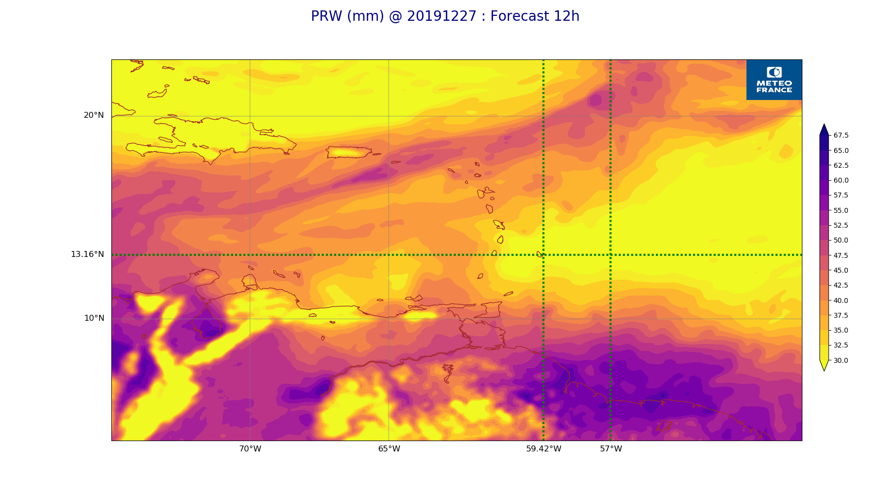
ARPEGE_map2D_PRW_20191227_fct_12.png
2019-12-27 12:02
232K
ARPEGE_map2D_qv_850hPa_20191227_fct_0.png
2019-12-27 11:58
233K
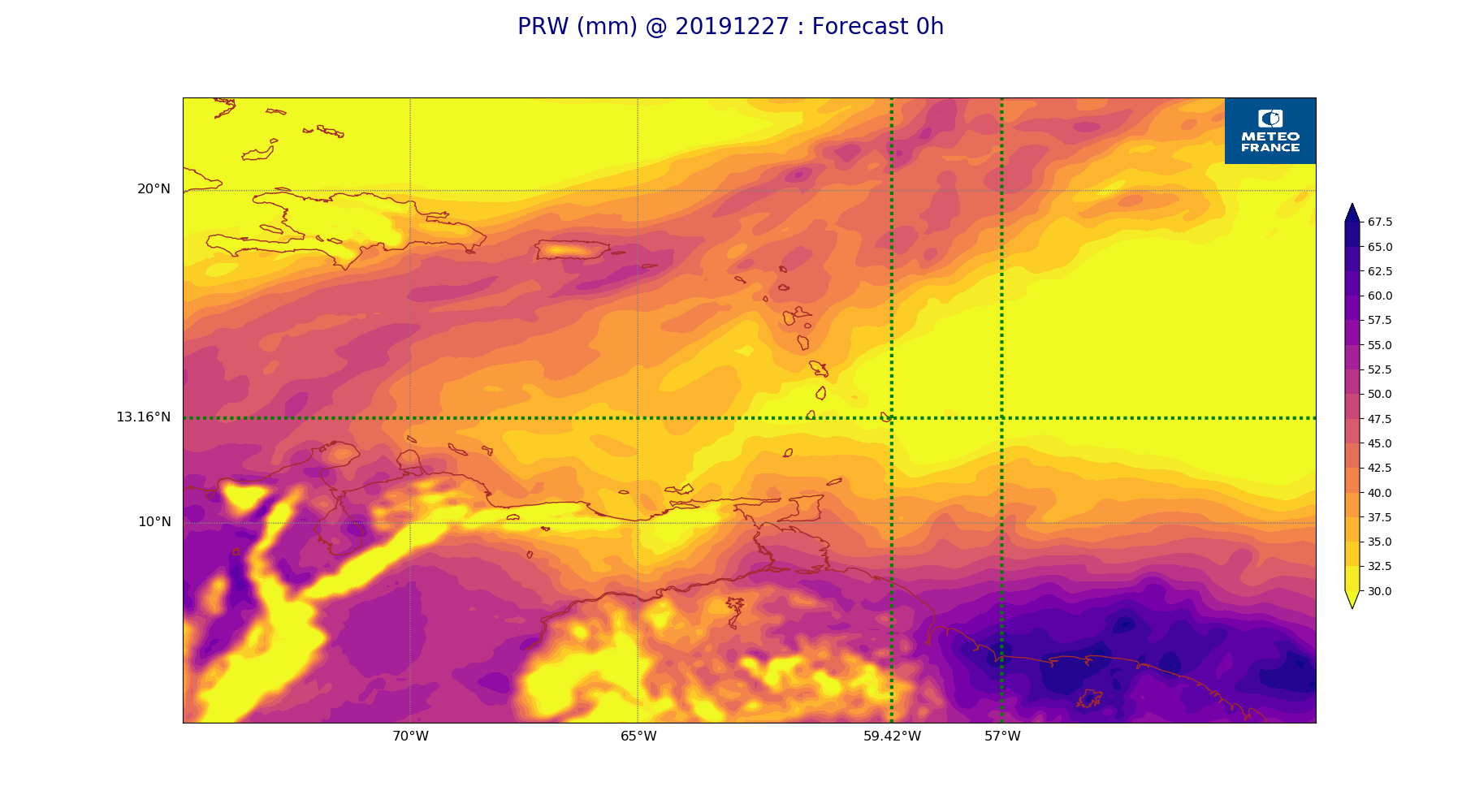
ARPEGE_map2D_PRW_20191227_fct_0.png
2019-12-27 12:02
233K
ARPEGE_map2D_qv_850hPa_20191227_fct_24.png
2019-12-27 11:59
233K
ARPEGE_map2D_Vertical_velocity_500hPa_20191227_fct_12.png
2019-12-27 11:54
233K
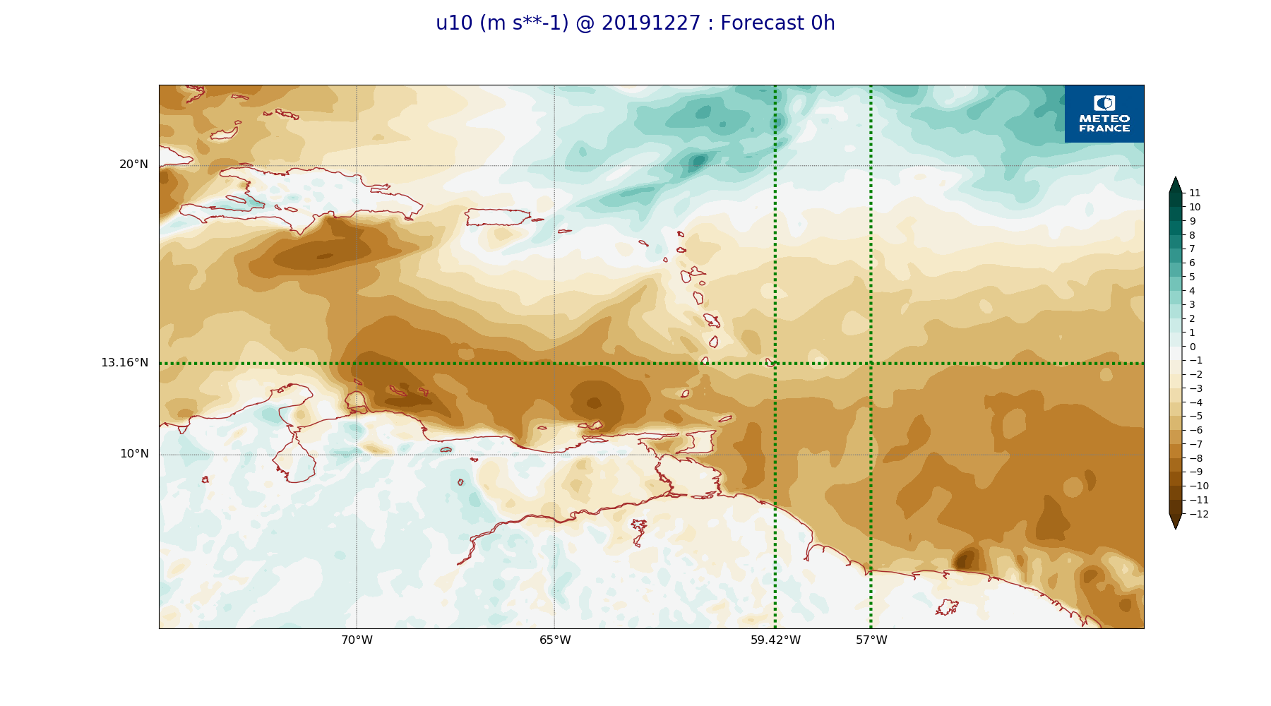
ARPEGE_map2D_u10_20191227_fct_0.png
2019-12-27 12:03
234K
ARPEGE_map2D_qv_925hPa_20191227_fct_12.png
2019-12-27 11:58
234K
ARPEGE_map2D_qv_925hPa_20191227_fct_48.png
2019-12-27 11:59
235K
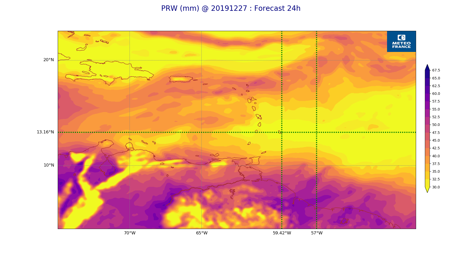
ARPEGE_map2D_PRW_20191227_fct_24.png
2019-12-27 12:03
235K
ARPEGE_map2D_qv_925hPa_20191227_fct_36.png
2019-12-27 11:59
235K
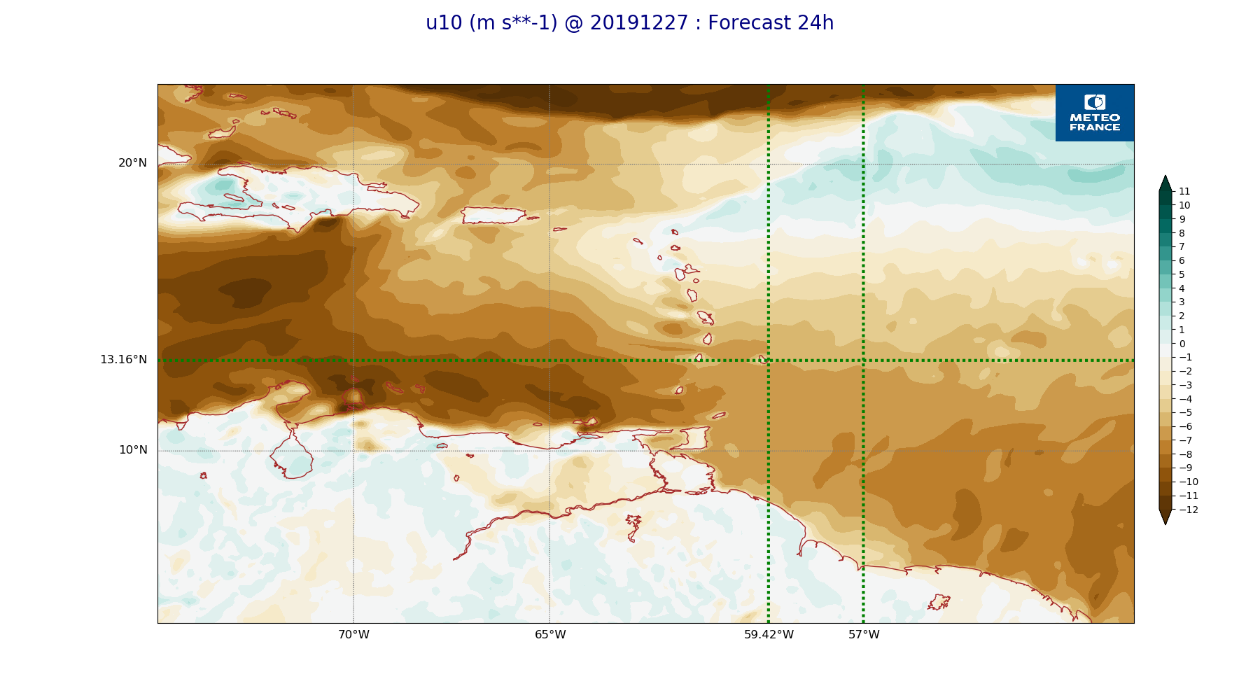
ARPEGE_map2D_u10_20191227_fct_24.png
2019-12-27 12:03
236K
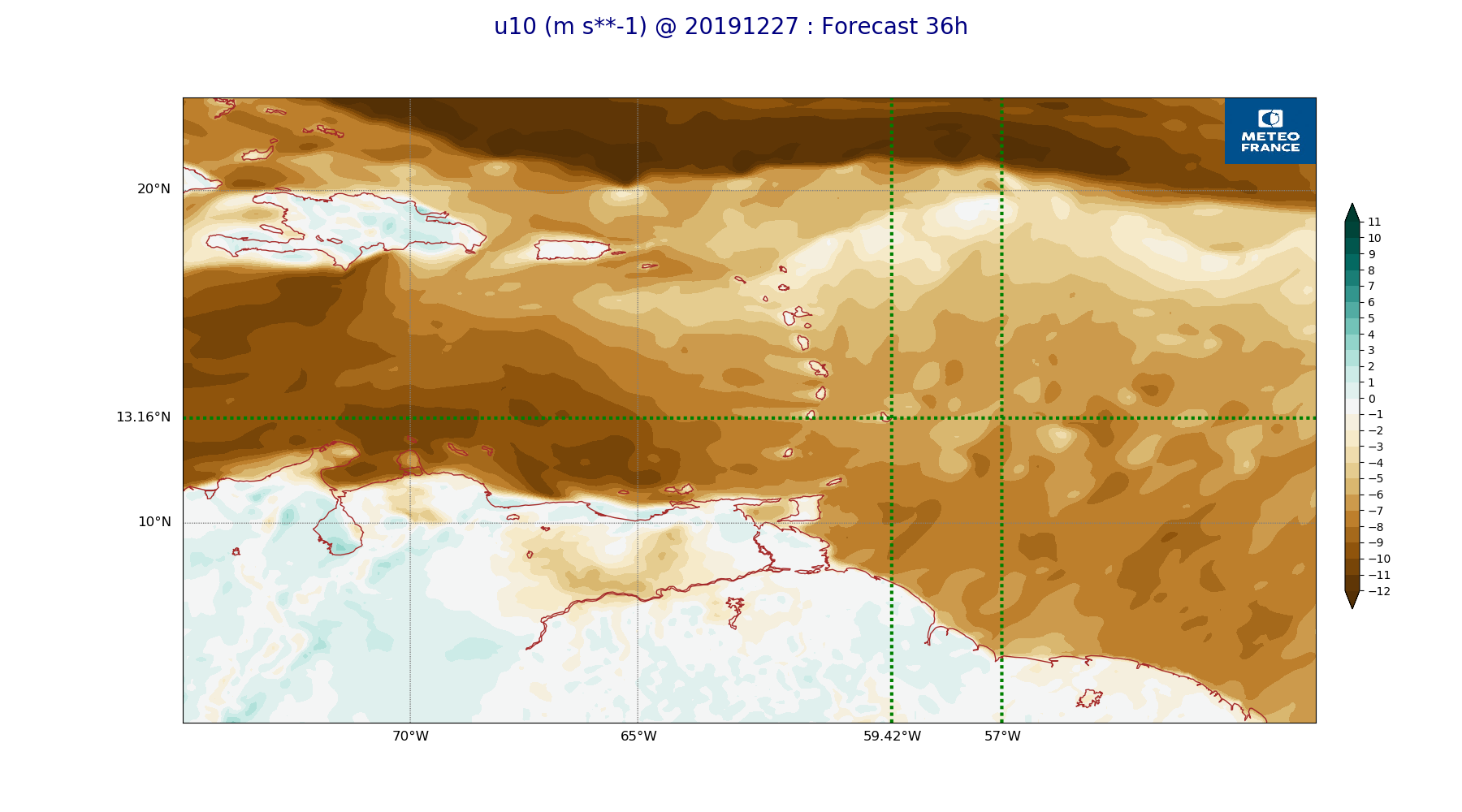
ARPEGE_map2D_u10_20191227_fct_36.png
2019-12-27 12:03
236K
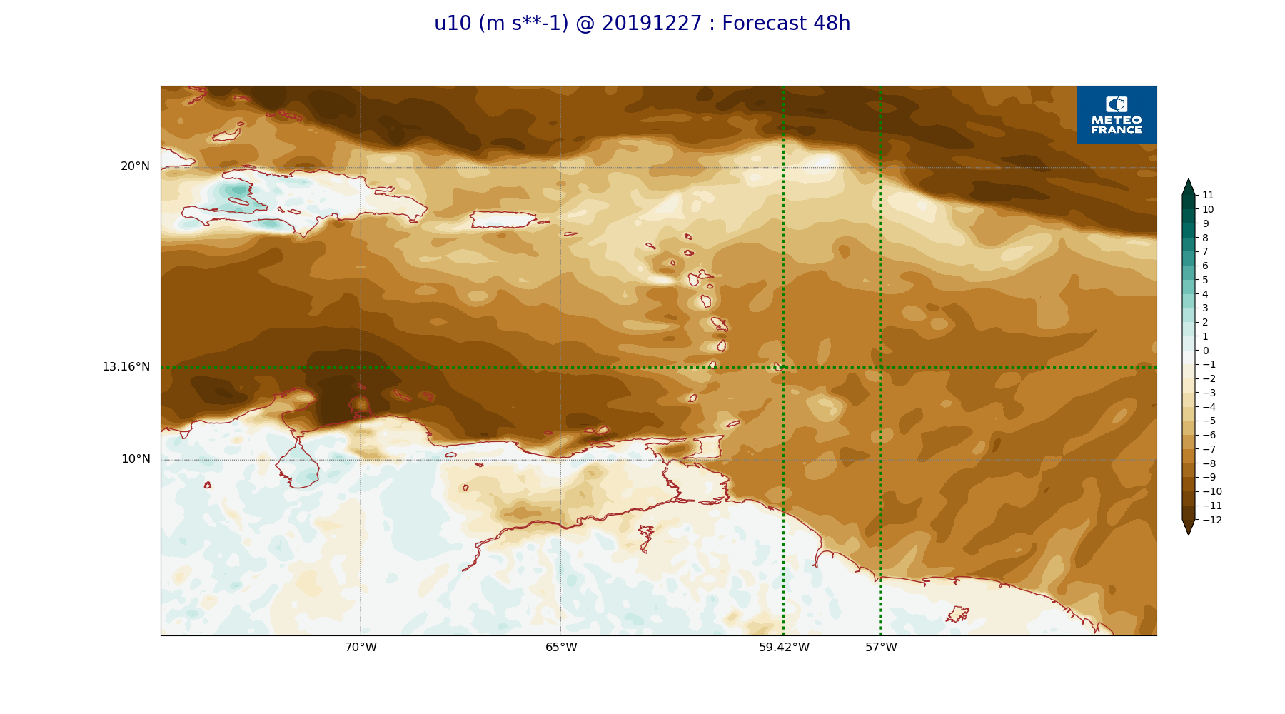
ARPEGE_map2D_u10_20191227_fct_48.png
2019-12-27 12:04
236K
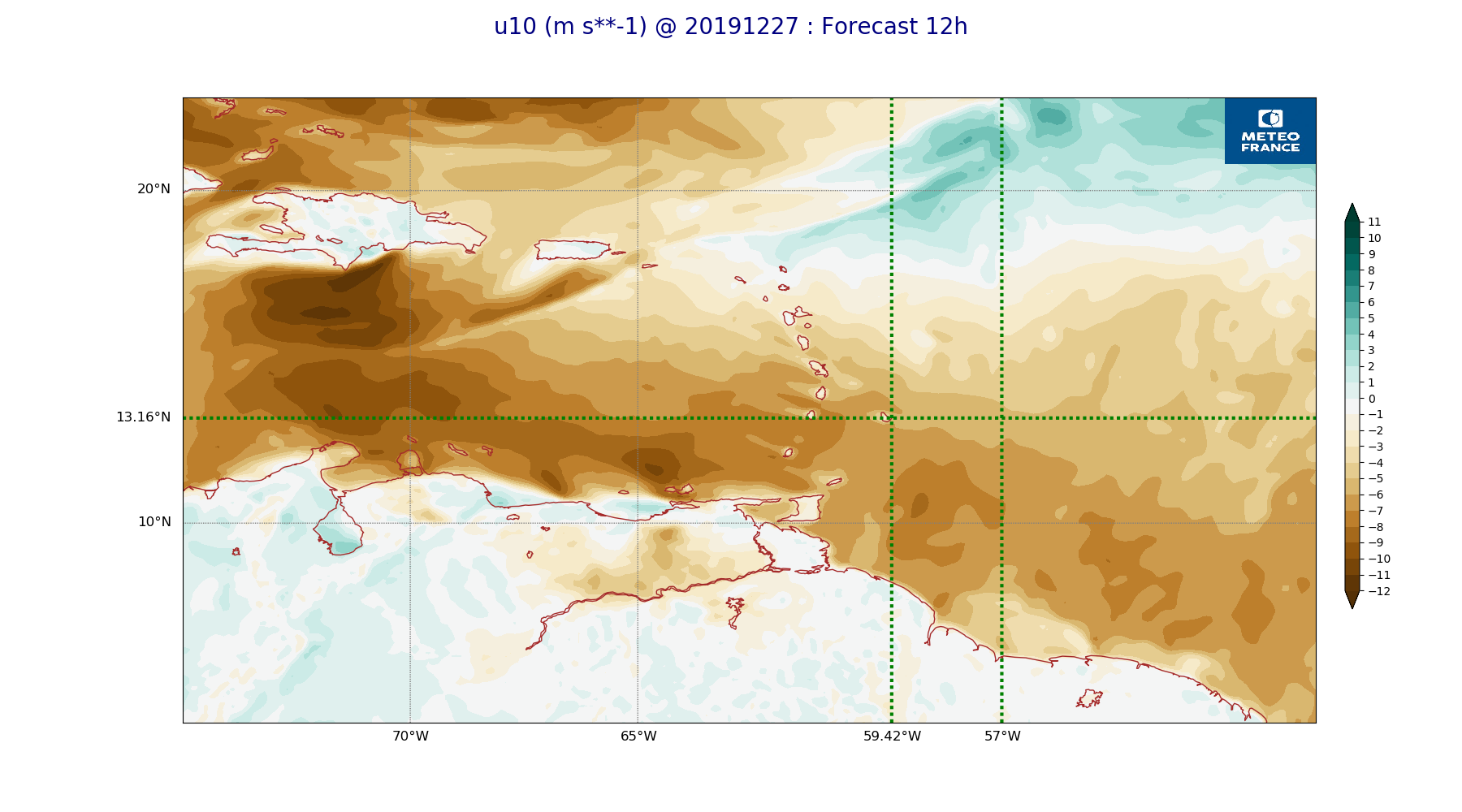
ARPEGE_map2D_u10_20191227_fct_12.png
2019-12-27 12:03
237K
ARPEGE_map2D_qv_925hPa_20191227_fct_24.png
2019-12-27 11:59
239K
ARPEGE_map2D_High_CC_sup_450hPa_20191227_fct_48.png
2019-12-27 12:02
239K
ARPEGE_map2D_RH_700hPa_20191227_fct_12.png
2019-12-27 11:58
239K
ARPEGE_map2D_qv_850hPa_20191227_fct_36.png
2019-12-27 11:59
240K
ARPEGE_map2D_RH_700hPa_20191227_fct_0.png
2019-12-27 11:58
241K
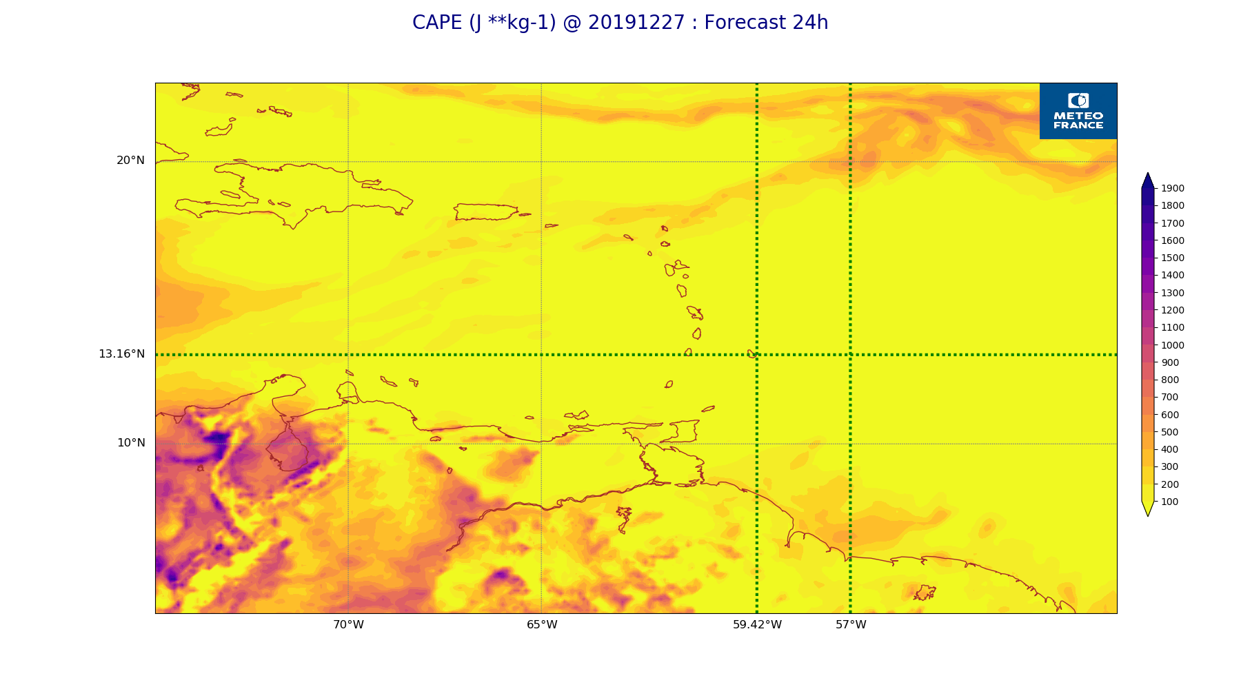
ARPEGE_map2D_CAPE_20191227_fct_24.png
2019-12-27 12:07
243K
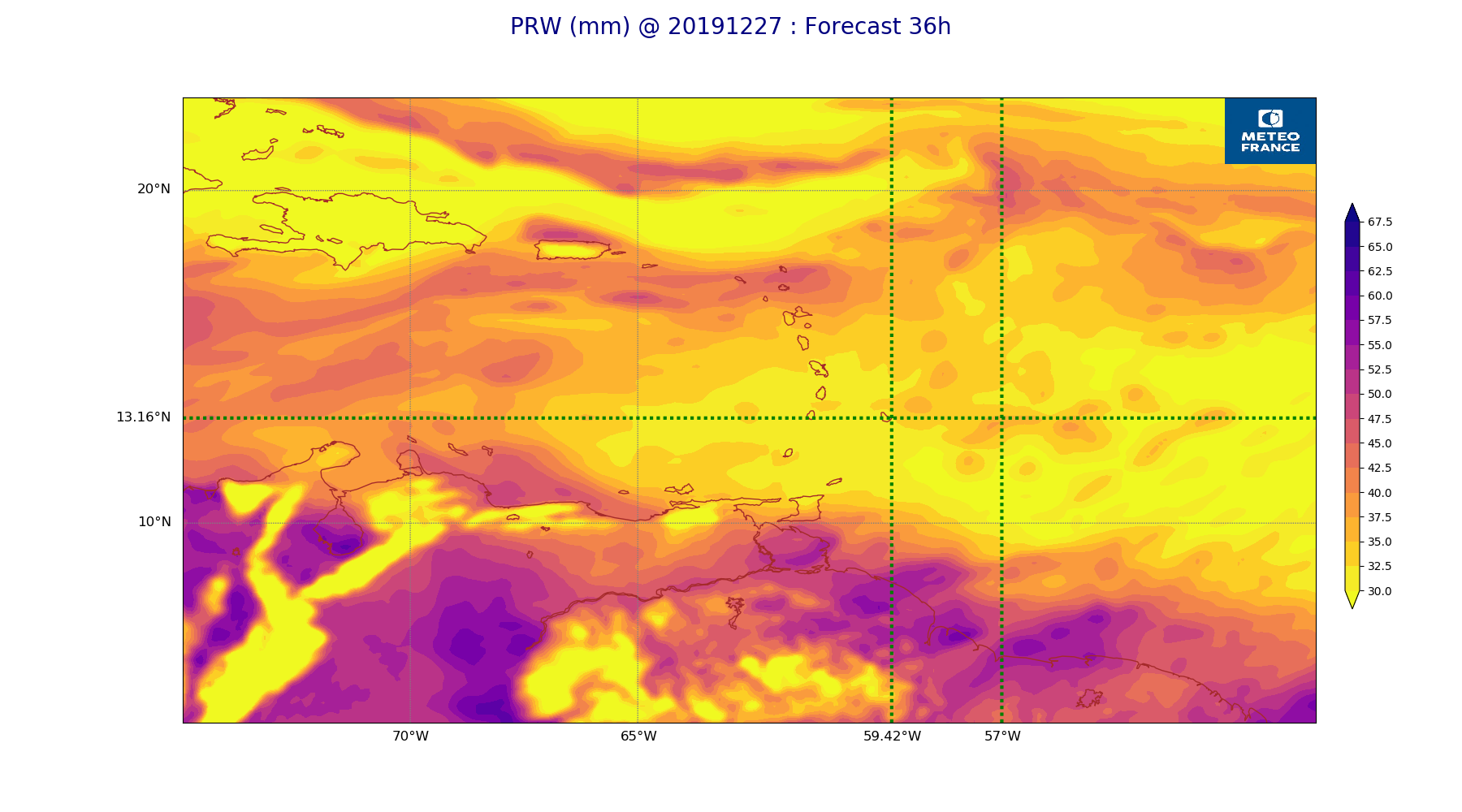
ARPEGE_map2D_PRW_20191227_fct_36.png
2019-12-27 12:03
243K
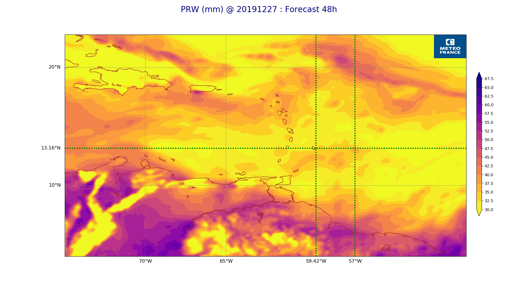
ARPEGE_map2D_PRW_20191227_fct_48.png
2019-12-27 12:03
243K
ARPEGE_map2D_Vertical_velocity_500hPa_20191227_fct_0.png
2019-12-27 11:54
245K
ARPEGE_map2D_qv_850hPa_20191227_fct_48.png
2019-12-27 11:59
245K
ARPEGE_map2D_qv_925hPa_20191227_fct_0.png
2019-12-27 11:58
247K
ARPEGE_map2D_V_925hPa_20191227_fct_48.png
2019-12-27 11:56
250K
ARPEGE_map2D_Vertical_velocity_700hPa_20191227_fct_24.png
2019-12-27 11:54
250K
ARPEGE_map2D_RH_700hPa_20191227_fct_24.png
2019-12-27 11:58
250K
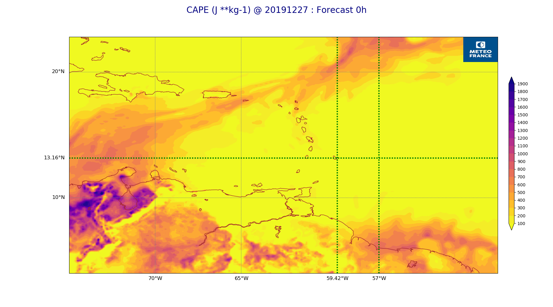
ARPEGE_map2D_CAPE_20191227_fct_0.png
2019-12-27 12:06
252K
ARPEGE_map2D_V_925hPa_20191227_fct_36.png
2019-12-27 11:56
252K
ARPEGE_map2D_V_925hPa_20191227_fct_24.png
2019-12-27 11:56
253K
ARPEGE_map2D_V_925hPa_20191227_fct_12.png
2019-12-27 11:56
254K
ARPEGE_map2D_V_850hPa_20191227_fct_24.png
2019-12-27 11:56
254K
ARPEGE_map2D_V_925hPa_20191227_fct_0.png
2019-12-27 11:55
257K
ARPEGE_map2D_V_850hPa_20191227_fct_12.png
2019-12-27 11:55
258K
ARPEGE_map2D_Vertical_velocity_700hPa_20191227_fct_12.png
2019-12-27 11:54
259K
ARPEGE_map2D_Vertical_velocity_700hPa_20191227_fct_0.png
2019-12-27 11:54
260K
ARPEGE_map2D_V_850hPa_20191227_fct_36.png
2019-12-27 11:56
262K
ARPEGE_map2D_Vertical_velocity_700hPa_20191227_fct_36.png
2019-12-27 11:54
262K
ARPEGE_map2D_Vertical_velocity_700hPa_20191227_fct_48.png
2019-12-27 11:55
262K
ARPEGE_map2D_RH_700hPa_20191227_fct_36.png
2019-12-27 11:58
264K
ARPEGE_map2D_RH_850hPa_20191227_fct_12.png
2019-12-27 11:58
264K
ARPEGE_map2D_V_850hPa_20191227_fct_0.png
2019-12-27 11:55
264K
ARPEGE_map2D_V_850hPa_20191227_fct_48.png
2019-12-27 11:56
266K
ARPEGE_map2D_RH_850hPa_20191227_fct_24.png
2019-12-27 11:58
269K
ARPEGE_map2D_RH_850hPa_20191227_fct_0.png
2019-12-27 11:58
269K
ARPEGE_map2D_Vertical_velocity_850hPa_20191227_fct_24.png
2019-12-27 11:54
273K
ARPEGE_map2D_RH_700hPa_20191227_fct_48.png
2019-12-27 11:58
277K
ARPEGE_map2D_RH_850hPa_20191227_fct_36.png
2019-12-27 11:58
282K
ARPEGE_map2D_Vertical_velocity_850hPa_20191227_fct_12.png
2019-12-27 11:54
283K
ARPEGE_map2D_Vertical_velocity_850hPa_20191227_fct_0.png
2019-12-27 11:54
284K
ARPEGE_map2D_RH_850hPa_20191227_fct_48.png
2019-12-27 11:58
285K
ARPEGE_map2D_Fraction_cloud_cover_200hPa_20191227_fct_12.png
2019-12-27 11:56
288K
ARPEGE_map2D_Vertical_velocity_850hPa_20191227_fct_48.png
2019-12-27 11:55
290K
ARPEGE_map2D_Vertical_velocity_850hPa_20191227_fct_36.png
2019-12-27 11:54
290K
ARPEGE_map2D_Fraction_cloud_cover_200hPa_20191227_fct_36.png
2019-12-27 11:56
293K
ARPEGE_map2D_Fraction_cloud_cover_500hPa_20191227_fct_48.png
2019-12-27 11:57
305K
ARPEGE_map2D_Fraction_cloud_cover_200hPa_20191227_fct_24.png
2019-12-27 11:56
318K
ARPEGE_map2D_Fraction_cloud_cover_500hPa_20191227_fct_36.png
2019-12-27 11:56
319K
ARPEGE_map2D_Fraction_cloud_cover_500hPa_20191227_fct_12.png
2019-12-27 11:56
321K
ARPEGE_map2D_Fraction_cloud_cover_200hPa_20191227_fct_48.png
2019-12-27 11:57
328K
ARPEGE_map2D_Low_CC_inf_785hPa_20191227_fct_12.png
2019-12-27 12:00
332K
ARPEGE_map2D_Low_CC_inf_785hPa_20191227_fct_48.png
2019-12-27 12:00
339K
ARPEGE_map2D_Fraction_cloud_cover_500hPa_20191227_fct_24.png
2019-12-27 11:56
340K
ARPEGE_map2D_Mid_CC_785_450hPa_20191227_fct_12.png
2019-12-27 12:00
348K
ARPEGE_map2D_Low_CC_inf_785hPa_20191227_fct_36.png
2019-12-27 12:00
348K
ARPEGE_map2D_Mid_CC_785_450hPa_20191227_fct_24.png
2019-12-27 12:01
352K
ARPEGE_map2D_Low_CC_inf_785hPa_20191227_fct_24.png
2019-12-27 12:00
359K
ARPEGE_map2D_Mid_CC_785_450hPa_20191227_fct_36.png
2019-12-27 12:01
389K
ARPEGE_map2D_Mid_CC_785_450hPa_20191227_fct_48.png
2019-12-27 12:01
393K
ARPEGE_map2D_Fraction_cloud_cover_850hPa_20191227_fct_12.png
2019-12-27 11:56
496K
ARPEGE_map2D_Fraction_cloud_cover_850hPa_20191227_fct_24.png
2019-12-27 11:56
497K
ARPEGE_map2D_Fraction_cloud_cover_850hPa_20191227_fct_36.png
2019-12-27 11:56
530K
ARPEGE_map2D_Fraction_cloud_cover_850hPa_20191227_fct_48.png
2019-12-27 11:57
567K
ARPEGE_map2D_Fraction_cloud_cover_925hPa_20191227_fct_12.png
2019-12-27 11:56
597K
ARPEGE_map2D_Fraction_cloud_cover_925hPa_20191227_fct_36.png
2019-12-27 11:56
617K
ARPEGE_map2D_Fraction_cloud_cover_925hPa_20191227_fct_48.png
2019-12-27 11:57
623K
ARPEGE_map2D_Fraction_cloud_cover_925hPa_20191227_fct_24.png
2019-12-27 11:56
636K