Index of /aeris/eurec4a-data/FORECASTS/GLOBAL/ARPEGE/2020/20200110/map2D
Name
Last modified
Size
Parent Directory
-
ARPEGE_map2D_LWP_20200110_fct_0.png
2020-01-10 12:05
115K
ARPEGE_map2D_LWP_20200110_fct_12.png
2020-01-10 12:05
115K
ARPEGE_map2D_LWP_20200110_fct_24.png
2020-01-10 12:05
116K
ARPEGE_map2D_LWP_20200110_fct_48.png
2020-01-10 12:06
116K
ARPEGE_map2D_LWP_20200110_fct_36.png
2020-01-10 12:06
116K
ARPEGE_map2D_Psfc_20200110_fct_0.png
2020-01-10 12:07
122K
ARPEGE_map2D_Psfc_20200110_fct_12.png
2020-01-10 12:07
122K
ARPEGE_map2D_Psfc_20200110_fct_24.png
2020-01-10 12:07
122K
ARPEGE_map2D_Psfc_20200110_fct_48.png
2020-01-10 12:07
122K
ARPEGE_map2D_Psfc_20200110_fct_36.png
2020-01-10 12:07
122K
ARPEGE_map2D_IWP_20200110_fct_0.png
2020-01-10 12:06
123K
ARPEGE_map2D_Cum_3h_RAIN_20200110_fct_0.png
2020-01-10 12:02
123K
ARPEGE_map2D_IWP_20200110_fct_12.png
2020-01-10 12:06
123K
ARPEGE_map2D_IWP_20200110_fct_24.png
2020-01-10 12:06
124K
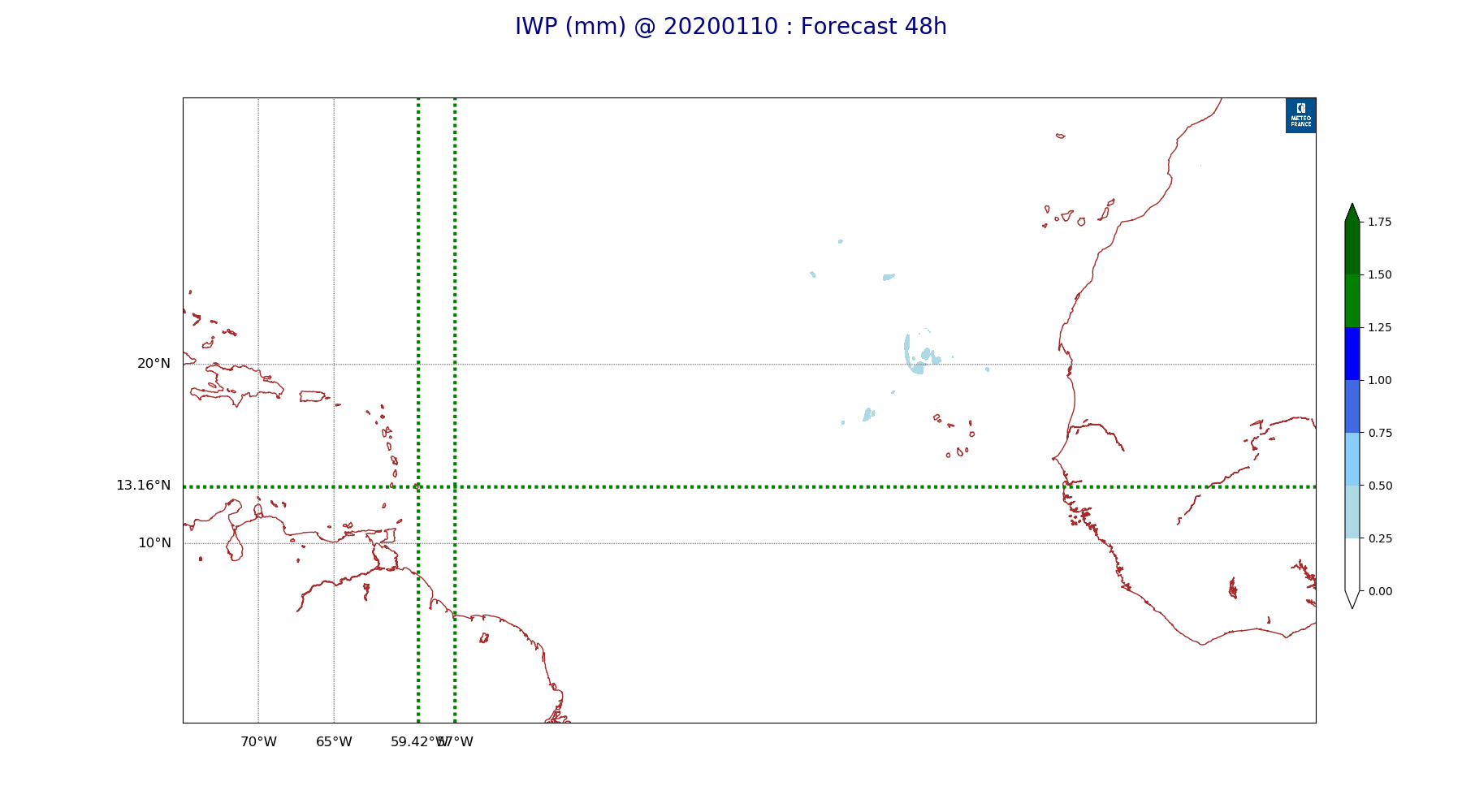
ARPEGE_map2D_IWP_20200110_fct_48.png
2020-01-10 12:07
124K
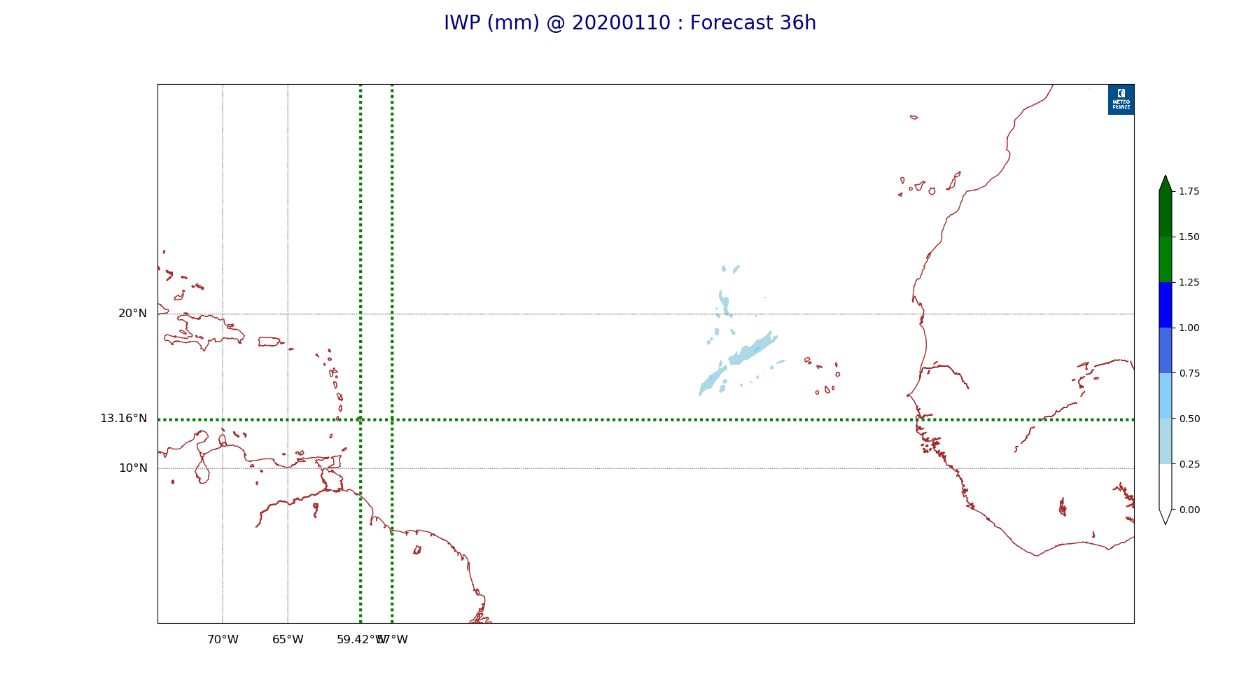
ARPEGE_map2D_IWP_20200110_fct_36.png
2020-01-10 12:06
125K
ARPEGE_map2D_qv_500hPa_20200110_fct_0.png
2020-01-10 11:58
132K
ARPEGE_map2D_qv_500hPa_20200110_fct_12.png
2020-01-10 11:58
133K
ARPEGE_map2D_qv_500hPa_20200110_fct_24.png
2020-01-10 11:58
133K
ARPEGE_map2D_qv_500hPa_20200110_fct_48.png
2020-01-10 11:58
133K
ARPEGE_map2D_qv_500hPa_20200110_fct_36.png
2020-01-10 11:58
133K
ARPEGE_map2D_Fraction_cloud_cover_925hPa_20200110_fct_0.png
2020-01-10 11:55
133K
ARPEGE_map2D_Fraction_cloud_cover_200hPa_20200110_fct_0.png
2020-01-10 11:55
133K
ARPEGE_map2D_Fraction_cloud_cover_500hPa_20200110_fct_0.png
2020-01-10 11:55
133K
ARPEGE_map2D_Fraction_cloud_cover_850hPa_20200110_fct_0.png
2020-01-10 11:55
133K
ARPEGE_map2D_Low_CC_inf_785hPa_20200110_fct_0.png
2020-01-10 11:59
139K
ARPEGE_map2D_High_CC_sup_450hPa_20200110_fct_0.png
2020-01-10 12:01
140K
ARPEGE_map2D_Mid_CC_785_450hPa_20200110_fct_0.png
2020-01-10 12:00
140K
ARPEGE_map2D_T_850hPa_20200110_fct_0.png
2020-01-10 11:57
153K
ARPEGE_map2D_T_850hPa_20200110_fct_12.png
2020-01-10 11:57
153K
ARPEGE_map2D_T_850hPa_20200110_fct_24.png
2020-01-10 11:57
154K
ARPEGE_map2D_T_850hPa_20200110_fct_48.png
2020-01-10 11:57
156K
ARPEGE_map2D_theta_925hPa_20200110_fct_0.png
2020-01-10 11:56
158K
ARPEGE_map2D_theta_925hPa_20200110_fct_24.png
2020-01-10 11:56
159K
ARPEGE_map2D_theta_850hPa_20200110_fct_0.png
2020-01-10 11:56
159K
ARPEGE_map2D_theta_850hPa_20200110_fct_48.png
2020-01-10 11:56
160K
ARPEGE_map2D_T_850hPa_20200110_fct_36.png
2020-01-10 11:57
160K
ARPEGE_map2D_theta_850hPa_20200110_fct_24.png
2020-01-10 11:56
161K
ARPEGE_map2D_theta_925hPa_20200110_fct_48.png
2020-01-10 11:56
162K
ARPEGE_map2D_T_925hPa_20200110_fct_0.png
2020-01-10 11:57
163K
ARPEGE_map2D_theta_500hPa_20200110_fct_48.png
2020-01-10 11:56
163K
ARPEGE_map2D_T_925hPa_20200110_fct_24.png
2020-01-10 11:57
163K
ARPEGE_map2D_theta_850hPa_20200110_fct_12.png
2020-01-10 11:56
163K
ARPEGE_map2D_T_925hPa_20200110_fct_48.png
2020-01-10 11:57
164K
ARPEGE_map2D_theta_925hPa_20200110_fct_12.png
2020-01-10 11:56
165K
ARPEGE_map2D_T_500hPa_20200110_fct_48.png
2020-01-10 11:57
165K
ARPEGE_map2D_theta_925hPa_20200110_fct_36.png
2020-01-10 11:56
165K
ARPEGE_map2D_T_500hPa_20200110_fct_0.png
2020-01-10 11:57
167K
ARPEGE_map2D_T_925hPa_20200110_fct_12.png
2020-01-10 11:57
167K
ARPEGE_map2D_T_925hPa_20200110_fct_36.png
2020-01-10 11:57
167K
ARPEGE_map2D_theta_500hPa_20200110_fct_36.png
2020-01-10 11:56
168K
ARPEGE_map2D_theta_850hPa_20200110_fct_36.png
2020-01-10 11:56
168K
ARPEGE_map2D_theta_500hPa_20200110_fct_0.png
2020-01-10 11:56
169K
ARPEGE_map2D_T_500hPa_20200110_fct_12.png
2020-01-10 11:57
170K
ARPEGE_map2D_T_500hPa_20200110_fct_36.png
2020-01-10 11:57
170K
ARPEGE_map2D_T_500hPa_20200110_fct_24.png
2020-01-10 11:57
170K
ARPEGE_map2D_U_200hPa_20200110_fct_36.png
2020-01-10 11:54
170K
ARPEGE_map2D_theta_500hPa_20200110_fct_24.png
2020-01-10 11:56
170K
ARPEGE_map2D_U_200hPa_20200110_fct_48.png
2020-01-10 11:54
171K
ARPEGE_map2D_theta_500hPa_20200110_fct_12.png
2020-01-10 11:56
171K
ARPEGE_map2D_U_200hPa_20200110_fct_24.png
2020-01-10 11:54
172K
ARPEGE_map2D_Cum_3h_RAIN_20200110_fct_24.png
2020-01-10 12:02
174K
ARPEGE_map2D_U_200hPa_20200110_fct_12.png
2020-01-10 11:54
179K
ARPEGE_map2D_Cum_3h_RAIN_20200110_fct_48.png
2020-01-10 12:03
180K
ARPEGE_map2D_U_200hPa_20200110_fct_0.png
2020-01-10 11:53
185K
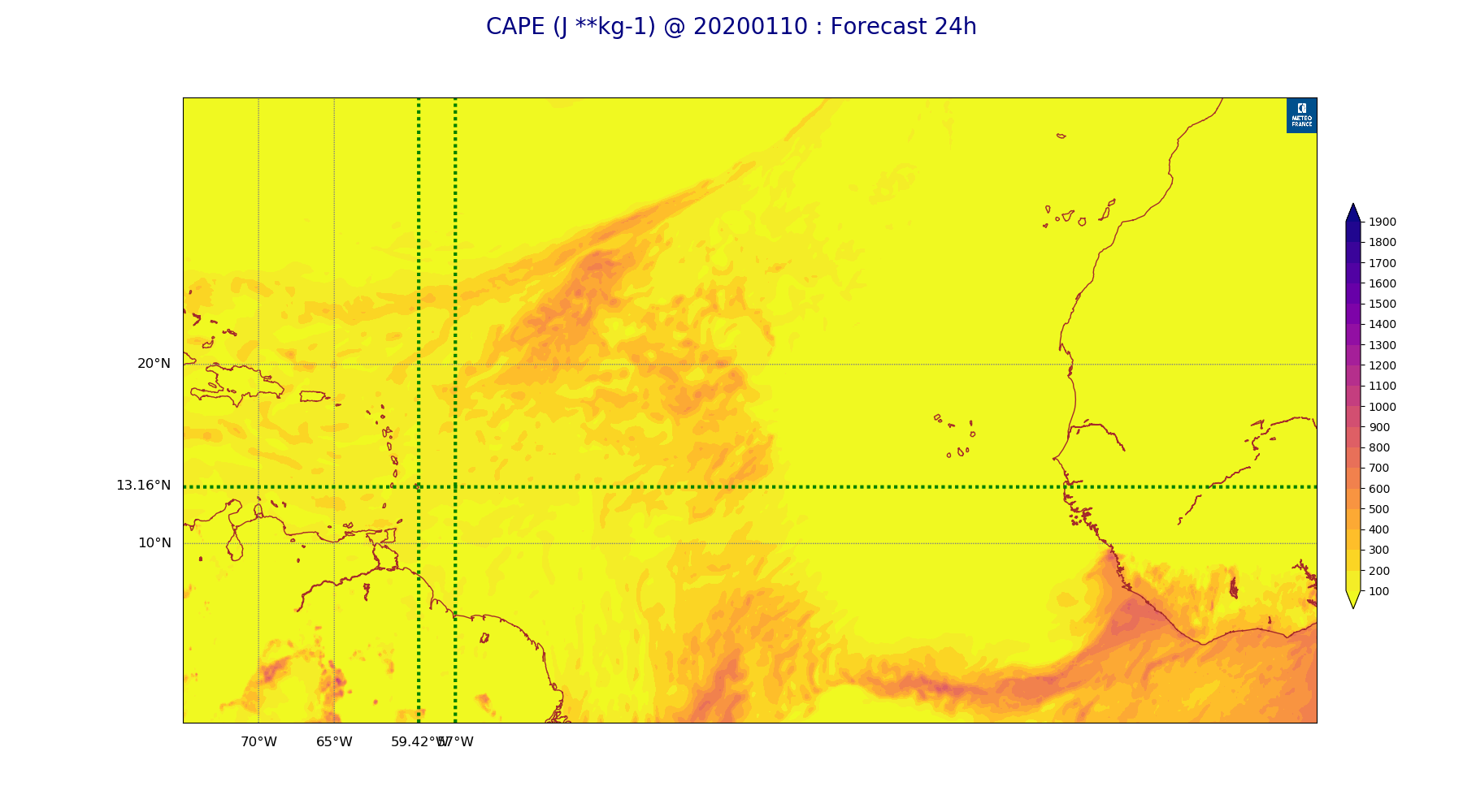
ARPEGE_map2D_CAPE_20200110_fct_24.png
2020-01-10 12:08
201K
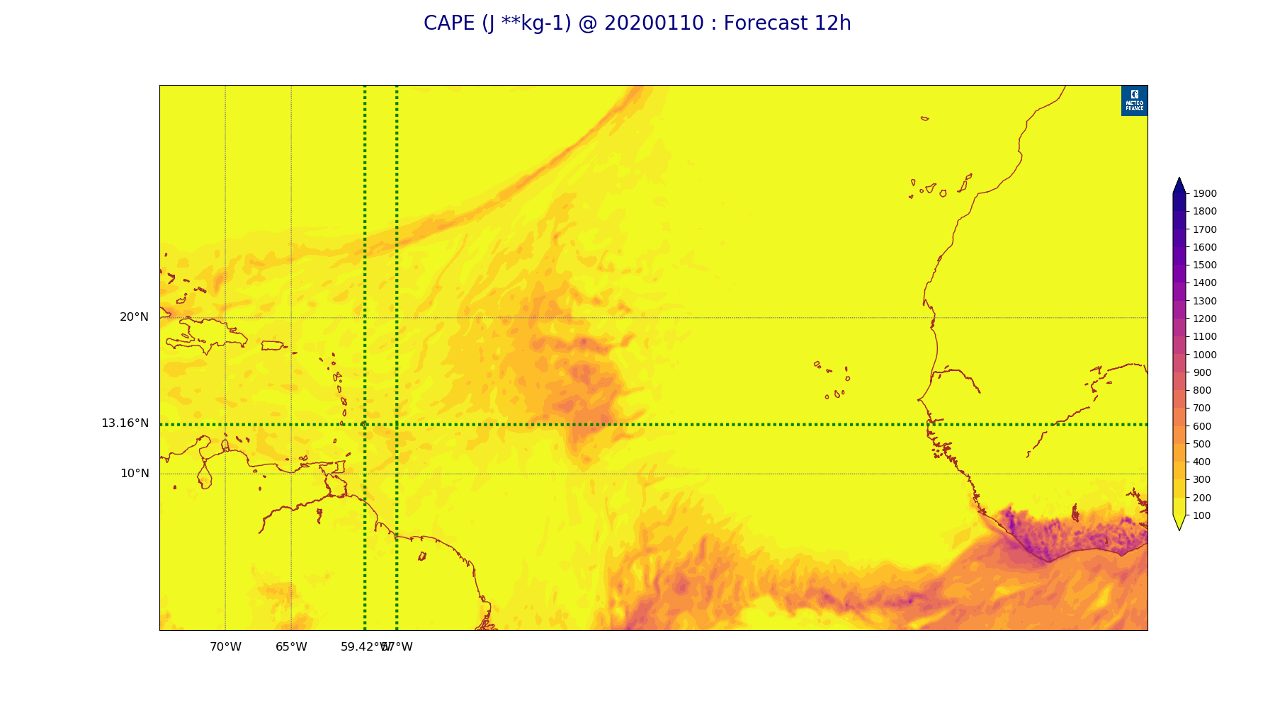
ARPEGE_map2D_CAPE_20200110_fct_12.png
2020-01-10 12:08
204K
ARPEGE_map2D_U_500hPa_20200110_fct_0.png
2020-01-10 11:54
205K
ARPEGE_map2D_CAPE_20200110_fct_36.png
2020-01-10 12:08
207K
ARPEGE_map2D_Cum_3h_RAIN_20200110_fct_12.png
2020-01-10 12:02
208K
ARPEGE_map2D_CAPE_20200110_fct_0.png
2020-01-10 12:07
209K
ARPEGE_map2D_PRW_20200110_fct_48.png
2020-01-10 12:03
209K
ARPEGE_map2D_PRW_20200110_fct_0.png
2020-01-10 12:03
210K
ARPEGE_map2D_PRW_20200110_fct_24.png
2020-01-10 12:03
211K
ARPEGE_map2D_PRW_20200110_fct_12.png
2020-01-10 12:03
211K
ARPEGE_map2D_U_500hPa_20200110_fct_12.png
2020-01-10 11:54
213K
ARPEGE_map2D_PRW_20200110_fct_36.png
2020-01-10 12:03
214K
ARPEGE_map2D_U_500hPa_20200110_fct_24.png
2020-01-10 11:54
214K
ARPEGE_map2D_CAPE_20200110_fct_48.png
2020-01-10 12:08
216K
ARPEGE_map2D_U_500hPa_20200110_fct_48.png
2020-01-10 11:54
217K
ARPEGE_map2D_U_500hPa_20200110_fct_36.png
2020-01-10 11:54
217K
ARPEGE_map2D_U_925hPa_20200110_fct_0.png
2020-01-10 11:54
222K
ARPEGE_map2D_U_925hPa_20200110_fct_24.png
2020-01-10 11:54
225K
ARPEGE_map2D_U_925hPa_20200110_fct_48.png
2020-01-10 11:54
227K
ARPEGE_map2D_U_925hPa_20200110_fct_12.png
2020-01-10 11:54
227K
ARPEGE_map2D_U_925hPa_20200110_fct_36.png
2020-01-10 11:54
228K
ARPEGE_map2D_V_200hPa_20200110_fct_24.png
2020-01-10 11:55
230K
ARPEGE_map2D_Cum_3h_RAIN_20200110_fct_36.png
2020-01-10 12:02
231K
ARPEGE_map2D_V_200hPa_20200110_fct_0.png
2020-01-10 11:54
231K
ARPEGE_map2D_Geopotential_0_7_PVU_20200110_fct_0.png
2020-01-10 11:59
232K
ARPEGE_map2D_V_200hPa_20200110_fct_12.png
2020-01-10 11:54
233K
ARPEGE_map2D_Geopotential_0_7_PVU_20200110_fct_12.png
2020-01-10 11:59
234K
ARPEGE_map2D_Geopotential_0_7_PVU_20200110_fct_24.png
2020-01-10 11:59
237K
ARPEGE_map2D_U_850hPa_20200110_fct_0.png
2020-01-10 11:54
238K
ARPEGE_map2D_V_200hPa_20200110_fct_48.png
2020-01-10 11:55
240K
ARPEGE_map2D_U_850hPa_20200110_fct_48.png
2020-01-10 11:54
240K
ARPEGE_map2D_U_850hPa_20200110_fct_24.png
2020-01-10 11:54
241K
ARPEGE_map2D_U_850hPa_20200110_fct_12.png
2020-01-10 11:54
242K
ARPEGE_map2D_V_200hPa_20200110_fct_36.png
2020-01-10 11:55
242K
ARPEGE_map2D_U_850hPa_20200110_fct_36.png
2020-01-10 11:54
244K
ARPEGE_map2D_Geopotential_0_7_PVU_20200110_fct_36.png
2020-01-10 11:59
246K
ARPEGE_map2D_Geopotential_0_7_PVU_20200110_fct_48.png
2020-01-10 11:59
248K
ARPEGE_map2D_RH_500hPa_20200110_fct_36.png
2020-01-10 11:58
253K
ARPEGE_map2D_RH_500hPa_20200110_fct_24.png
2020-01-10 11:58
254K
ARPEGE_map2D_V_500hPa_20200110_fct_0.png
2020-01-10 11:54
255K
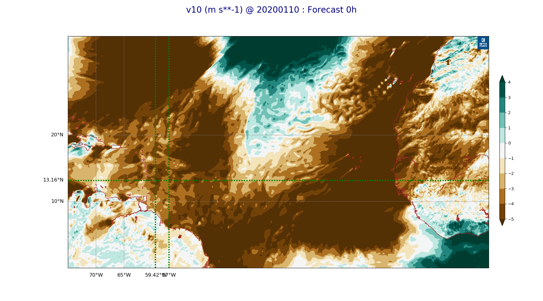
ARPEGE_map2D_v10_20200110_fct_0.png
2020-01-10 12:04
255K
ARPEGE_map2D_qv_925hPa_20200110_fct_24.png
2020-01-10 11:58
257K
ARPEGE_map2D_RH_500hPa_20200110_fct_0.png
2020-01-10 11:57
257K
ARPEGE_map2D_RH_500hPa_20200110_fct_12.png
2020-01-10 11:57
257K
ARPEGE_map2D_qv_850hPa_20200110_fct_48.png
2020-01-10 11:58
258K
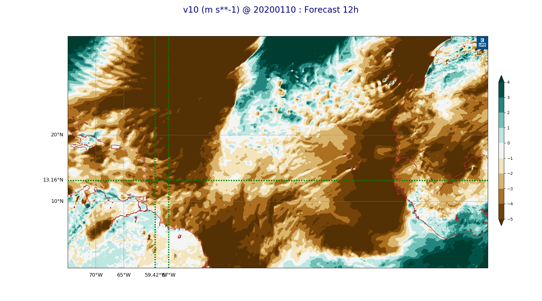
ARPEGE_map2D_v10_20200110_fct_12.png
2020-01-10 12:05
260K
ARPEGE_map2D_qv_850hPa_20200110_fct_24.png
2020-01-10 11:58
261K
ARPEGE_map2D_RH_500hPa_20200110_fct_48.png
2020-01-10 11:58
262K
ARPEGE_map2D_V_500hPa_20200110_fct_12.png
2020-01-10 11:54
262K
ARPEGE_map2D_qv_925hPa_20200110_fct_48.png
2020-01-10 11:58
263K
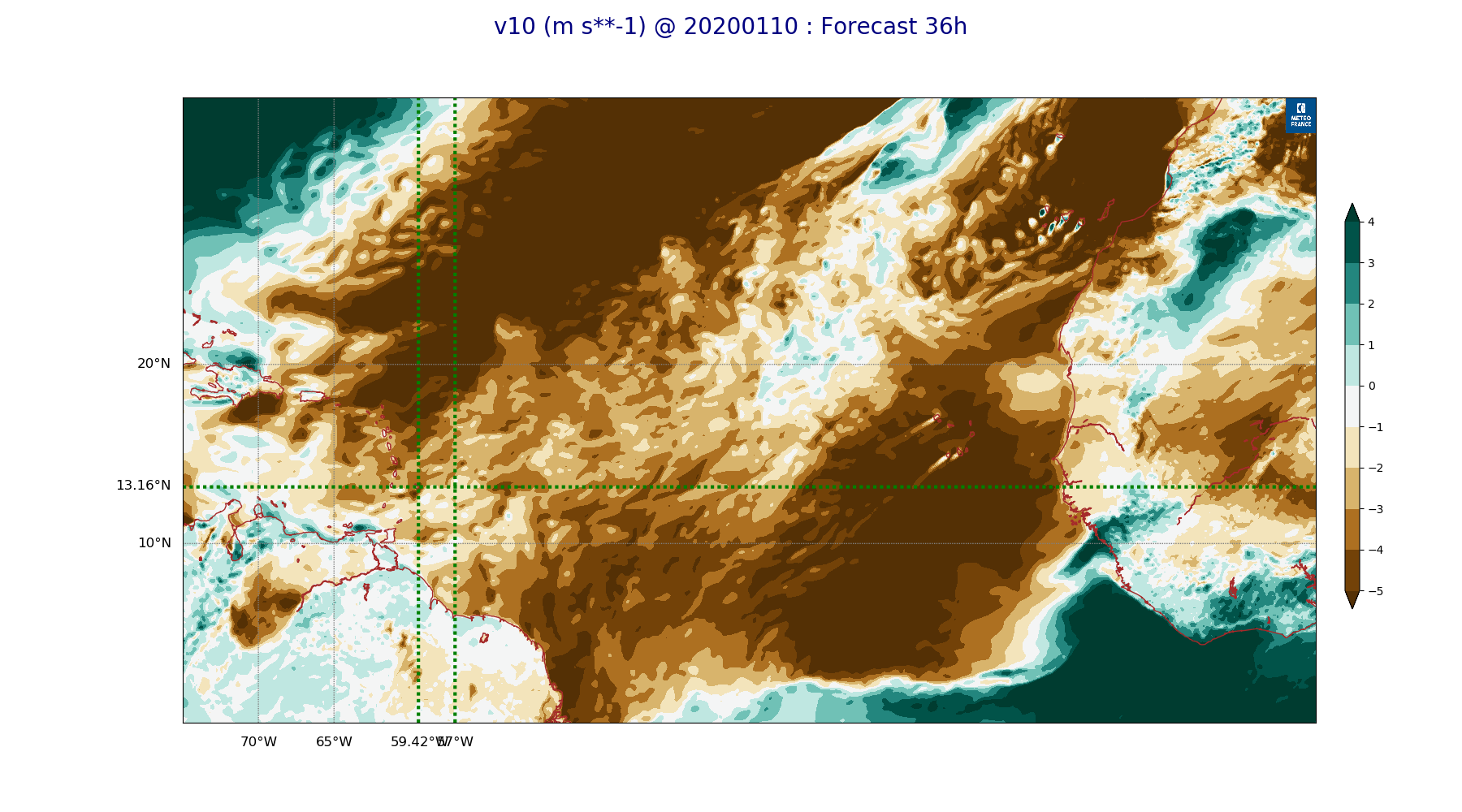
ARPEGE_map2D_v10_20200110_fct_36.png
2020-01-10 12:05
263K
ARPEGE_map2D_qv_925hPa_20200110_fct_36.png
2020-01-10 11:58
264K
ARPEGE_map2D_qv_850hPa_20200110_fct_36.png
2020-01-10 11:58
265K
ARPEGE_map2D_qv_925hPa_20200110_fct_0.png
2020-01-10 11:58
265K
ARPEGE_map2D_qv_850hPa_20200110_fct_0.png
2020-01-10 11:58
266K
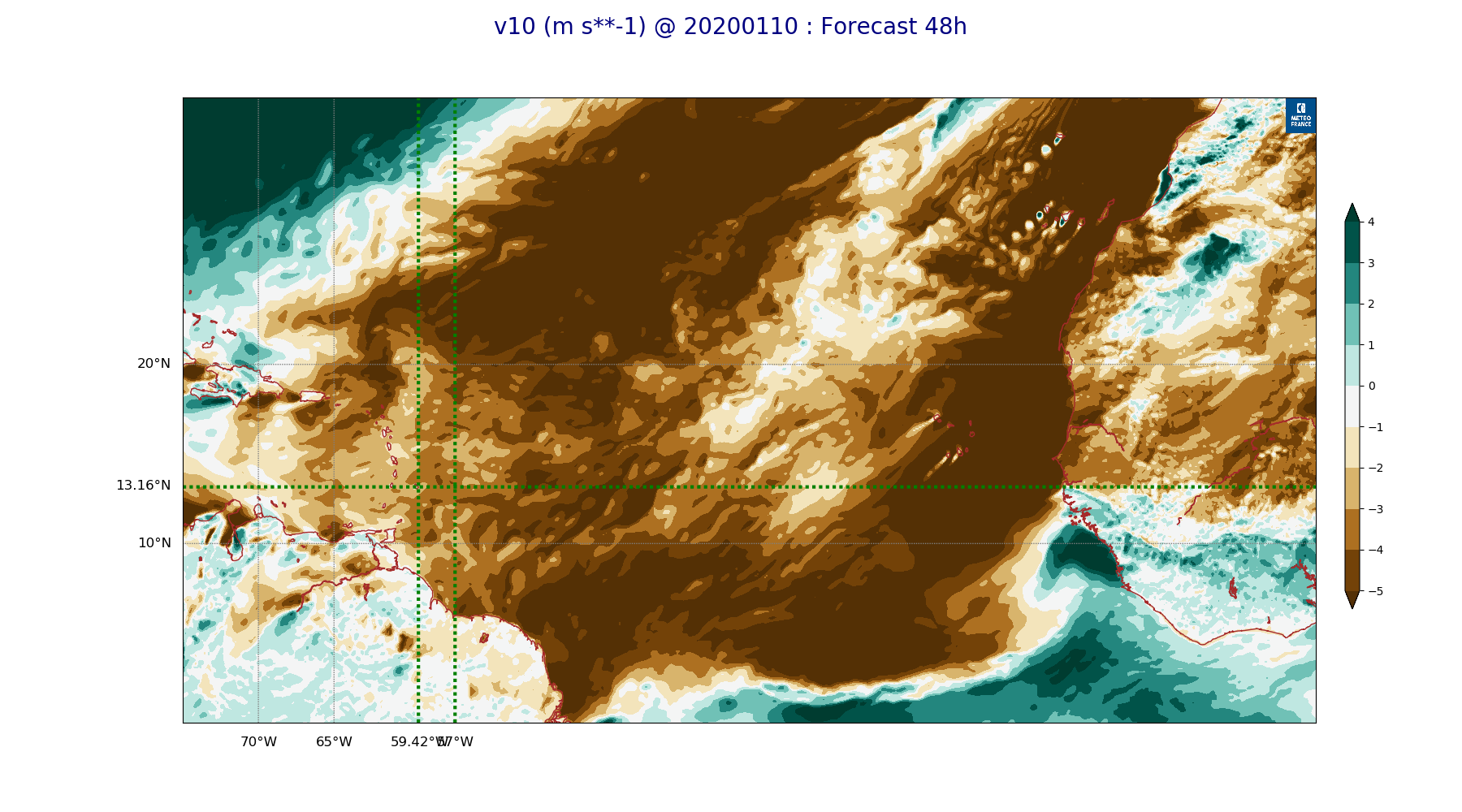
ARPEGE_map2D_v10_20200110_fct_48.png
2020-01-10 12:05
266K
ARPEGE_map2D_V_500hPa_20200110_fct_24.png
2020-01-10 11:55
266K
ARPEGE_map2D_qv_850hPa_20200110_fct_12.png
2020-01-10 11:58
266K
ARPEGE_map2D_qv_925hPa_20200110_fct_12.png
2020-01-10 11:58
267K
ARPEGE_map2D_V_500hPa_20200110_fct_36.png
2020-01-10 11:55
267K
ARPEGE_map2D_v10_20200110_fct_24.png
2020-01-10 12:05
267K
ARPEGE_map2D_V_500hPa_20200110_fct_48.png
2020-01-10 11:55
267K
ARPEGE_map2D_u10_20200110_fct_48.png
2020-01-10 12:04
282K
ARPEGE_map2D_u10_20200110_fct_36.png
2020-01-10 12:04
282K
ARPEGE_map2D_u10_20200110_fct_24.png
2020-01-10 12:04
283K
ARPEGE_map2D_Fraction_cloud_cover_200hPa_20200110_fct_12.png
2020-01-10 11:55
285K
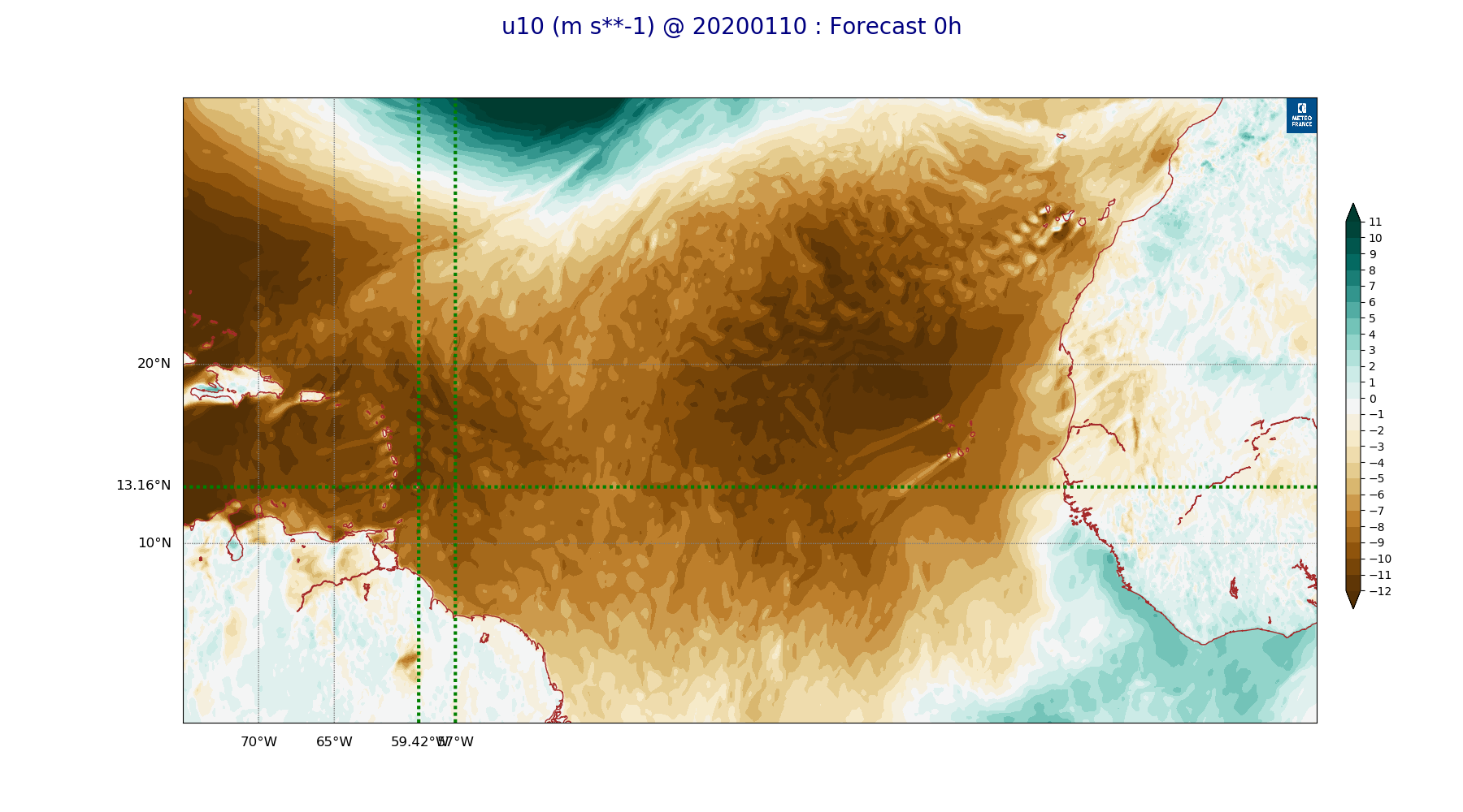
ARPEGE_map2D_u10_20200110_fct_12.png
2020-01-10 12:04
287K
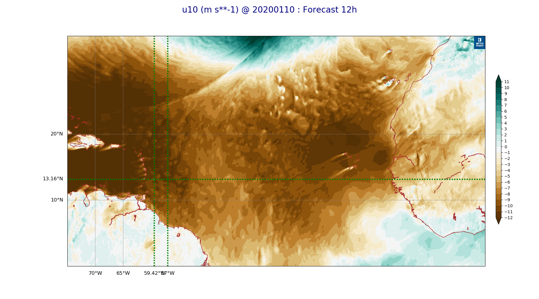
ARPEGE_map2D_u10_20200110_fct_0.png
2020-01-10 12:04
289K
ARPEGE_map2D_Fraction_cloud_cover_200hPa_20200110_fct_24.png
2020-01-10 11:55
290K
ARPEGE_map2D_Fraction_cloud_cover_200hPa_20200110_fct_48.png
2020-01-10 11:56
292K
ARPEGE_map2D_Fraction_cloud_cover_200hPa_20200110_fct_36.png
2020-01-10 11:56
297K
ARPEGE_map2D_RH_700hPa_20200110_fct_0.png
2020-01-10 11:57
302K
ARPEGE_map2D_RH_700hPa_20200110_fct_12.png
2020-01-10 11:57
313K
ARPEGE_map2D_RH_700hPa_20200110_fct_24.png
2020-01-10 11:58
316K
ARPEGE_map2D_V_925hPa_20200110_fct_0.png
2020-01-10 11:54
318K
ARPEGE_map2D_V_925hPa_20200110_fct_12.png
2020-01-10 11:55
322K
ARPEGE_map2D_Vertical_velocity_500hPa_20200110_fct_0.png
2020-01-10 11:53
326K
ARPEGE_map2D_Vertical_velocity_500hPa_20200110_fct_24.png
2020-01-10 11:53
327K
ARPEGE_map2D_V_925hPa_20200110_fct_36.png
2020-01-10 11:55
328K
ARPEGE_map2D_V_925hPa_20200110_fct_48.png
2020-01-10 11:55
328K
ARPEGE_map2D_High_CC_sup_450hPa_20200110_fct_12.png
2020-01-10 12:01
329K
ARPEGE_map2D_RH_700hPa_20200110_fct_36.png
2020-01-10 11:58
329K
ARPEGE_map2D_V_925hPa_20200110_fct_24.png
2020-01-10 11:55
329K
ARPEGE_map2D_RH_700hPa_20200110_fct_48.png
2020-01-10 11:58
330K
ARPEGE_map2D_Vertical_velocity_500hPa_20200110_fct_48.png
2020-01-10 11:53
330K
ARPEGE_map2D_High_CC_sup_450hPa_20200110_fct_24.png
2020-01-10 12:01
334K
ARPEGE_map2D_Vertical_velocity_500hPa_20200110_fct_36.png
2020-01-10 11:53
337K
ARPEGE_map2D_Vertical_velocity_500hPa_20200110_fct_12.png
2020-01-10 11:53
344K
ARPEGE_map2D_V_850hPa_20200110_fct_48.png
2020-01-10 11:55
348K
ARPEGE_map2D_V_850hPa_20200110_fct_0.png
2020-01-10 11:54
351K
ARPEGE_map2D_V_850hPa_20200110_fct_36.png
2020-01-10 11:55
351K
ARPEGE_map2D_V_850hPa_20200110_fct_12.png
2020-01-10 11:55
354K
ARPEGE_map2D_V_850hPa_20200110_fct_24.png
2020-01-10 11:55
360K
ARPEGE_map2D_Vertical_velocity_700hPa_20200110_fct_0.png
2020-01-10 11:53
360K
ARPEGE_map2D_Vertical_velocity_700hPa_20200110_fct_24.png
2020-01-10 11:53
367K
ARPEGE_map2D_Vertical_velocity_700hPa_20200110_fct_48.png
2020-01-10 11:53
369K
ARPEGE_map2D_Vertical_velocity_700hPa_20200110_fct_36.png
2020-01-10 11:53
375K
ARPEGE_map2D_Vertical_velocity_700hPa_20200110_fct_12.png
2020-01-10 11:53
376K
ARPEGE_map2D_High_CC_sup_450hPa_20200110_fct_36.png
2020-01-10 12:02
379K
ARPEGE_map2D_RH_850hPa_20200110_fct_24.png
2020-01-10 11:57
391K
ARPEGE_map2D_RH_850hPa_20200110_fct_48.png
2020-01-10 11:58
394K
ARPEGE_map2D_RH_850hPa_20200110_fct_36.png
2020-01-10 11:58
397K
ARPEGE_map2D_High_CC_sup_450hPa_20200110_fct_48.png
2020-01-10 12:02
400K
ARPEGE_map2D_RH_850hPa_20200110_fct_0.png
2020-01-10 11:57
409K
ARPEGE_map2D_RH_850hPa_20200110_fct_12.png
2020-01-10 11:57
411K
ARPEGE_map2D_Fraction_cloud_cover_500hPa_20200110_fct_24.png
2020-01-10 11:55
415K
ARPEGE_map2D_Vertical_velocity_850hPa_20200110_fct_0.png
2020-01-10 11:53
417K
ARPEGE_map2D_Vertical_velocity_850hPa_20200110_fct_12.png
2020-01-10 11:53
422K
ARPEGE_map2D_Vertical_velocity_850hPa_20200110_fct_36.png
2020-01-10 11:53
424K
ARPEGE_map2D_Fraction_cloud_cover_500hPa_20200110_fct_12.png
2020-01-10 11:55
428K
ARPEGE_map2D_Fraction_cloud_cover_500hPa_20200110_fct_36.png
2020-01-10 11:56
430K
ARPEGE_map2D_Vertical_velocity_850hPa_20200110_fct_24.png
2020-01-10 11:53
430K
ARPEGE_map2D_Fraction_cloud_cover_500hPa_20200110_fct_48.png
2020-01-10 11:56
430K
ARPEGE_map2D_Vertical_velocity_850hPa_20200110_fct_48.png
2020-01-10 11:53
431K
ARPEGE_map2D_Mid_CC_785_450hPa_20200110_fct_12.png
2020-01-10 12:00
601K
ARPEGE_map2D_Low_CC_inf_785hPa_20200110_fct_24.png
2020-01-10 12:00
623K
ARPEGE_map2D_Mid_CC_785_450hPa_20200110_fct_36.png
2020-01-10 12:01
649K
ARPEGE_map2D_Low_CC_inf_785hPa_20200110_fct_48.png
2020-01-10 12:00
657K
ARPEGE_map2D_Low_CC_inf_785hPa_20200110_fct_12.png
2020-01-10 12:00
670K
ARPEGE_map2D_Mid_CC_785_450hPa_20200110_fct_24.png
2020-01-10 12:01
675K
ARPEGE_map2D_Low_CC_inf_785hPa_20200110_fct_36.png
2020-01-10 12:00
680K
ARPEGE_map2D_Mid_CC_785_450hPa_20200110_fct_48.png
2020-01-10 12:01
692K
ARPEGE_map2D_Fraction_cloud_cover_850hPa_20200110_fct_36.png
2020-01-10 11:56
839K
ARPEGE_map2D_Fraction_cloud_cover_850hPa_20200110_fct_12.png
2020-01-10 11:55
841K
ARPEGE_map2D_Fraction_cloud_cover_850hPa_20200110_fct_48.png
2020-01-10 11:56
841K
ARPEGE_map2D_Fraction_cloud_cover_850hPa_20200110_fct_24.png
2020-01-10 11:55
881K
ARPEGE_map2D_Fraction_cloud_cover_925hPa_20200110_fct_24.png
2020-01-10 11:56
914K
ARPEGE_map2D_Fraction_cloud_cover_925hPa_20200110_fct_48.png
2020-01-10 11:56
924K
ARPEGE_map2D_Fraction_cloud_cover_925hPa_20200110_fct_12.png
2020-01-10 11:55
927K
ARPEGE_map2D_Fraction_cloud_cover_925hPa_20200110_fct_36.png
2020-01-10 11:56
1.0M