Index of /aeris/eurec4a-data/FORECASTS/GLOBAL/ARPEGE/2020/20200112/map2D
Name
Last modified
Size
Parent Directory
-
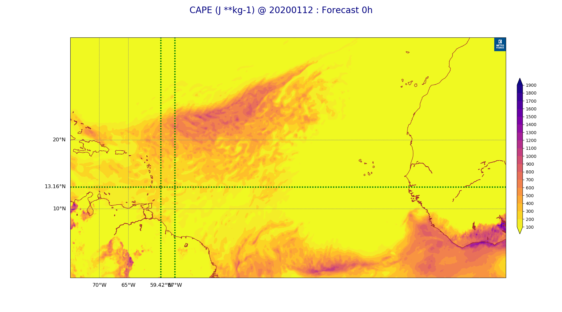
ARPEGE_map2D_CAPE_20200112_fct_0.png
2020-01-12 12:08
223K
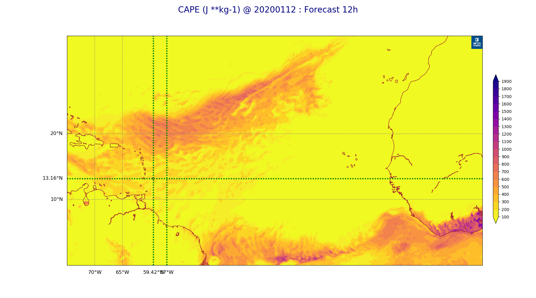
ARPEGE_map2D_CAPE_20200112_fct_12.png
2020-01-12 12:08
218K
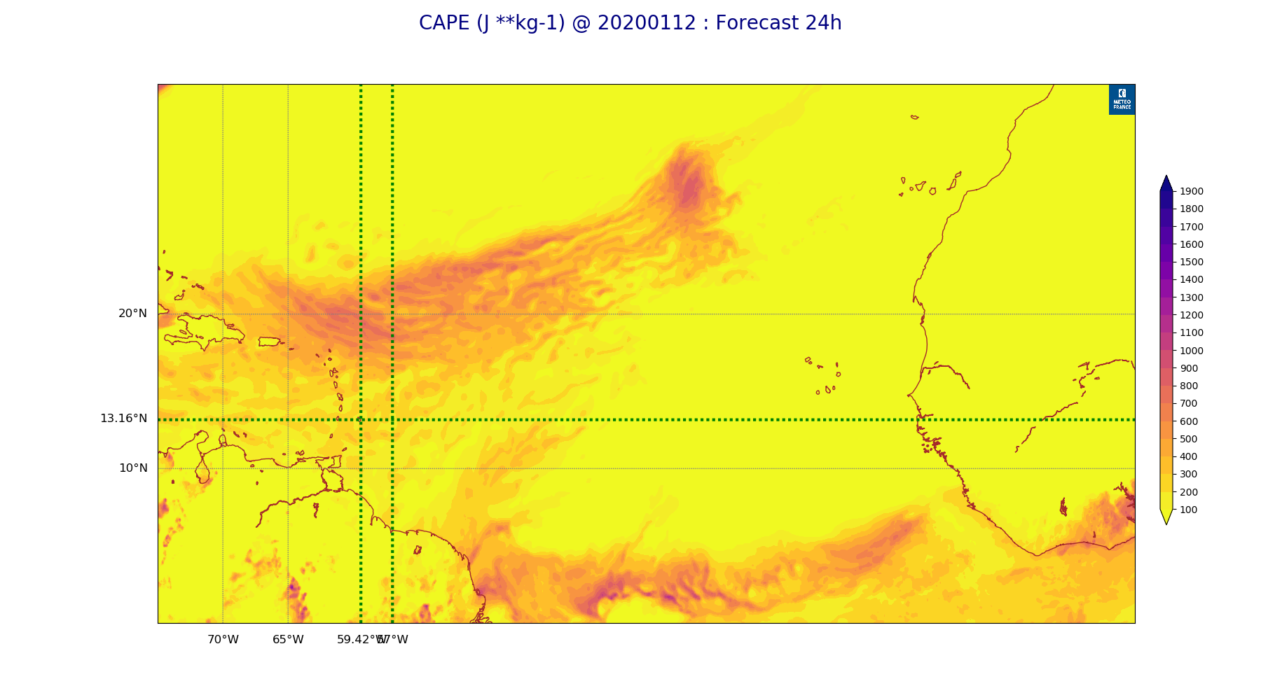
ARPEGE_map2D_CAPE_20200112_fct_24.png
2020-01-12 12:08
215K
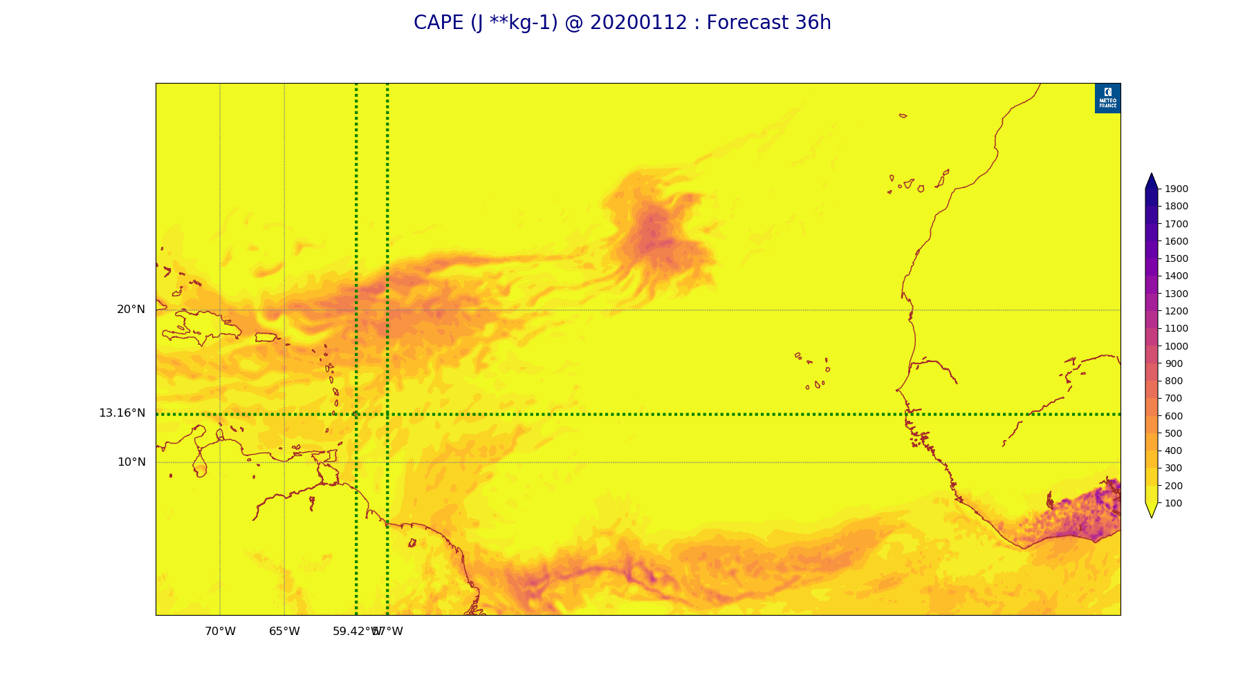
ARPEGE_map2D_CAPE_20200112_fct_36.png
2020-01-12 12:08
207K
ARPEGE_map2D_CAPE_20200112_fct_48.png
2020-01-12 12:08
209K
ARPEGE_map2D_Cum_3h_RAIN_20200112_fct_0.png
2020-01-12 12:02
123K
ARPEGE_map2D_Cum_3h_RAIN_20200112_fct_12.png
2020-01-12 12:02
191K
ARPEGE_map2D_Cum_3h_RAIN_20200112_fct_24.png
2020-01-12 12:02
222K
ARPEGE_map2D_Cum_3h_RAIN_20200112_fct_36.png
2020-01-12 12:03
176K
ARPEGE_map2D_Cum_3h_RAIN_20200112_fct_48.png
2020-01-12 12:03
174K
ARPEGE_map2D_Fraction_cloud_cover_200hPa_20200112_fct_0.png
2020-01-12 11:55
134K
ARPEGE_map2D_Fraction_cloud_cover_200hPa_20200112_fct_12.png
2020-01-12 11:56
282K
ARPEGE_map2D_Fraction_cloud_cover_200hPa_20200112_fct_24.png
2020-01-12 11:56
284K
ARPEGE_map2D_Fraction_cloud_cover_200hPa_20200112_fct_36.png
2020-01-12 11:56
282K
ARPEGE_map2D_Fraction_cloud_cover_200hPa_20200112_fct_48.png
2020-01-12 11:56
299K
ARPEGE_map2D_Fraction_cloud_cover_500hPa_20200112_fct_0.png
2020-01-12 11:55
134K
ARPEGE_map2D_Fraction_cloud_cover_500hPa_20200112_fct_12.png
2020-01-12 11:56
499K
ARPEGE_map2D_Fraction_cloud_cover_500hPa_20200112_fct_24.png
2020-01-12 11:56
443K
ARPEGE_map2D_Fraction_cloud_cover_500hPa_20200112_fct_36.png
2020-01-12 11:56
448K
ARPEGE_map2D_Fraction_cloud_cover_500hPa_20200112_fct_48.png
2020-01-12 11:56
417K
ARPEGE_map2D_Fraction_cloud_cover_850hPa_20200112_fct_0.png
2020-01-12 11:55
134K
ARPEGE_map2D_Fraction_cloud_cover_850hPa_20200112_fct_12.png
2020-01-12 11:56
778K
ARPEGE_map2D_Fraction_cloud_cover_850hPa_20200112_fct_24.png
2020-01-12 11:56
799K
ARPEGE_map2D_Fraction_cloud_cover_850hPa_20200112_fct_36.png
2020-01-12 11:56
749K
ARPEGE_map2D_Fraction_cloud_cover_850hPa_20200112_fct_48.png
2020-01-12 11:56
757K
ARPEGE_map2D_Fraction_cloud_cover_925hPa_20200112_fct_0.png
2020-01-12 11:55
133K
ARPEGE_map2D_Fraction_cloud_cover_925hPa_20200112_fct_12.png
2020-01-12 11:56
962K
ARPEGE_map2D_Fraction_cloud_cover_925hPa_20200112_fct_24.png
2020-01-12 11:56
928K
ARPEGE_map2D_Fraction_cloud_cover_925hPa_20200112_fct_36.png
2020-01-12 11:56
875K
ARPEGE_map2D_Fraction_cloud_cover_925hPa_20200112_fct_48.png
2020-01-12 11:56
875K
ARPEGE_map2D_Geopotential_0_7_PVU_20200112_fct_0.png
2020-01-12 11:59
258K
ARPEGE_map2D_Geopotential_0_7_PVU_20200112_fct_12.png
2020-01-12 11:59
258K
ARPEGE_map2D_Geopotential_0_7_PVU_20200112_fct_24.png
2020-01-12 11:59
238K
ARPEGE_map2D_Geopotential_0_7_PVU_20200112_fct_36.png
2020-01-12 11:59
233K
ARPEGE_map2D_Geopotential_0_7_PVU_20200112_fct_48.png
2020-01-12 11:59
228K
ARPEGE_map2D_High_CC_sup_450hPa_20200112_fct_0.png
2020-01-12 12:01
140K
ARPEGE_map2D_High_CC_sup_450hPa_20200112_fct_12.png
2020-01-12 12:02
410K
ARPEGE_map2D_High_CC_sup_450hPa_20200112_fct_24.png
2020-01-12 12:02
418K
ARPEGE_map2D_High_CC_sup_450hPa_20200112_fct_36.png
2020-01-12 12:02
433K
ARPEGE_map2D_High_CC_sup_450hPa_20200112_fct_48.png
2020-01-12 12:02
448K
ARPEGE_map2D_IWP_20200112_fct_0.png
2020-01-12 12:06
123K
ARPEGE_map2D_IWP_20200112_fct_12.png
2020-01-12 12:06
124K
ARPEGE_map2D_IWP_20200112_fct_24.png
2020-01-12 12:06
124K
ARPEGE_map2D_IWP_20200112_fct_36.png
2020-01-12 12:07
124K
ARPEGE_map2D_IWP_20200112_fct_48.png
2020-01-12 12:07
124K
ARPEGE_map2D_LWP_20200112_fct_0.png
2020-01-12 12:05
116K
ARPEGE_map2D_LWP_20200112_fct_12.png
2020-01-12 12:06
116K
ARPEGE_map2D_LWP_20200112_fct_24.png
2020-01-12 12:06
116K
ARPEGE_map2D_LWP_20200112_fct_36.png
2020-01-12 12:06
116K
ARPEGE_map2D_LWP_20200112_fct_48.png
2020-01-12 12:06
116K
ARPEGE_map2D_Low_CC_inf_785hPa_20200112_fct_0.png
2020-01-12 12:00
140K
ARPEGE_map2D_Low_CC_inf_785hPa_20200112_fct_12.png
2020-01-12 12:00
665K
ARPEGE_map2D_Low_CC_inf_785hPa_20200112_fct_24.png
2020-01-12 12:00
642K
ARPEGE_map2D_Low_CC_inf_785hPa_20200112_fct_36.png
2020-01-12 12:00
627K
ARPEGE_map2D_Low_CC_inf_785hPa_20200112_fct_48.png
2020-01-12 12:00
589K
ARPEGE_map2D_Mid_CC_785_450hPa_20200112_fct_0.png
2020-01-12 12:01
141K
ARPEGE_map2D_Mid_CC_785_450hPa_20200112_fct_12.png
2020-01-12 12:01
616K
ARPEGE_map2D_Mid_CC_785_450hPa_20200112_fct_24.png
2020-01-12 12:01
617K
ARPEGE_map2D_Mid_CC_785_450hPa_20200112_fct_36.png
2020-01-12 12:01
598K
ARPEGE_map2D_Mid_CC_785_450hPa_20200112_fct_48.png
2020-01-12 12:01
605K
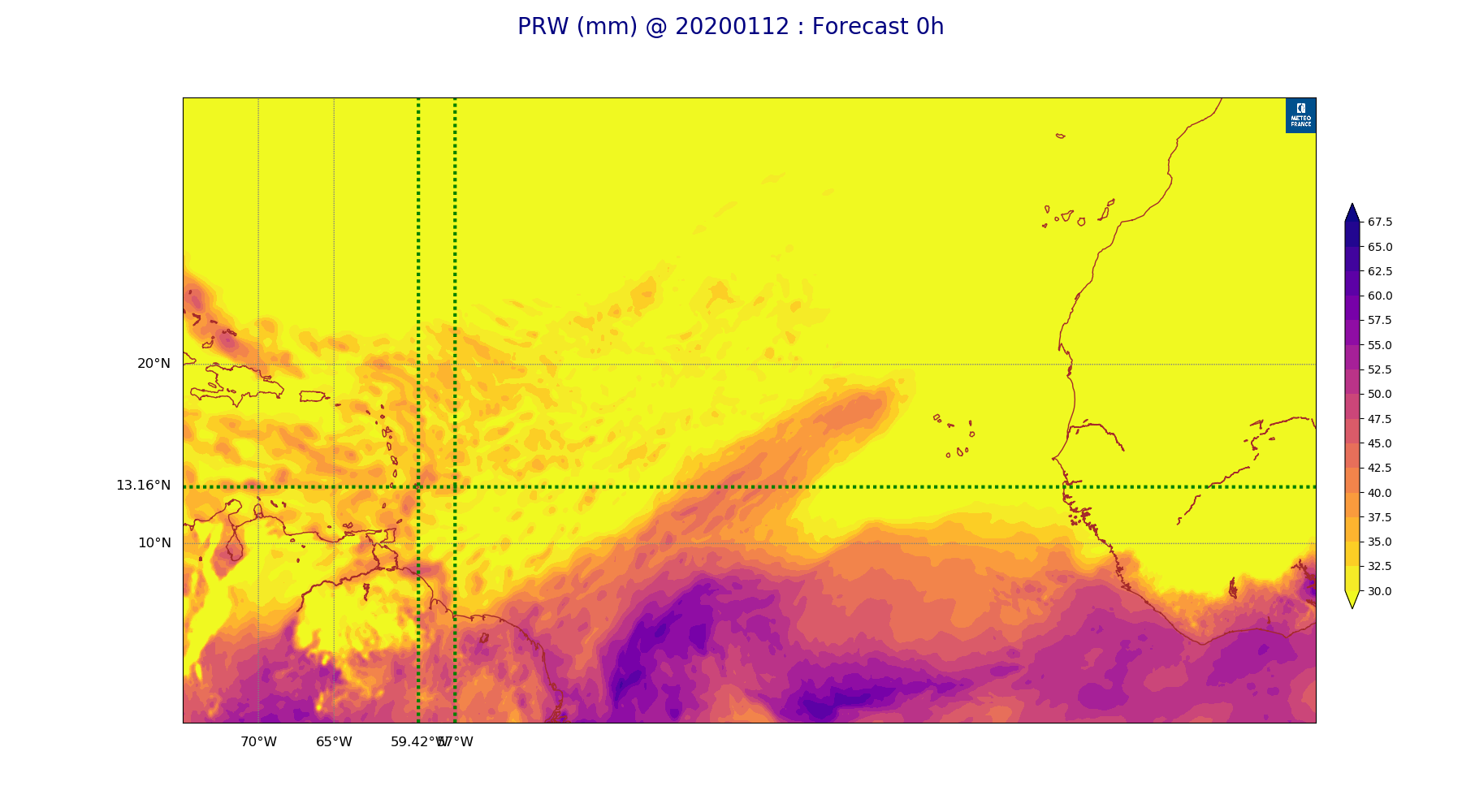
ARPEGE_map2D_PRW_20200112_fct_0.png
2020-01-12 12:03
211K
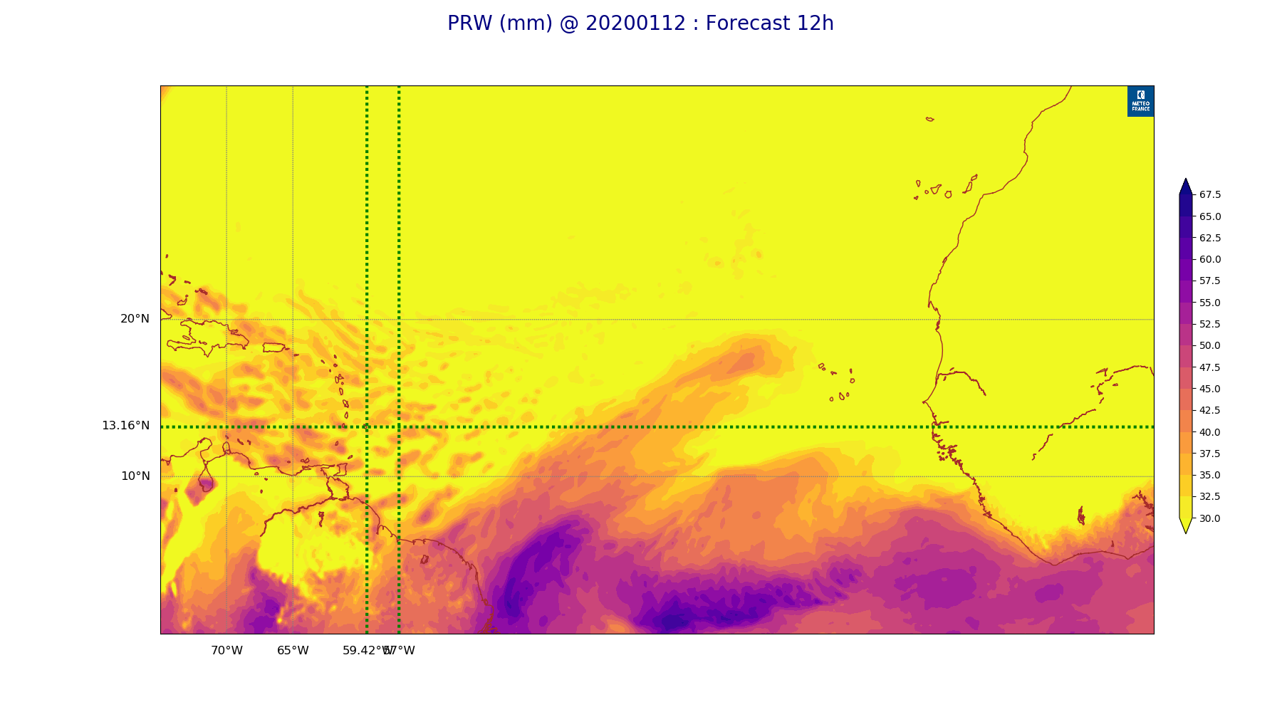
ARPEGE_map2D_PRW_20200112_fct_12.png
2020-01-12 12:03
205K
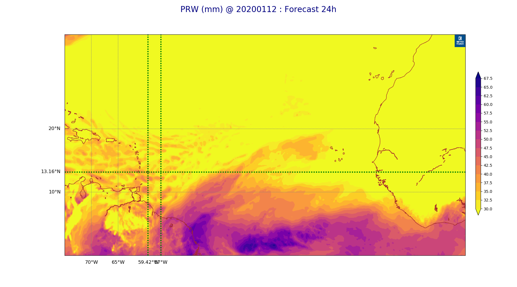
ARPEGE_map2D_PRW_20200112_fct_24.png
2020-01-12 12:03
201K
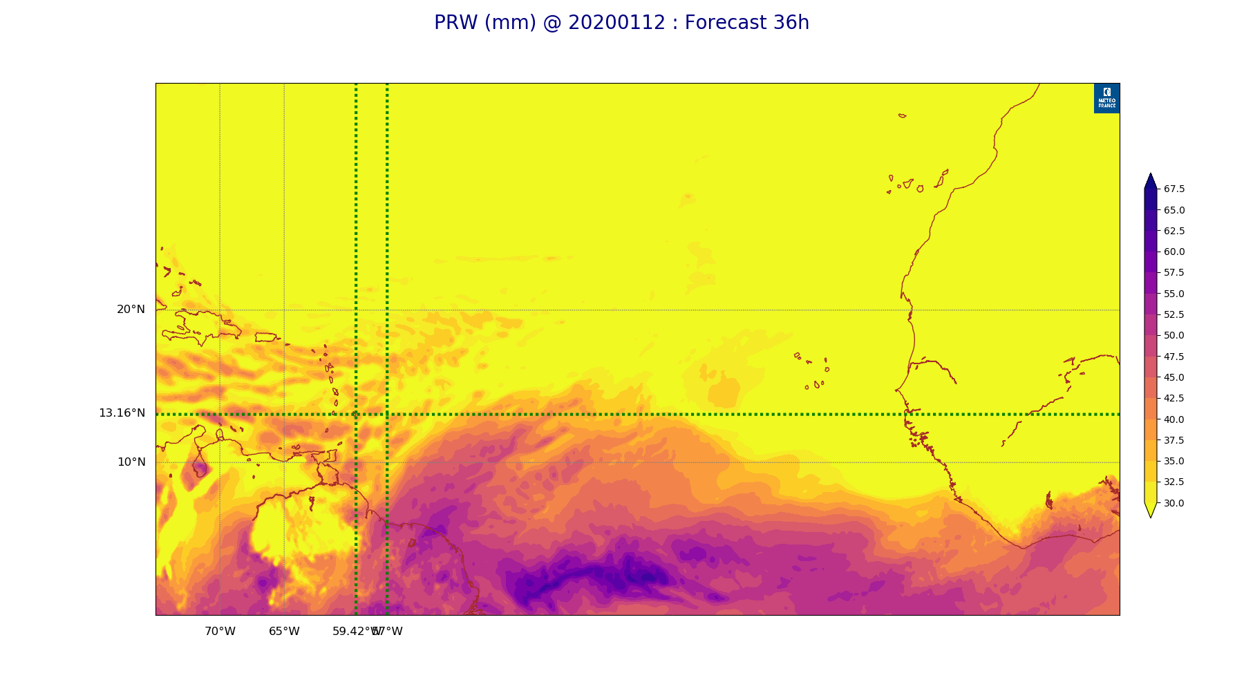
ARPEGE_map2D_PRW_20200112_fct_36.png
2020-01-12 12:03
199K
ARPEGE_map2D_PRW_20200112_fct_48.png
2020-01-12 12:04
199K
ARPEGE_map2D_Psfc_20200112_fct_0.png
2020-01-12 12:07
122K
ARPEGE_map2D_Psfc_20200112_fct_12.png
2020-01-12 12:07
122K
ARPEGE_map2D_Psfc_20200112_fct_24.png
2020-01-12 12:07
122K
ARPEGE_map2D_Psfc_20200112_fct_36.png
2020-01-12 12:07
123K
ARPEGE_map2D_Psfc_20200112_fct_48.png
2020-01-12 12:07
123K
ARPEGE_map2D_RH_500hPa_20200112_fct_0.png
2020-01-12 11:57
278K
ARPEGE_map2D_RH_500hPa_20200112_fct_12.png
2020-01-12 11:58
278K
ARPEGE_map2D_RH_500hPa_20200112_fct_24.png
2020-01-12 11:58
268K
ARPEGE_map2D_RH_500hPa_20200112_fct_36.png
2020-01-12 11:58
263K
ARPEGE_map2D_RH_500hPa_20200112_fct_48.png
2020-01-12 11:58
269K
ARPEGE_map2D_RH_700hPa_20200112_fct_0.png
2020-01-12 11:57
326K
ARPEGE_map2D_RH_700hPa_20200112_fct_12.png
2020-01-12 11:58
314K
ARPEGE_map2D_RH_700hPa_20200112_fct_24.png
2020-01-12 11:58
296K
ARPEGE_map2D_RH_700hPa_20200112_fct_36.png
2020-01-12 11:58
290K
ARPEGE_map2D_RH_700hPa_20200112_fct_48.png
2020-01-12 11:58
281K
ARPEGE_map2D_RH_850hPa_20200112_fct_0.png
2020-01-12 11:57
386K
ARPEGE_map2D_RH_850hPa_20200112_fct_12.png
2020-01-12 11:58
393K
ARPEGE_map2D_RH_850hPa_20200112_fct_24.png
2020-01-12 11:58
391K
ARPEGE_map2D_RH_850hPa_20200112_fct_36.png
2020-01-12 11:58
385K
ARPEGE_map2D_RH_850hPa_20200112_fct_48.png
2020-01-12 11:58
372K
ARPEGE_map2D_T_500hPa_20200112_fct_0.png
2020-01-12 11:57
168K
ARPEGE_map2D_T_500hPa_20200112_fct_12.png
2020-01-12 11:57
168K
ARPEGE_map2D_T_500hPa_20200112_fct_24.png
2020-01-12 11:57
165K
ARPEGE_map2D_T_500hPa_20200112_fct_36.png
2020-01-12 11:57
168K
ARPEGE_map2D_T_500hPa_20200112_fct_48.png
2020-01-12 11:57
164K
ARPEGE_map2D_T_850hPa_20200112_fct_0.png
2020-01-12 11:57
154K
ARPEGE_map2D_T_850hPa_20200112_fct_12.png
2020-01-12 11:57
154K
ARPEGE_map2D_T_850hPa_20200112_fct_24.png
2020-01-12 11:57
154K
ARPEGE_map2D_T_850hPa_20200112_fct_36.png
2020-01-12 11:57
150K
ARPEGE_map2D_T_850hPa_20200112_fct_48.png
2020-01-12 11:57
149K
ARPEGE_map2D_T_925hPa_20200112_fct_0.png
2020-01-12 11:57
165K
ARPEGE_map2D_T_925hPa_20200112_fct_12.png
2020-01-12 11:57
170K
ARPEGE_map2D_T_925hPa_20200112_fct_24.png
2020-01-12 11:57
164K
ARPEGE_map2D_T_925hPa_20200112_fct_36.png
2020-01-12 11:57
167K
ARPEGE_map2D_T_925hPa_20200112_fct_48.png
2020-01-12 11:57
164K
ARPEGE_map2D_U_200hPa_20200112_fct_0.png
2020-01-12 11:54
169K
ARPEGE_map2D_U_200hPa_20200112_fct_12.png
2020-01-12 11:54
166K
ARPEGE_map2D_U_200hPa_20200112_fct_24.png
2020-01-12 11:54
162K
ARPEGE_map2D_U_200hPa_20200112_fct_36.png
2020-01-12 11:54
164K
ARPEGE_map2D_U_200hPa_20200112_fct_48.png
2020-01-12 11:54
156K
ARPEGE_map2D_U_500hPa_20200112_fct_0.png
2020-01-12 11:54
221K
ARPEGE_map2D_U_500hPa_20200112_fct_12.png
2020-01-12 11:54
225K
ARPEGE_map2D_U_500hPa_20200112_fct_24.png
2020-01-12 11:54
218K
ARPEGE_map2D_U_500hPa_20200112_fct_36.png
2020-01-12 11:54
217K
ARPEGE_map2D_U_500hPa_20200112_fct_48.png
2020-01-12 11:54
210K
ARPEGE_map2D_U_850hPa_20200112_fct_0.png
2020-01-12 11:54
240K
ARPEGE_map2D_U_850hPa_20200112_fct_12.png
2020-01-12 11:54
237K
ARPEGE_map2D_U_850hPa_20200112_fct_24.png
2020-01-12 11:54
236K
ARPEGE_map2D_U_850hPa_20200112_fct_36.png
2020-01-12 11:54
234K
ARPEGE_map2D_U_850hPa_20200112_fct_48.png
2020-01-12 11:54
232K
ARPEGE_map2D_U_925hPa_20200112_fct_0.png
2020-01-12 11:54
225K
ARPEGE_map2D_U_925hPa_20200112_fct_12.png
2020-01-12 11:54
225K
ARPEGE_map2D_U_925hPa_20200112_fct_24.png
2020-01-12 11:54
224K
ARPEGE_map2D_U_925hPa_20200112_fct_36.png
2020-01-12 11:54
223K
ARPEGE_map2D_U_925hPa_20200112_fct_48.png
2020-01-12 11:54
222K
ARPEGE_map2D_V_200hPa_20200112_fct_0.png
2020-01-12 11:55
247K
ARPEGE_map2D_V_200hPa_20200112_fct_12.png
2020-01-12 11:55
250K
ARPEGE_map2D_V_200hPa_20200112_fct_24.png
2020-01-12 11:55
248K
ARPEGE_map2D_V_200hPa_20200112_fct_36.png
2020-01-12 11:55
247K
ARPEGE_map2D_V_200hPa_20200112_fct_48.png
2020-01-12 11:55
232K
ARPEGE_map2D_V_500hPa_20200112_fct_0.png
2020-01-12 11:55
283K
ARPEGE_map2D_V_500hPa_20200112_fct_12.png
2020-01-12 11:55
280K
ARPEGE_map2D_V_500hPa_20200112_fct_24.png
2020-01-12 11:55
274K
ARPEGE_map2D_V_500hPa_20200112_fct_36.png
2020-01-12 11:55
276K
ARPEGE_map2D_V_500hPa_20200112_fct_48.png
2020-01-12 11:55
269K
ARPEGE_map2D_V_850hPa_20200112_fct_0.png
2020-01-12 11:55
352K
ARPEGE_map2D_V_850hPa_20200112_fct_12.png
2020-01-12 11:55
349K
ARPEGE_map2D_V_850hPa_20200112_fct_24.png
2020-01-12 11:55
346K
ARPEGE_map2D_V_850hPa_20200112_fct_36.png
2020-01-12 11:55
345K
ARPEGE_map2D_V_850hPa_20200112_fct_48.png
2020-01-12 11:55
337K
ARPEGE_map2D_V_925hPa_20200112_fct_0.png
2020-01-12 11:55
323K
ARPEGE_map2D_V_925hPa_20200112_fct_12.png
2020-01-12 11:55
321K
ARPEGE_map2D_V_925hPa_20200112_fct_24.png
2020-01-12 11:55
324K
ARPEGE_map2D_V_925hPa_20200112_fct_36.png
2020-01-12 11:55
321K
ARPEGE_map2D_V_925hPa_20200112_fct_48.png
2020-01-12 11:55
317K
ARPEGE_map2D_Vertical_velocity_500hPa_20200112_fct_0.png
2020-01-12 11:53
349K
ARPEGE_map2D_Vertical_velocity_500hPa_20200112_fct_12.png
2020-01-12 11:53
352K
ARPEGE_map2D_Vertical_velocity_500hPa_20200112_fct_24.png
2020-01-12 11:53
336K
ARPEGE_map2D_Vertical_velocity_500hPa_20200112_fct_36.png
2020-01-12 11:53
332K
ARPEGE_map2D_Vertical_velocity_500hPa_20200112_fct_48.png
2020-01-12 11:54
320K
ARPEGE_map2D_Vertical_velocity_700hPa_20200112_fct_0.png
2020-01-12 11:53
392K
ARPEGE_map2D_Vertical_velocity_700hPa_20200112_fct_12.png
2020-01-12 11:53
379K
ARPEGE_map2D_Vertical_velocity_700hPa_20200112_fct_24.png
2020-01-12 11:53
364K
ARPEGE_map2D_Vertical_velocity_700hPa_20200112_fct_36.png
2020-01-12 11:54
357K
ARPEGE_map2D_Vertical_velocity_700hPa_20200112_fct_48.png
2020-01-12 11:54
348K
ARPEGE_map2D_Vertical_velocity_850hPa_20200112_fct_0.png
2020-01-12 11:53
438K
ARPEGE_map2D_Vertical_velocity_850hPa_20200112_fct_12.png
2020-01-12 11:53
424K
ARPEGE_map2D_Vertical_velocity_850hPa_20200112_fct_24.png
2020-01-12 11:53
423K
ARPEGE_map2D_Vertical_velocity_850hPa_20200112_fct_36.png
2020-01-12 11:54
406K
ARPEGE_map2D_Vertical_velocity_850hPa_20200112_fct_48.png
2020-01-12 11:54
406K
ARPEGE_map2D_qv_500hPa_20200112_fct_0.png
2020-01-12 11:58
133K
ARPEGE_map2D_qv_500hPa_20200112_fct_12.png
2020-01-12 11:58
133K
ARPEGE_map2D_qv_500hPa_20200112_fct_24.png
2020-01-12 11:58
133K
ARPEGE_map2D_qv_500hPa_20200112_fct_36.png
2020-01-12 11:59
133K
ARPEGE_map2D_qv_500hPa_20200112_fct_48.png
2020-01-12 11:59
134K
ARPEGE_map2D_qv_850hPa_20200112_fct_0.png
2020-01-12 11:58
249K
ARPEGE_map2D_qv_850hPa_20200112_fct_12.png
2020-01-12 11:58
254K
ARPEGE_map2D_qv_850hPa_20200112_fct_24.png
2020-01-12 11:58
252K
ARPEGE_map2D_qv_850hPa_20200112_fct_36.png
2020-01-12 11:59
253K
ARPEGE_map2D_qv_850hPa_20200112_fct_48.png
2020-01-12 11:59
244K
ARPEGE_map2D_qv_925hPa_20200112_fct_0.png
2020-01-12 11:58
257K
ARPEGE_map2D_qv_925hPa_20200112_fct_12.png
2020-01-12 11:58
257K
ARPEGE_map2D_qv_925hPa_20200112_fct_24.png
2020-01-12 11:58
254K
ARPEGE_map2D_qv_925hPa_20200112_fct_36.png
2020-01-12 11:59
253K
ARPEGE_map2D_qv_925hPa_20200112_fct_48.png
2020-01-12 11:59
255K
ARPEGE_map2D_theta_500hPa_20200112_fct_0.png
2020-01-12 11:56
168K
ARPEGE_map2D_theta_500hPa_20200112_fct_12.png
2020-01-12 11:56
169K
ARPEGE_map2D_theta_500hPa_20200112_fct_24.png
2020-01-12 11:56
166K
ARPEGE_map2D_theta_500hPa_20200112_fct_36.png
2020-01-12 11:57
167K
ARPEGE_map2D_theta_500hPa_20200112_fct_48.png
2020-01-12 11:57
162K
ARPEGE_map2D_theta_850hPa_20200112_fct_0.png
2020-01-12 11:56
157K
ARPEGE_map2D_theta_850hPa_20200112_fct_12.png
2020-01-12 11:56
161K
ARPEGE_map2D_theta_850hPa_20200112_fct_24.png
2020-01-12 11:56
159K
ARPEGE_map2D_theta_850hPa_20200112_fct_36.png
2020-01-12 11:57
158K
ARPEGE_map2D_theta_850hPa_20200112_fct_48.png
2020-01-12 11:57
159K
ARPEGE_map2D_theta_925hPa_20200112_fct_0.png
2020-01-12 11:56
163K
ARPEGE_map2D_theta_925hPa_20200112_fct_12.png
2020-01-12 11:56
168K
ARPEGE_map2D_theta_925hPa_20200112_fct_24.png
2020-01-12 11:56
160K
ARPEGE_map2D_theta_925hPa_20200112_fct_36.png
2020-01-12 11:57
166K
ARPEGE_map2D_theta_925hPa_20200112_fct_48.png
2020-01-12 11:57
161K
ARPEGE_map2D_u10_20200112_fct_0.png
2020-01-12 12:04
285K
ARPEGE_map2D_u10_20200112_fct_12.png
2020-01-12 12:04
283K
ARPEGE_map2D_u10_20200112_fct_24.png
2020-01-12 12:04
279K
ARPEGE_map2D_u10_20200112_fct_36.png
2020-01-12 12:04
272K
ARPEGE_map2D_u10_20200112_fct_48.png
2020-01-12 12:04
277K
ARPEGE_map2D_v10_20200112_fct_0.png
2020-01-12 12:05
259K
ARPEGE_map2D_v10_20200112_fct_12.png
2020-01-12 12:05
262K
ARPEGE_map2D_v10_20200112_fct_24.png
2020-01-12 12:05
264K
ARPEGE_map2D_v10_20200112_fct_36.png
2020-01-12 12:05
262K
ARPEGE_map2D_v10_20200112_fct_48.png
2020-01-12 12:05
259K